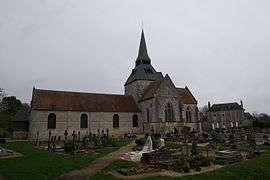
Gonneville-sur-Honfleur
| Gonneville-sur-Honfleur | |
|---|---|
 | |
 Gonneville-sur-Honfleur | |
|
Location within Normandy region  Gonneville-sur-Honfleur | |
| Coordinates: 49°23′04″N 0°14′42″E / 49.3844°N 0.245°ECoordinates: 49°23′04″N 0°14′42″E / 49.3844°N 0.245°E | |
| Country | France |
| Region | Normandy |
| Department | Calvados |
| Arrondissement | Lisieux |
| Canton | Honfleur |
| Intercommunality | Pays de Honfleur |
| Government | |
| • Mayor (2008–2014) | Dominique Le Sauvage |
| Area1 | 8.50 km2 (3.28 sq mi) |
| Population (2008)2 | 765 |
| • Density | 90/km2 (230/sq mi) |
| Time zone | CET (UTC+1) |
| • Summer (DST) | CEST (UTC+2) |
| INSEE/Postal code | 14304 / 14600 |
| Elevation | 34–129 m (112–423 ft) |
|
1 French Land Register data, which excludes lakes, ponds, glaciers > 1 km² (0.386 sq mi or 247 acres) and river estuaries. 2 Population without double counting: residents of multiple communes (e.g., students and military personnel) only counted once. | |
Gonneville-sur-Honfleur is a commune in the Calvados department in the Normandy region in northwestern France.
Population
| Historical population | ||
|---|---|---|
| Year | Pop. | ±% |
| 1962 | 513 | — |
| 1968 | 524 | +2.1% |
| 1975 | 493 | −5.9% |
| 1982 | 552 | +12.0% |
| 1990 | 718 | +30.1% |
| 1999 | 723 | +0.7% |
| 2008 | 765 | +5.8% |
See also
References
| Wikimedia Commons has media related to Gonneville-sur-Honfleur. |
This article is issued from Wikipedia - version of the 3/16/2016. The text is available under the Creative Commons Attribution/Share Alike but additional terms may apply for the media files.