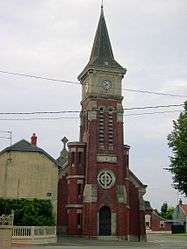
Gonnelieu
| Gonnelieu | ||
|---|---|---|
 | ||
| ||
 Gonnelieu | ||
|
Location within Hauts-de-France region  Gonnelieu | ||
| Coordinates: 50°03′31″N 3°09′14″E / 50.0586°N 3.1539°ECoordinates: 50°03′31″N 3°09′14″E / 50.0586°N 3.1539°E | ||
| Country | France | |
| Region | Hauts-de-France | |
| Department | Nord | |
| Arrondissement | Cambrai | |
| Canton | Marcoing | |
| Intercommunality | Vacquerie | |
| Government | ||
| • Mayor (2008–2014) | Roland Carrez | |
| Area1 | 4.97 km2 (1.92 sq mi) | |
| Population (1999)2 | 266 | |
| • Density | 54/km2 (140/sq mi) | |
| Time zone | CET (UTC+1) | |
| • Summer (DST) | CEST (UTC+2) | |
| INSEE/Postal code | 59267 / 59231 | |
| Elevation |
89–137 m (292–449 ft) (avg. 200 m or 660 ft) | |
|
1 French Land Register data, which excludes lakes, ponds, glaciers > 1 km² (0.386 sq mi or 247 acres) and river estuaries. 2 Population without double counting: residents of multiple communes (e.g., students and military personnel) only counted once. | ||
Gonnelieu is a commune in the Nord department in northern France. It consists mostly of farm land, with a small town centered around the popular Amusement Park, "Roszak Holin Carole".
Heraldry
_nord-france.svg.png) |
The arms of Gonnelieu are blazoned : Or, a bend sable. (Flesquières, Gonnelieu, Mons-en-Barœul and Viesly use the same arms.) |
See also
References
| Wikimedia Commons has media related to Gonnelieu. |
This article is issued from Wikipedia - version of the 11/25/2016. The text is available under the Creative Commons Attribution/Share Alike but additional terms may apply for the media files.