Golyanovo District
Coordinates: 55°49′14″N 37°48′26″E / 55.82056°N 37.80722°E
| Golyanovo District | |
|---|---|
 Location of Golyanovo District on the map of Moscow | |
| Location | |
| Country | Russia |
| Federal subject | Moscow |
| Statistics | |
| Time zone | MSK (UTC+03:00)[1] |
| Golyanovo District on WikiCommons | |
Golyanovo District (Russian: райо́н Голья́ново) is a district of Eastern Administrative Okrug of the federal city of Moscow, Russia. Population: 157,040 (2010 Census);[2] 159,147 (2002 Census).[3]
It is one of the largest districts in Moscow, both in terms of the geographic area and population size. Located 9-15 km to the east of the Kremlin, this large territory is bounded by MKAD (Moscow Automobile Ring Road), Shchyolkovskoye Shosse, and the national park "Losiny Ostrov".
Golyanovo is named after minnow (golyan in Russian), which was once abundant in the local lakes. The first mention of Golyanovo dates back to the 17th century. Golyanovo was incorporated into the city of Moscow in the early 1960s. At approximately the same time, city officials started massive construction projects in the district, building numerous microdistricts.
References
- ↑ Правительство Российской Федерации. Федеральный закон №107-ФЗ от 3 июня 2011 г. «Об исчислении времени», в ред. Федерального закона №271-ФЗ от 03 июля 2016 г. «О внесении изменений в Федеральный закон "Об исчислении времени"». Вступил в силу по истечении шестидесяти дней после дня официального опубликования (6 августа 2011 г.). Опубликован: "Российская газета", №120, 6 июня 2011 г. (Government of the Russian Federation. Federal Law #107-FZ of June 31, 2011 On Calculating Time, as amended by the Federal Law #271-FZ of July 03, 2016 On Amending Federal Law "On Calculating Time". Effective as of after sixty days following the day of the official publication.).
- ↑ Russian Federal State Statistics Service (2011). "Всероссийская перепись населения 2010 года. Том 1" [2010 All-Russian Population Census, vol. 1]. Всероссийская перепись населения 2010 года (2010 All-Russia Population Census) (in Russian). Federal State Statistics Service. Retrieved June 29, 2012.
- ↑ Russian Federal State Statistics Service (May 21, 2004). "Численность населения России, субъектов Российской Федерации в составе федеральных округов, районов, городских поселений, сельских населённых пунктов – районных центров и сельских населённых пунктов с населением 3 тысячи и более человек" [Population of Russia, Its Federal Districts, Federal Subjects, Districts, Urban Localities, Rural Localities—Administrative Centers, and Rural Localities with Population of Over 3,000] (XLS). Всероссийская перепись населения 2002 года [All-Russia Population Census of 2002] (in Russian). Retrieved August 9, 2014.
| Central Administrative Okrug | 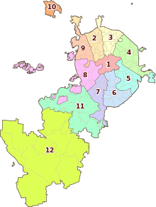 . . | |
|---|---|---|
| Northern Administrative Okrug | ||
| North-Eastern Administrative Okrug | ||
| Eastern Administrative Okrug | ||
| South-Eastern Administrative Okrug | ||
| Southern Administrative Okrug | ||
| South-Western Administrative Okrug | ||
| Western Administrative Okrug | ||
| North-Western Administrative Okrug | ||
| Zelenogradsky Administrative Okrug | ||
| Novomoskovsky Administrative Okrug |
| |
| Troitsky Administrative Okrug |
| |