Gold Hill, Oregon
| Gold Hill, Oregon | |
|---|---|
| City | |
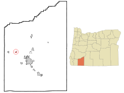 Location in Oregon | |
| Coordinates: 42°26′1″N 123°3′16″W / 42.43361°N 123.05444°WCoordinates: 42°26′1″N 123°3′16″W / 42.43361°N 123.05444°W | |
| Country | United States |
| State | Oregon |
| County | Jackson |
| Incorporated | 1895 |
| Government | |
| • Mayor | Jan Fish |
| Area[1] | |
| • Total | 0.77 sq mi (1.99 km2) |
| • Land | 0.77 sq mi (1.99 km2) |
| • Water | 0 sq mi (0 km2) |
| Elevation | 1,085 ft (330.7 m) |
| Population (2010)[2] | |
| • Total | 1,220 |
| • Estimate (2012[3]) | 1,236 |
| • Density | 1,584.4/sq mi (611.7/km2) |
| Time zone | Pacific (UTC-8) |
| • Summer (DST) | Pacific (UTC-7) |
| ZIP code | 97525 |
| Area code(s) | 541 |
| FIPS code | 41-29950[2] |
| GNIS feature ID | 1639311[4] |
| Website | www.ci.goldhill.or.us |
Gold Hill is a city in Jackson County, Oregon, in the United States. As of July 1, 2011, the population was 1,220 people.[5] It is located on a bend of the Rogue River.
History
The city's name comes from a nearby hill that was the site of a 19th-century gold discovery. The community's post office was established in 1884. An earlier settlement in the area was known as Dardanelles.[6]
Geography
According to the United States Census Bureau, the city has a total area of 0.77 square miles (1.99 km2), all of it land.[1]
The city lies east of the city of Rogue River and northwest of Central Point and Medford along Interstate 5 and Oregon Route 99 in the Rogue River Valley. Gold Hill is connected to Shady Cove to the northeast by Oregon Route 234.[7]
Demographics
| Historical population | |||
|---|---|---|---|
| Census | Pop. | %± | |
| 1900 | 385 | — | |
| 1920 | 422 | — | |
| 1930 | 502 | 19.0% | |
| 1950 | 619 | — | |
| 1960 | 608 | −1.8% | |
| 1970 | 603 | −0.8% | |
| 1980 | 904 | 49.9% | |
| 1990 | 964 | 6.6% | |
| 2000 | 1,073 | 11.3% | |
| 2010 | 1,220 | 13.7% | |
| Est. 2015 | 1,266 | [8] | 3.8% |
2010 census
As of the census of 2010, there were 1,220 people, 509 households, and 336 families residing in the city. The population density was 1,584.4 inhabitants per square mile (611.7/km2). There were 552 housing units at an average density of 716.9 per square mile (276.8/km2). The racial makeup of the city was 93.5% White, 0.2% African American, 1.6% Native American, 0.5% Asian, 0.7% from other races, and 3.6% from two or more races. Hispanic or Latino of any race were 2.7% of the population.[2]
There were 509 households of which 27.3% had children under the age of 18 living with them, 46.4% were married couples living together, 12.4% had a female householder with no husband present, 7.3% had a male householder with no wife present, and 34.0% were non-families. 25.7% of all households were made up of individuals and 8.6% had someone living alone who was 65 years of age or older. The average household size was 2.40 and the average family size was 2.83.[2]
The median age in the city was 43.9 years. 19.5% of residents were under the age of 18; 8.8% were between the ages of 18 and 24; 23.1% were from 25 to 44; 34.2% were from 45 to 64; and 14.4% were 65 years of age or older. The gender makeup of the city was 50.1% male and 49.9% female.[2]
2000 census
As of the census of 2000, there were 1,073 people, 419 households, and 294 families residing in the city. The population density was 1,543.5 people per square mile (591.8/km²). There were 446 housing units at an average density of 641.6 per square mile (246.0/km²). The racial makeup of the city was 96.09% White, 0.09% African American, 1.96% Native American, 0.09% Asian, 0.09% Pacific Islander, 0.28% from other races, and 1.40% from two or more races. Hispanic or Latino of any race were 3.36% of the population.[2]
There were 419 households out of which 35.8% had children under the age of 18 living with them, 49.6% were married couples living together, 14.6% had a female householder with no husband present, and 29.8% were non-families. 23.9% of all households were made up of individuals and 8.8% had someone living alone who was 65 years of age or older. The average household size was 2.56 and the average family size was 2.95.[2]
In the city the population was spread out with 28.3% under the age of 18, 7.0% from 18 to 24, 27.4% from 25 to 44, 25.9% from 45 to 64, and 11.4% who were 65 years of age or older. The median age was 37 years. For every 100 females there were 91.3 males. For every 100 females age 18 and over, there were 89.9 males.[2]
The median income for a household in the city was $32,500, and the median income for a family was $35,438. Males had a median income of $33,625 versus $23,036 for females. The per capita income for the city was $16,856. About 10.3% of families and 12.5% of the population were below the poverty line, including 15.3% of those under age 18 and 6.4% of those age 65 or over.[2]
Museums and other points of interest
Gold Hill is home to the roadside attraction the Oregon Vortex.
The Gold Hill Historical Society maintains a free museum in the 1901 Beeman–Martin House that is open Thursday through Saturday. The museum collection includes mining equipment, a stamp mill, and artifacts related to Gold Hill's early history.[10]
References
- 1 2 "US Gazetteer files 2010". United States Census Bureau. Retrieved 2012-12-21.
- 1 2 3 4 5 6 7 8 9 "American FactFinder". United States Census Bureau. Retrieved 2012-12-21.
- ↑ "Population Estimates". United States Census Bureau. Retrieved 2013-06-02.
- ↑ "US Board on Geographic Names". United States Geological Survey. 2007-10-25. Retrieved 2008-01-31.
- ↑ "2011 Certified Population Estimates". Portland State University. Retrieved December 29, 2011.
- ↑ McArthur, Lewis A.; Lewis L. McArthur (2003) [1928]. Oregon Geographic Names (7th ed.). Portland, Oregon: Oregon Historical Society Press. p. 410. ISBN 0-87595-277-1.
- ↑ Oregon Road & Recreation Atlas (5th ed.). Santa Barbara, California: Benchmark Maps. 2012. p. 96. ISBN 978-0-929591-62-9.
- ↑ "Annual Estimates of the Resident Population for Incorporated Places: April 1, 2010 to July 1, 2015". Retrieved July 2, 2016.
- ↑ "Census of Population and Housing". Census.gov. Retrieved June 4, 2015.
- ↑ "Gold Hill Historical Society". Jackson County Heritage Association. Retrieved October 14, 2015.
External links
Municipalities and communities of Jackson County, Oregon, United States | ||
|---|---|---|
| Cities | 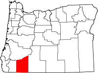 | |
| CDPs | ||
| Other unincorporated communities | ||
| Ghost towns | ||