Global Forecast System
The Global Forecast System (GFS) is a global numerical weather prediction system containing a global computer model and variational analysis run by the United States' National Weather Service (NWS).
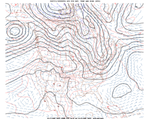
The mathematical model is run four times a day, and produces forecasts for up to 16 days in advance, but with decreased spatial resolution after 10 days. The forecast skill generally decreases with time (as with any numerical weather prediction model) and for longer term forecasts, only the larger scales retain significant accuracy. It is one of the predominant synoptic scale medium-range models in general use.
The GFS model is a spectral model with an approximate horizontal resolution of 13 km for the first 10 days and 27 km from 240 to 384 hours (16 days). In the vertical, the model is divided into 64 layers and temporally, it produces forecast output every hour for the first 120 hours,[1] three hourly through day 10 and 12 hourly through day 16. The output from the GFS is also used to produce model output statistics.
In addition to the main model, the GFS is also the basis of a lower resolution 20-member (22, counting the control and operational members) ensemble that runs concurrent with the operational GFS and is available on the same time scales. This ensemble is referred to as the "Global Ensemble Forecast System" (GEFS). Ensemble model output statistics are available out to 8 days. The GFS ensemble is combined with Canada's Global Environmental Multiscale Model ensemble to form the North American Ensemble Forecast System (NAEFS).
As with most works of the U.S. government, GFS data is not copyrighted and is available for free in the public domain under provisions of U.S. law. Because of this, the model serves as the basis for the forecasts of numerous private, commercial and foreign weather companies.
By 2015 the GFS model had fallen behind the accuracy of other global weather models.[2][3] This was most notable in the GFS model incorrectly predicting Hurricane Sandy turning out to sea until 4 days before landfall; while the European Centre for Medium-Range Weather Forecasts' model predicted landfall correctly at 7 days. Much of this was suggested to be due to limits in computational resources within the National Weather Service. In response, the NWS purchased new supercomputers, increasing processing power from 776 teraflops to 5.78 petaflops.[4][5][6] The agency has also been testing a potential replacement model with different mechanics, the flow-following, finite-volume Icosahedral Model (FIM), since the early 2010s.
See also
References
- ↑ Timothy McClung. "Technical Implementation Notice 16-11 Amended". Nation Weather Service. Archived from the original on 5 June 2016. Retrieved 5 June 2016.
- ↑ Berger, Eric (21 June 2016). "The US weather model is now the fourth best in the world". Ars Technica.
- ↑ Berger, Eric (11 March 2016). "The European forecast model already kicking America's butt just improved". Ars Technica. Retrieved 16 August 2016.
- ↑ Kravets, David (5 January 2015). "National Weather Service will boost its supercomputing capacity tenfold". Ars Technica. Retrieved 16 August 2016.
- ↑ Rice, Doyle (22 February 2016). "Supercomputer quietly puts U.S. weather resources back on top". USA Today. Retrieved 16 August 2016.
- ↑ "NOAA completes weather and climate supercomputer upgrades". NOAA. Retrieved 16 August 2016.
NOAA GFS Model Information Website