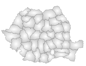
Giurgiu County
| Giurgiu County Județul Giurgiu | ||
|---|---|---|
| County | ||
| ||
 | ||
| Coordinates: 44°10′N 25°54′E / 44.16°N 25.9°ECoordinates: 44°10′N 25°54′E / 44.16°N 25.9°E | ||
| Country |
| |
| Development region1 | Sud | |
| Historic region | Muntenia | |
| Capital city (Reşedinţă de judeţ) | Giurgiu | |
| Government | ||
| • Type | County Board | |
| • President of the County Board | Victor Boiangiu (PSD) | |
| • Prefect2 | Sergiu Noruţ Stănişteanu | |
| Area | ||
| • Total | 3,526 km2 (1,361 sq mi) | |
| Area rank | 40th in Romania | |
| Population (2011) | ||
| • Total | 265,494 | |
| • Rank | 38th in Romania | |
| • Density | 75.92/km2 (196.6/sq mi) | |
| Time zone | EET (UTC+2) | |
| • Summer (DST) | EEST (UTC+3) | |
| Postal Code | 08wxyz3 | |
| Area code(s) | +40 x464 | |
| Car Plates | GR5 | |
| GDP | US$ 1.59 billion (2008) | |
| GDP/capita | US$ 5,358 (2008) | |
| Website |
County Board County Prefecture | |
|
1The developing regions of Romania have no administrative role. They were formed to attract funds from the European Union 2 as of 2007, the Prefect is not a politician, but a public functionary. He (or she) is not allowed to be a member of a political party, and is banned from any political activity in the first six months after the resignation (or exclusion) from the public functionary corps 3w, x, y, and z are digits that indicate the city, the street, part of the street, or even the building of the address 4x is a digit indicating the operator: 2 for the former national operator, Romtelecom, and 3 for the other ground telephone networks 5used on both the plates of the vehicles that operate only in the county limits (like utility vehicles, ATVs, etc.), and the ones used outside the county | ||
.svg.png)
Giurgiu (Romanian pronunciation: [ˈd͡ʒjurd͡ʒju]) is a county (judeţ) of Romania on the border with Bulgaria, in Muntenia, with the capital city at Giurgiu.
Demographics
In 2011, it had a population of 265,494 and the population density was 75.29/km².
| Year | County population[2] |
|---|---|
| 1948 | 313,793 |
| 1956 | |
| 1966 | |
| 1977 | |
| 1992 | |
| 2002 | |
| 2011 |
Geography
This county has a total area of 3,526 km².
The county is situated on a plain – the Southern part of the Romanian Plain. The landscape is flat, crossed by small rivers. The southern part is the valley of the Danube which forms the border with Bulgaria. In the North, the Argeş River and Dâmboviţa River flow.
Neighbours
- Călăraşi County in the East.
- Teleorman County in the West.
- Ilfov County and Dâmboviţa County in the North.
- Bulgaria in the South – Ruse Province and Silistra Province.
Economy
The county has two big areas of development: one close to the city of Giurgiu – The Free Trade Zone Giurgiu, and one in the North of the county due to its proximity with Bucharest.
The predominant industries in the county are:
- Food and beverages industry.
- Textile industry.
- Chemical industry.
- Wood and furniture industry.
- Mechanical components industry.
Agriculture is the main occupation in the county. Both extensive agriculture, and small scale – for Bucharest markets, is practiced. 59% of the cultivated surface is irrigated.
Tourism
The county recently became famous for its lăutari, especially the group Taraful Haiducilor.
The main tourist destinations are:
The city of Giurgiu
Here the tourists can visit:
- The Clock Tower, made by Turks when the Giurgiu was "raia"
- The Historical Museum
- The theatre "Valah"
- The first bridge built in angel from Europe, over the Canalul Sf Gheorghe and Canalul Plantelor, with a specific construction over 100 years old; near this bridge is a new one from 2007
- The Bridge of Friendship over the Danube between Giurgiu, Romania and Rousse, Bulgaria
- The churches painted by important painters like Grigorescu
- The fluvial station on the Danube river "Port Giurgiu"
- The street "Str. Garii" filled with markets
- The beautiful parks from town where many statues and fountains can be found
- Fishing along the Danube
- The Călugăreni area
- The monasteries from Giurgiu, Comana

Politics
The Giurgiu County Council, elected at the 2016 local government elections, is made up of 31 counselors, with the following party composition:[3]
| Party | Seats | Current County Council | ||||||||||||||||||||
|---|---|---|---|---|---|---|---|---|---|---|---|---|---|---|---|---|---|---|---|---|---|---|
| Social Democratic Party | 20 | |||||||||||||||||||||
| National Liberal Party | 8 | |||||||||||||||||||||
| Alliance of Liberals and Democrats | 3 | |||||||||||||||||||||
Administrative divisions
Giurgiu County has 1 municipality, 2 towns and 51 communes:
- Municipalities
- Giurgiu – capital city; population: 54,655 (as of 2011)
- Towns
- Communes
- Adunaţii-Copăceni
- Băneasa
- Bolintin-Deal
- Bucşani
- Bulbucata
- Buturugeni
- Călugăreni
- Clejani
- Colibaşi
- Comana
- Cosoba
- Crevedia Mare
- Daia
- Floreşti-Stoeneşti
- Frăteşti
- Găiseni
- Găujani
- Ghimpaţi
- Gogoşari
- Gostinari
- Gostinu
- Grădinari
- Greaca
- Herăşti
- Hotarele
- Iepureşti
- Isvoarele
- Izvoarele
- Joiţa
- Letca Nouă
- Malu
- Mârşa
- Mihai Bravu
- Ogrezeni
- Oinacu
- Prundu
- Putineiu
- Răsuceni
- Roata de Jos
- Săbăreni
- Schitu
- Singureni
- Slobozia
- Stăneşti
- Stoeneşti
- Toporu
- Ulmi
- Valea Dragului
- Vânătorii Mici
- Vărăşti
- Vedea
References
| Wikimedia Commons has media related to Giurgiu County. |
- ↑ National Institute of Statistics, "Populaţia după etnie"
- ↑ National Institute of Statistics, "Populaţia la recensămintele din anii 1948, 1956, 1966, 1977, 1992 şi 2002"
- ↑ "Mandate de CJ pe judete si competitori" (in Romanian). Biroul Electoral Central. 10 June 2016. Retrieved 16 June 2016.