Gitarama
| Gitarama | |
|---|---|
|
Central Gitarama | |
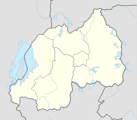 Gitarama Location in Rwanda | |
| Coordinates: 02°04′48″S 29°45′00″E / 2.08000°S 29.75000°E | |
| Country |
|
| Province | Southern Province |
| District | Muhanga District |
| City | Gitarama City Council |
| Elevation | 5,945 ft (1,812 m) |
| Population (2015) | |
| • Total | 87,613 |
| Climate | Aw |
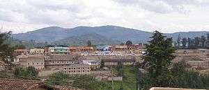
Gitarama is a city in Rwanda, in the Muhanga District, in Southern Province—at the coordinates 2° 4' 48.00"S, 29° 45' 0.00"E (Latitude:2.0800; Longitude:29.7500). The city is 5,945 feet (1,812 m), above sea level.[1]
Though officially part of the Southern Province, Gitarama is geographically in central Rwanda, approximately 45 kilometres (28 mi) by road southwest of Kigali, Rwanda's capital and largest city.[2] This location lies approximately 85 kilometres (53 mi), north of Kibeho, in Nyaruguru District, the southernmost district in Southern Province.[3] The provincial headquarters at Nyanza in Nyanza District lie about 40 kilometres (25 mi), by road, directly south of Gitarama.[4]
Overview
Gitarama is the second-largest city in Rwanda, behind Kigali, the capital. Gitarama is the capital and largest metropolitan area in the district of Muhanga. Due to its geographical location, the city serves as the gateway to the west and south of the country. During the 1994 Rwandan genocide, Gitarama was the seat of the provisional government. The city has many amenities, including the ones listed below:[5]
- Administration & Public safety
- The offices of Muhanga District Administration
- The offices of Muhanga District Council
- The offices of Gitarama City Council
- Gitarama Police Station
- Gitarama City Jail
- Muhanga District Prison
- Muhanga High Court Building
- Educational institutions
- St. Leon Minor Seminary, Kabgayi
- Kabgayi Major Seminary
- St. Joseph Primary School
- St. Joseph Secondary School
- St. Elizabeth Nurses & Midwives College
- Kabgayi Technical College
- Kabgayi Catholic Institute
- Catholic University of Rwanda
- Gitarama Adventist Secondary School
- St. Marie-Reine Secondary School
- Groupe Scolaire de Nyabikenke
- College de Karambi
- College Adventiste de Gitwe
- Public Service
- Kabgayi Hospital
- Gitarama Regional Stadium
- Gitarama Bus Station
- Muhanga Cultural Center
- Economy
- Muhanga Farmers' Market
- A branch of Inkingi Microfinance Limited
- Three branches of Bank of Kigali
- A branch of Ecobank Rwanda
- A branch of Fina Bank Rwanda
- A branch of Banque Populaire du Rwanda SA
- Zipline Muhanga Distribution Center
- Hotel Splendid, a private hospitality establishment.[6]
- Religion
- Kabgayi Minor Basilica
- St. Andrew's Pastoral Center
- Muhanga Zion Temple
- St. Andrew's Church
Population
The 2002 national census put the city's population at 84,669. In 2004, the population of Gitarama was estimated at 87,613 people.[7]
See also
References
- ↑ Elevation of Gitarama, Rwanda
- ↑ Road Distance Between Kigali And Gitarama With Map
- ↑ Map Showing Gitarama And Kibeho With Distance Marker
- ↑ Road Distance Between Gitarama And Nyanza With Map
- ↑ Major Points of Interest In Gitarama
- ↑ Hotel Splendid Best Taxpayer In Muhanga District
- ↑ Estimated City Population In 2004
Coordinates: 02°04′48″S 29°45′00″E / 2.08000°S 29.75000°E