Al-Muabbada
| Al-Muabbada المعبدة Girkê Legê | |
|---|---|
| Town | |
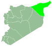
 Al-Muabbada Location in Syria | |
| Coordinates: 37°0′59″N 41°57′16″E / 37.01639°N 41.95444°E | |
| Country |
|
| Governorate | Al-Hasakah Governorate |
| District | Al-Malikiyah District |
| Nahiyah | Al-Malikiyah |
| Elevation | 470 m (1,540 ft) |
| Population (2004 census)[1] | |
| • Total | 15,759 |
| Time zone | EET (UTC+3) |
| • Summer (DST) | EEST (UTC+2) |
Al-Muabbada (Arabic: المعبدة; Kurdish: Girkê Legê) is a town in al-Hasakah Governorate, Syria. According to the Syria Central Bureau of Statistics (CBS), Al-Muabbada had a population of 15,759 in the 2004 census.[1] According to the Kurdish news agency "Rudaw", the Ba'athist Party under president Hafez al-Assad changed the name of the town to Al-Muabbada.[2] The town is 35 kilometres from the Iraqi border and 15 kilometres from the Turkish border.[3] As of 2004, al-Muabbada is the eighth largest town in Al-Hasakah governorate.
On 24 July 2012, the PYD announced that Syrian security forces withdrew from Al-Muabbada. The YPG forces afterwards took control of all government institutions[2] and the town became fully under the PYD's control.[3] As a preliminary result of the ongoing Syrian Civil War, Al-Muabbada today is situated in Jazira Canton within the autonomous Federation of Northern Syria – Rojava framework.
References
- 1 2 General Census of Population and Housing 2004. Syria Central Bureau of Statistics (CBS). Al-Hasakah Governorate. (Arabic)
- 1 2 "Girke Lege Becomes Sixth Kurdish City Liberated in Syria". Rudaw. 17 November 2012. Retrieved 27 July 2012.
- 1 2 "Syrian Crisis Brings a Blessing for Kurds". Inter Press Service. 17 November 2012. Retrieved 17 November 2012.
Rojava articles | |||
|---|---|---|---|
| History |  | ||
| Geography | |||
| Politics | |||
| Economy | |||
| Culture | |||
| |||