Elephanta Island
| Elephanta Island Gharapuri | |
|---|---|
| Island Neighbourhood | |
|
The island as seen from close to the boat landing | |
 Elephanta Island | |
| Coordinates: 18°57′36″N 72°56′06″E / 18.96°N 72.935°ECoordinates: 18°57′36″N 72°56′06″E / 18.96°N 72.935°E | |
| Country | India |
| State | Maharashtra |
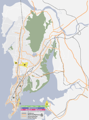
| Metro | Mumbai |
| Languages | |
| • Official | Marathi |
| Time zone | IST (UTC+5:30) |
Elephanta Island (also called Gharapuri Island or place of caves or Pory Island[1]) is one of a number of islands in Mumbai Harbour, east of Mumbai, India.
Tourist attractions and accessibility
This island is a popular tourist destination because of the island's cave temples, the Elephanta Caves, that have been carved out of rock.
The island is easily accessible by ferry from Mumbai, being about 10 kilometres (6.2 mi) from the south east coast of the island city. Boats leave daily from the Gateway of India, taking about an hour each way. The tickets for these can be bought at the Gateway itself. The first ferry leaves at 9 am and the last at 2 pm. From the boat landing stage on the island, a walkway leads to steps that go up to the famous caves.
There is also a narrow-gauge toy train from the boat area on the dock to the base of the steps leading up to the caves (about 600 meters). Along the path, hawkers sell souvenirs like necklaces, anklets, showpieces and keychains. There are also stalls to buy food and drinks. Small monkeys play along the sides of the path, occasionally thieving items from the hawkers, trashcans and tourists.
History
Known in ancient times as Gharapuri, the name Elephanta island (i.e. "ilha do Elefante"), was given by 16th century Portuguese explorers, after seeing a monolithic basalt sculpture of an elephant found near the entrance. They decided to take it home but ended up dropping it into the sea because their chains were not strong enough. Later, this sculpture was moved to the Victoria and Albert Museum (now Dr. Bhau Daji Lad Museum) in Mumbai, by the British.[2] This island was once the capital of a powerful local kingdom. In Manuscript F by Leonardo da Vinci (kept at the Library de France) there is a note in which he says 'Map of Elephanta in India which Antonello the heberdasher has.' It is unclear who this Florentine travelle Antonello might have been.
Orientation
The island has an area of 16 km2 (6.2 sq mi). It is located at approximately 18°57′N 72°56′E / 18.95°N 72.93°E. The area comes under the jurisdiction of the Raigad district in Maharashtra State.
Agricultural makeup
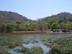
The island is thickly wooded with palm, mango, and tamarind trees.
Inhabitants
It has a population of about 1,200. The inhabitants are mainly involved in growing rice, fishing, and repairing boats. There are two British-era cannons at the top. Quite recently, a small dam has been built so as to hold rainwater but that part of the island is privately owned and not accessible for tourists.
There are a total of three villages: Shentbandar, Morabandar, and Rajbandar, of which Rajbandar is the capital. Caves and stalls can be seen in Shentbandar. Morabandar has a thick forest. Staying overnight is not permitted for tourists. The first return ferry leaves at 12:30pm and the last at 5:30pm.
Gallery
 View of Elephanta island jetty, from Elephanta Caves
 Sculpture inside a cave
 Boats of fishermen living on the island
 Elephanta-Mumbai ferry
 View from Cannon Point
 Houses on Elephanta Island
References
| Wikimedia Commons has media related to Elephanta. |
- Elephanta
- Elephanta caves
- UNESCO World Heritage Site
- Duffer's Guide to Elephanta, Mid-Day, Feb 22, 2007, pg A14
- ↑ Da Cunha 1993, p. 96
- ↑ HT Cafe, Mumbai, Monday, June 4, 2007 pg.31 - Article 'Lord of the Islands" by Jerry Pinto