Georgia State Route 95
| ||||
|---|---|---|---|---|
 | ||||
| Route information | ||||
| Maintained by GDOT | ||||
| Length: | 7.8 mi[1] (12.6 km) | |||
| Existed: | 1930s – present | |||
| Major junctions | ||||
| South end: |
| |||
| North end: |
| |||
| Location | ||||
| Counties: | Walker | |||
| Highway system | ||||
| ||||

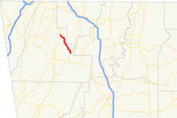
State Route 95 (SR 95) is a 7.8-mile-long (12.6 km) state highway that runs southeast-to-northwest entirely through portions of Walker county in the northwestern part of the U.S. state of Georgia.
Route description
SR 95 begins at an intersection with SR 151 (Old Alabama Highway) northeast of LaFayette, along the northwestern edge of the Armuchee-Cohutta Ranger District of the Chattahoochee-Oconee National Forest. It heads northwest through rural portions of the county. The only major intersection of any kind along the route's length (except for the terminii) is with Beaumont Road, which drivers can take to get to Ringgold. SR 95 continues to the northwest until it enters Rock Spring, where it meets its northern terminus, an intersection with US 27/SR 1.[1]
SR 95 is not part of the National Highway System, a system of roadways important to the nation's economy, defense, and mobility.[2]
History
Originally a route built and maintained by the Department of the Interior as part of Chickamauga and Chattanooga National Military Park, SR 95 was designated in the 1930s when the National Park Service ceded control of roads outside of the park. Originally extending from SR 143 (now SR 136) to US 27 in Rock Spring, the highway was truncated to SR 151 when SR 151 was extended south to US 27. Not a major highway, the route has otherwise seen very little change since it was first commissioned and bisects the Round Pond community, noted on maps as Catlett (the store there carries the Catlett name). However, guide signs on US 27/SR 1 identify Catlett as a control city.
Major intersections
The entire route is in Walker County.
| Location | mi[1] | km | Destinations | Notes | |
|---|---|---|---|---|---|
| | 0.0 | 0.0 | Southern terminus | ||
| Rock Spring | 7.8 | 12.6 | Northern terminus | ||
| 1.000 mi = 1.609 km; 1.000 km = 0.621 mi | |||||
See also
-
.svg.png) Georgia (U.S. state) portal
Georgia (U.S. state) portal -
 U.S. Roads portal
References
- 1 2 3 Google (July 18, 2013). "Route of SR 95" (Map). Google Maps. Google. Retrieved July 18, 2013.
- ↑ "National Highway System: Georgia" (PDF). United States Department of Transportation. October 1, 2012. Retrieved June 13, 2013.