Interstate 95 in Georgia
| |||||||
|---|---|---|---|---|---|---|---|
_map.svg.png) | |||||||
| Route information | |||||||
| Maintained by GDOT | |||||||
| Length: | 112.03 mi[1] (180.29 km) | ||||||
| Existed: | 1966[2] – present | ||||||
| Major junctions | |||||||
| South end: |
| ||||||
|
| |||||||
| North end: |
| ||||||
| Location | |||||||
| Counties: | Camden, Glynn, McIntosh, Liberty, Bryan, Chatham, Effingham | ||||||
| Highway system | |||||||
| |||||||
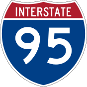
Interstate 95 (I-95), the main Interstate Highway on the east coast of the United States, serves the Atlantic coast of the U.S. state of Georgia. It crosses into the state from Florida at the St. Marys River near Kingsland and travels to the north past the cities of Brunswick and Savannah to the South Carolina state line at the Savannah River near Port Wentworth. The route also passes through the cities of Richmond Hill, Darien and Woodbine. I-95 in Georgia has the unsigned designation of State Route 405 (SR 405).
Route description
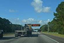
All of I-95 in Georgia has three lanes in each direction, except in the Brunswick area, where it has four lanes in each direction. From the Florida state line to west of Savannah, I-95 travels along the U.S. Route 17 (US 17) corridor, passing near or through marshlands, and is close to the Atlantic coastline.
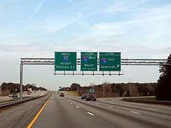
The freeway enters Georgia via twin bridges over the St. Marys River, where it immediately enters the city of Kingsland, intersecting State Route 40 (SR 40). The Interstate continues generally north-northeast, bypassing the smaller communities of Woodbine and Waverly en route to Brunswick, where it intersects US 17, US 25, and US 341. The freeway leaves Brunswick, bypassing the cities of Darien and Midway, before reaching the southern suburbs of Savannah. The route first encounters US 17 again, this time in Richmond Hill, before intersecting SR 204, a busy freeway and southern bypass into Savannah. The route then intersects with I-16 and US 80 in Pooler, also providing direct access to Savannah/Hilton Head International Airport via the Airways Avenue exit (exit 104). After that, the final exit in Georgia is in Port Wentworth, where it intersects SR 21, the major thoroughfare between Augusta and Savannah. I-95 leaves Georgia via twin bridges over the Savannah River, and heads north into South Carolina.
The State Welcome Centers on both ends of I-95 are integrated with other interchanges. The northbound Welcome Center is built into the northbound off-ramp with exit 1, while the on-ramp from here runs under a bridge beneath the same off-ramp before leading back onto northbound I-95. The southbound Welcome Center can be found just after the off-ramp for first southbound truck weighing center, only for both facilities to share an on ramp back to southbound I-95. Other rest areas, weigh stations, and visitors centers operate independently with no access to any other facilities or destinations.
I-95 intersects I-16 near Savannah (exit 99). Ramps to and from the eastbound lanes of I-16 feature barrier gates to prevent traffic from entering I-16 in the wrong direction during contraflow lane reversal for hurricane evacuations.
The only auxiliary route for I-95 in Georgia is a business loop in Darien. Another business loop used to exist for Brunswick however.
History
In 1998, the Georgia State Senate passed a resolution to designate the portion of Interstate 95 between the Ogeechee River (Bryan–Chatham county line) north to the Savannah River in the Greater Savannah Area as the Tom Coleman Highway, in honor of Tom Coleman, a Democrat who served as state senator from 1981 to 1995.[3]
Until 2000, the state of Georgia used the sequential interchange numbering system on all of its Interstate Highways. The first exit on each highway would begin with the number "1" and increase numerically with each exit. In 2000, the Georgia Department of Transportation switched to a mileage-based exit system, in which the exit number corresponded to the nearest milepost.[4][5]
Construction to widen I-95 from two to three lanes started with the Chatham County segment in 1989, with the other county segments done in phases, with the project completed throughout Georgia on December 10, 2010.
Exit list
| County | Location | mi | km | Old exit[5] | New exit | Destinations | Notes | |
|---|---|---|---|---|---|---|---|---|
| St. Mary's River | 0.00 | 0.00 | Florida–Georgia state line | |||||
| Camden | Kingsland | 1.07 | 1.72 | 1 | 1 | St. Marys Road – St. Marys | Northbound traffic can access the Georgia Welcome Center using exit 1 | |
| 3.27 | 5.26 | 2 | 3 | |||||
| 5.73 | 9.22 | 2A | 6 | Laurel Island Parkway – Kingsland , Saint Marys | ||||
| 7.23 | 11.64 | 3 | 7 | Harriets Bluff Road | ||||
| Woodbine | 14.24 | 22.92 | 4 | 14 | ||||
| | 22.44 | 36.11 | — | 22 | Horse Stamp Church Road | Fully opened April 3, 2012 | ||
| Waverly | 26.46 | 42.58 | 5 | 26 | Dover Bluff Road | |||
| Glynn | Brunswick | 29.26 | 47.09 | 6 | 29 | |||
| 35.86 | 57.71 | 7 | 36 | Signed as exits 36A (south) and 36B (north); previously signed as exits 7A and 7B accordingly | ||||
| Dock Junction | 37.69 | 60.66 | 8 | 38 | ||||
| | 42.40 | 68.24 | 9 | 42 | ||||
| McIntosh | Darien | 48.88 | 78.66 | 10 | 49 | |||
| Townsend | 58.32 | 93.86 | 11 | 58 | ||||
| Liberty | Riceboro | 67.29 | 108.29 | 12 | 67 | |||
| Midway | 75.96 | 122.25 | 13 | 76 | ||||
| Bryan | Richmond Hill | 87.01 | 140.03 | 14 | 87 | |||
| 89.38 | 143.84 | 15 | 90 | Signed as Old Clyde Road northbound | ||||
| Chatham | Savannah | 93.45 | 150.39 | 16 | 94 | |||
| Pooler | 98.76 | 158.94 | 17 | 99 | Signed as exits 99A (east) and 99B (west); previously signed as exits 17A and 17B accordingly; I-16 exits 157A-B; cloverleaf interchange. | |||
| 101.51 | 163.36 | 18 | 102 | |||||
| Savannah | 103.50 | 166.57 | 18A | 104 | ||||
| 105.92 | 170.46 | — | 106 | Jimmy DeLoach Parkway – Bloomingdale, Port Wentworth | Signed as exits 106A (south) and 106B (north) | |||
| Port Wentworth | 108.03 | 173.86 | 19 | 109 | ||||
| Effingham |
No major junctions | |||||||
| Savannah River | 112.03 | 180.29 | Georgia–South Carolina state line | |||||
| 1.000 mi = 1.609 km; 1.000 km = 0.621 mi | ||||||||
Business loops
Darien
| |
|---|---|
| Location: | Darien, Georgia |
The Interstate 95 Business Loop (BL 95) for Darien begins at Exit 42 on I-95, and runs concurrent with SR 99. It then joins US 17/SR 25 (Ocean Highway) and follows the road north in a triple concurrency. After SR 99 separates to the northeast in downtown Darien, BL 95 turns northwest onto SR 251 where it reunites with I-95 at its northern terminus on Exit 49.
Brunswick
| |
|---|---|
| Location: | Brunswick, Georgia |
The former Interstate 95 Business Loop (BL 95) for Brunswick used to serve Brunswick and the Golden Isles between Exits 29 and 38 (former Exits 6 and 8). It was concurrent with US 17/SR 25 but no longer exists. The route returned to I-95 via SR 25 Spur.[6]
See also
 U.S. Roads portal
.svg.png) Georgia (U.S. state) portal
Georgia (U.S. state) portal
References
- ↑ Office of Transportation Data (December 31, 2003). Interstate Mileage Report (PDF) (Report). Georgia Department of Transportation. 1DPP438. Archived from the original (PDF) on February 18, 2006. Retrieved March 9, 2012.
- ↑ Georgia State Highway System (PDF) (Map). Cartography by GSHD. Georgia State Highway Department. January 1, 1966. Retrieved July 6, 2016.
- ↑ Staff (March 9, 1998). "State Resolution 648: Designate portion of I-95 in honor of Tom Coleman and Mack Mattingly". First Reader Summary. Georgia General Assembly. Retrieved March 9, 2012.
- ↑ Staff (June 12, 2003). "Georgia's Interstate Exit Numbers". Georgia Department of Transportation. Archived from the original on February 15, 2004. Retrieved April 30, 2007.
- 1 2 Staff (June 12, 2003). "Interstate 95". Georgia's Interstate Exit Numbers. Georgia Department of Transportation. Archived from the original on February 26, 2004. Retrieved March 9, 2012.
- ↑ "Interstate Business Route 95". Interstate Guide. AARoads. June 10, 2009. Retrieved March 9, 2012.
External links
-
 Media related to Interstate 95 in Georgia at Wikimedia Commons
 - Interstate 95 Georgia (AARoads.com)
- Exitlists.com (I-95)
| Previous state: Florida |
Georgia | Next state: South Carolina |