Geography of Mali

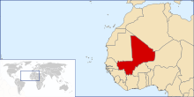
Mali is a landlocked nation in West Africa, located southwest of Algeria, extending south-west from the southern Sahara Desert through the Sahel to the Sudanian savanna zone. Mali's size is 1,240,192 square kilometres.
Desert or semi-desert covers about 65 percent of Mali's area. The Niger River creates a large and fertile inland delta as it arcs northeast through Mali from Guinea before turning south and eventually emptying into the Gulf of Guinea.[1]
Topography
Mali's territory encompasses three natural zones: the southern cultivated Sudanese zone, central semi-desert Sahelian zone, and northern desert Saharan zone. The terrain is primarily savanna in the south and flat to rolling plains or high plateau (200–500 meters in elevation) in the north. There are rugged hills in the northeast, with elevations of up to 1,000 meters.
Desert or semi-desert covers about 65 percent of Mali's area. The Niger River creates a large and fertile inland delta as it arcs northeast through Mali from Guinea before turning south and eventually emptying into the Gulf of Guinea.[1]
The Niger (with 1,693 kilometers in Mali) and Senegal are Mali’s two largest rivers. The Niger is generally described as Mali’s lifeblood, a source of food, drinking water, irrigation, and transportation.[1]
The country's lowest point is on the Senegal River (23 m) and its highest point is Hombori Tondo (1155 m).
Climate

Mali is one of the hottest countries in the world. The thermal equator, which matches the hottest spots year-round on the planet based on the mean daily annual temperature, crosses the country[2] Most of Mali receives negligible rainfall and droughts are very frequent[2] Late June to early December is the rainy season in the southernmost area. During this time, flooding of the Niger River is common, creating the Inner Niger Delta. The vast northern desert part of Mali has a hot desert climate (Köppen climate classification BWh) with long, extremely hot summers and scarce rainfall which decreases northwards. The central area has a hot semi-arid climate (Köppen climate classification BSh) with very high temperatures year-round, a long, intense dry season and a brief, irregular rainy season. The little southern band possesses a tropical wet and dry climate (Köppen climate classification Aw) very high temperatures year-round with a dry season and a rainy season.[1] During the hottest season of the year, temperatures are high throughout the country. Timbuktu, Taoudenni, Araouane, Gao, Kidal, Tessalit are some of the hottest spots on Earth during their warmest months. Kayes, with an average high temperature of about 44° (111.2°) in April is nicknamed "the pressure cooker of Africa" due to his extreme heat year-round. The heat is more extreme to the north in the Sahara Desert; the maximum average high temperature of the year reaches 46 °C (114.8 °F) in Araouane in June[3] and comes close to 48° (118.4°) in the Taoudenni region during July[4] sunshine duration is high in Mali, reaching the highest levels in the northern arid zone with about 3,600 - 3,700 h a year. Mali has overall a hot, sunny and dry climate dominated by the subtropical ridge.
Geology

Geologically, Mali consists mostly of vast flatlands of granite and shale covered by sandstone and alluvial quartz.[5] Mali extends over two main geological structures, the West African craton in the west and the Tuareg shield in the southeast, which came together at the end of the Precambrian era between 600 and 550 million years ago. The suture zone is to the west of the Adrar des Ifoghas mountains.[6]
The underlying rocks of the West African craton are covered in the northwest by sediments of the Taoudeni basin, with two main outcrops of crystalline rocks in the northern Reguibat shield in Mauritania and the southern Leo shield which includes the Bougouni and Kaneiba outcrops, both of which contain valuable minerals.[6] There may also be petroleum reserves in the Taoudeni basin.[7]
Borders
Mali shares a total of 7,243 kilometers (4,500 miles) of land boundaries with seven bordering states: North and northeast: Algeria- 1,376 km/855 mi East: Niger- 821 km/510 mi Southeast: Burkina Faso- 1,000 km/621 mi South: Ivory Coast- 532 km/330 mi Southwest: Guinea- 858 km/533 mi West: Senegal & Mauritania- 419 km/260 mi & 2,237 km/1390 mi (respectively)
Natural resources
Mali is endowed with bauxite, copper, diamonds, gold, Granite, gypsum, iron ore, kaolin, limestone, lithium, manganese, phosphates, salt, silver, uranium, and zinc. Not all deposits are being exploited, and some may not be commercially viable. Mali also has ample hydropower.
Land use
Sixty-five percent of Mali’s land area is desert or semi-desert. According to estimates in 2011, only 5.63 percent of Mali’s area can be classified as arable land, and 0.1 percent was planted to permanent crops. Mali was estimated to have 2,358 square kilometers of irrigated land in 2003. Mali has 100 cubic kilometers of total renewable water resources as off 2011 estimates.[1]
Environmental issues
Mali faces numerous environmental challenges, including desertification, deforestation, soil erosion, drought, and inadequate supplies of potable water. Deforestation is an especially serious and growing problem. According to the Ministry of the Environment, Mali’s population consumes 6 million tons of wood per year for timber and fuel. To meet this demand, 400,000 hectares of tree cover are lost annually, virtually ensuring destruction of the country’s savanna woodlands.[1]
Mali is a party to international treaties on Biodiversity, Climate Change, Climate Change-Kyoto Protocol, Desertification, Endangered Species, Hazardous Wastes, Law of the Sea, Ozone Layer Protection, Wetlands, and Whaling. It has signed, but not ratified the selected agreements.
Natural hazards
Natural hazards in Mali include:
- Desert sandstorms in the north
- Dust-laden harmattan wind is common during dry seasons, bringing a dust haze which may ground aircraft and damage computers and sensitive electronics and machines, as well as aggravating respiratory diseases.
- Recurring droughts
- Bushfires in the south
- Occasional floods, for example in July 2007.[8]
- Tropical thunderstorms in the south, which may bring wind and lightning damage as well as flash floods.
- Occasional Niger River flooding
- No harm to wild animals, but for humans in the forests of Mali.
Extreme points
This is a list of the extreme points of Mali, the points that are farther north, south, east or west than any other location.
- Northernmost point – the northern section of the border with Mauritania, Tombouctou Region*
- Easternmost point – the eastern section of the border with Niger**
- Southernmost point – Fonto Kourou on the border with Cote d'Ivoire, Sikasso Region
- Westernmost point - the tripoint with Senegal and Mauritania, Kayes Region
- *Note: Mali does not have a northernmost point, the border being formed by a straight east–west line
- **Note: Mali does not have an easternmost point, the border being formed by a straight north–south line
See also
References
- 1 2 3 4 5 6 Mali country profile. Library of Congress Federal Research Division (January 2005). This article incorporates text from this source, which is in the public domain.
- 1 2 http://lcweb2.loc.gov/frd/cs/profiles/Mali.pdf
- ↑ https://books.google.fr/books?id=cHRHH7_minUC&pg=PA411&dq=Araouan+%C3%A0+sa+limite+sud-est&hl=fr&sa=X&ei=8CNCVYGuMdPLaO-CgPgL&ved=0CCAQ6AEwAA#v=onepage&q=Araouan%20%C3%A0%20sa%20limite%20sud-est&f=false
- ↑ https://books.google.fr/books?id=0K8sAQAAIAAJ&q=Sahara+climate+amplitude+Bilma&dq=Sahara+climate+amplitude+Bilma&hl=fr&sa=X&ei=LKM8VcHdCtfhaviNgJAI&ved=0CEwQ6AEwBw
- ↑ John Middleton, ed. (1997). "Mali". Encyclopedia of Africa South of the Sahara. 3. Charles Scribner's Sons.
- 1 2 Imrich Kusnir (1999). "Gold in Mali" (PDF). Acta Montanistica Slovaca. Retrieved 2009-03-14.
- ↑ "Taoudeni Basin,OnshoreMali & Mauritania" (PDF). IHS. August 2007. Retrieved 2009-03-14.
- ↑ International Federation of Red Cross And Red Crescent Societies (IFRC): "Mali: Floods DREF Bulletin No. MDRML004". 13 July 2007. ReliefWeb site retrieved 13 August 2007.