Djibouti is a country in the Horn of Africa. It is bordered by Eritrea in the north, Ethiopia in the west and south, and Somalia in the southeast. To the east is its coastline on the Red Sea and the Gulf of Aden. Rainfall is sparse, and most of the territory has a semi-arid or arid environment. Djibouti's major settlements include the capital Djibouti City, the port towns of Tadjoura and Obock, and the southern cities of Ali Sabieh and Dikhil. It is the 151st largest country in the world by land area, covering a total of 23,200 km2, of which 23,180 km2 is land and 20 km2 is water.[1]
Location
Djibouti shares 125 kilometres (78 mi) of border with Eritrea, 342 kilometres (213 mi) with Ethiopia, and 61 kilometres (38 mi) with Somalia (total 528 km or 328 mi). It has a strategic location on the Horn of Africa and the Bab el Mandeb, along a route through the Red Sea and Suez Canal. Djibouti's coastline serves as a commercial gateway between the Arabian Peninsula and the Horn region's interior. The country is also the terminus of rail traffic into Ethiopia.
Physiographic regions
Djibouti can be divided into three physiographic regions
- The Northern Mountains
- Danakil Depression
- Grand Bara

The Goda Mountains
Mountains
A great arc of mountains, consisting of the Mousa Ali, Goda Mountains, and Arrei Mountains surrounds Djibouti.
Djibouti has eight mountain ranges with peaks of over 1,000 m (3,281 ft).[2]
- The Mousa Ali range is considered the country's highest mountain range, with the tallest peak on the border with Ethiopia and Eritrea. It has an elevation of 2,028 m.[2]
- The Goda Mountains lie northwest of the Gulf of Tadjoura in Tadjoura Region. They rise to 1,750 m (5,740 ft) above sea level and are the nation's largest heavily vegetated area.
- Garbi is a mountain in the west of Tadjourah Region. It has an elevation of 1680 metres (5,512 ft).
- The Arrei Mountains are in the southern Ali Sabieh Region. The mountain range has an elevation of 1,301 metres (4,268 ft) above sea level, and is situated near the border with Ethiopia.
- The Mabla Mountains are located in Obock Region. At 1780 m (5850 ft) above sea level, the mountains are situated behind the coastal plain where the Red Sea meets the Gulf of Aden, on the northern side of the Gulf of Tadjoura.
- The Dagouein Mountain sit at an elevation of 1,124 m (3,688 ft) above sea level.
- Hemed is a mountain in the western part of the Arta Region in south-central Djibouti. The summit is 1,103 metres (3,619 ft) above sea level.
- The Boura Mountains' highest peak has an elevation of 1037 m (3,402 ft. The ecology of this landform is semi-desert. The altitude and size of the range affects its weather, with precipitation levels varying greatly and climatic conditions consisting of distinct zones.
Grand Bara
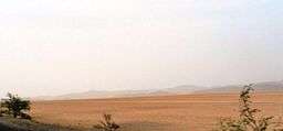
Grand Bara Desert
The Grand Bara Desert covers parts of South Djibouti in Arta Region, Ali Sabieh Region and Dikhil Region. The majority of the Grand Bara Desert lies at a relatively low elevation, below 1,700 feet (560 m). Home of the popular Grand Bara footrace.
Coasts
Most of Djibouti has been described as part of the Ethiopian xeric grasslands and shrublands ecoregion. The exception is a strip along the Red Sea coast, which is part of the Eritrean coastal desert; it is noted as an important migration route for birds of prey.[3]
Djibouti Regions

Map of the regions of Djibouti.
The area of the regions of Djibouti is set out in the table below.
Climate

The rainfall of Djibouti
There is not much seasonal variation in Djibouti's climate. Hot conditions prevail year-round along with winter rainfall. Mean daily maximum temperatures range from 32 to 41 °C (90 to 106 °F), except at high elevations. In Djibouti city, for instance, afternoon highs in April typically range from 28 °C (82 °F) to 34 °C (93 °F) in April. Nationally, mean daily minima generally vary between sites from about 15 to 30 °C (59 to 86 °F). The greatest range in climate occurs in eastern Djibouti, where temperatures sometimes surpass 41 °C (106 °F) in July on the littoral plains and fall below freezing point during December in the highlands. In this region, relative humidity ranges from about 40% in the mid-afternoon to 85% at night, changing somewhat according to the season.
Djibouti have either a hot semi-arid climate (BSh) or a hot desert climate (BWh), although temperatures are much moderated at the high elevations. On the eastern seaboard, annual rainfall is less than 5 inches (131 mm); in the central highlands, it is about 8 to 11 inches (200 to 300 mm). Although the coastal regions are hot and humid throughout the year, the hinterland is typically hot and dry. The climate conditions are highly variable within the country and vary locally by altitude. Summers are very humid along the coast but dry in the highlands. Heat waves are frequent. Annual precipitation amounts vary greatly from one year to another. In general, rain falls more frequently and extensively in the mountains. Sudden and brutal storms are also known to occur. Wadis turn for a few hours into raging torrents tearing everything in their path, and their course is regularized. Rainwater serves as an additional water supply for livestock and plants alongside seasonal watercourses. The highlands have temperate climate throughout out the year. The climate of most lowland zones is arid and semiarid.

Topography of Djibouti
The climate of the interior shows notable differences from the coastline. Especially when one rises, the temperature is pleasant: it is so in Arta, Randa and Day (where temperatures of 10 ° have been recorded).
Climate charts of different locations in Djibouti
| Djibouti city
|
|---|
| Climate chart (explanation) |
|---|
| J | F | M | A | M | J | J | A | S | O | N | D |
|
|
|
|
|
|
|
|
|
|
|
|
| Average max. and min. temperatures in °C |
| Precipitation totals in mm | | Source: BBC Weather |
|
| Imperial conversion |
|---|
| J | F | M | A | M | J | J | A | S | O | N | D |
|
|
|
|
|
|
|
|
|
|
|
|
| Average max. and min. temperatures in °F |
| Precipitation totals in inches |
|
| Arta
|
|---|
| Climate chart (explanation) |
|---|
| J | F | M | A | M | J | J | A | S | O | N | D |
|
|
|
|
|
|
|
|
|
|
|
|
| Average max. and min. temperatures in °C |
| Precipitation totals in mm | | Source: Climate-Data |
|
| Imperial conversion |
|---|
| J | F | M | A | M | J | J | A | S | O | N | D |
|
|
|
|
|
|
|
|
|
|
|
|
| Average max. and min. temperatures in °F |
| Precipitation totals in inches |
|
| Dikhil
|
|---|
| Climate chart (explanation) |
|---|
| J | F | M | A | M | J | J | A | S | O | N | D |
|
|
|
|
|
|
|
|
|
|
|
|
| Average max. and min. temperatures in °C |
| Precipitation totals in mm | | Source: Climate-Data |
|
| Imperial conversion |
|---|
| J | F | M | A | M | J | J | A | S | O | N | D |
|
|
|
|
|
|
|
|
|
|
|
|
| Average max. and min. temperatures in °F |
| Precipitation totals in inches |
|
| Randa
|
|---|
| Climate chart (explanation) |
|---|
| J | F | M | A | M | J | J | A | S | O | N | D |
|
|
|
|
|
|
|
|
|
|
|
|
| Average max. and min. temperatures in °C |
| Precipitation totals in mm | | Source: Climate-Data |
|
| Imperial conversion |
|---|
| J | F | M | A | M | J | J | A | S | O | N | D |
|
|
|
|
|
|
|
|
|
|
|
|
| Average max. and min. temperatures in °F |
| Precipitation totals in inches |
|
| Tadjoura
|
|---|
| Climate chart (explanation) |
|---|
| J | F | M | A | M | J | J | A | S | O | N | D |
|
|
|
|
|
|
|
|
|
|
|
|
| Average max. and min. temperatures in °C |
| Precipitation totals in mm | | Source: Climate-Data |
|
| Imperial conversion |
|---|
| J | F | M | A | M | J | J | A | S | O | N | D |
|
|
|
|
|
|
|
|
|
|
|
|
| Average max. and min. temperatures in °F |
| Precipitation totals in inches |
|
| Ali Sabieh
|
|---|
| Climate chart (explanation) |
|---|
| J | F | M | A | M | J | J | A | S | O | N | D |
|
|
|
|
|
|
|
|
|
|
|
|
| Average max. and min. temperatures in °C |
| Precipitation totals in mm | | Source: Climate-Data |
|
| Imperial conversion |
|---|
| J | F | M | A | M | J | J | A | S | O | N | D |
|
|
|
|
|
|
|
|
|
|
|
|
| Average max. and min. temperatures in °F |
| Precipitation totals in inches |
|
| Guelile
|
|---|
| Climate chart (explanation) |
|---|
| J | F | M | A | M | J | J | A | S | O | N | D |
|
|
|
|
|
|
|
|
|
|
|
|
| Average max. and min. temperatures in °C |
| Precipitation totals in mm | | Source: Climate-Data |
|
| Imperial conversion |
|---|
| J | F | M | A | M | J | J | A | S | O | N | D |
|
|
|
|
|
|
|
|
|
|
|
|
| Average max. and min. temperatures in °F |
| Precipitation totals in inches |
|
| Airolaf
|
|---|
| Climate chart (explanation) |
|---|
| J | F | M | A | M | J | J | A | S | O | N | D |
|
|
|
|
|
|
|
|
|
|
|
|
| Average max. and min. temperatures in °C |
| Precipitation totals in mm | | Source: Climate-Data |
|
| Imperial conversion |
|---|
| J | F | M | A | M | J | J | A | S | O | N | D |
|
|
|
|
|
|
|
|
|
|
|
|
| Average max. and min. temperatures in °F |
| Precipitation totals in inches |
|
Selected elevations of notable locations
| Location |
Region |
Elevation
(feet) |
Elevation
(metres) |
| Mousa Ali |
Tadjourah |
6,631 ft |
2,021 m |
| Goda Mountains |
Tadjourah |
5,840 ft |
1,780 m |
| Garbi |
Tadjourah |
5,512 ft |
1,680 m |
| Arrei Mountains |
Ali Sabieh |
4,268 ft |
1,301 m |
| Mabla Mountains |
Obock |
3,921 ft |
1,195 m |
| Dagouein Mountain |
Ali Sabieh |
3,688 ft |
1,124 m |
| Hemed |
Arta |
3,619 ft |
1,103 m |
| Boura Mountains |
Ali Sabieh |
3,402 ft |
1,037 m |
| Arta Mountains |
Arta |
2,477 ft |
755 m |
| Lake Assal |
Tadjourah |
– 509 ft |
– 155 m |
Lake Assal is the lowest point in Africa (the second lowest is the Qattara Depression in Northern Egypt).
Environment
Natural hazards include earthquakes, drought, and occasional cyclonic disturbances from the Indian Ocean, which bring heavy rains, and flash floods. Natural resources include geothermal energy. Inadequate supplies of potable water, limited arable land and desertification are current issues.
Djibouti is a party to international agreements on biodiversity, climate change, desertification, endangered species, Law of the Sea, ozone layer protection, ship pollution, and wetlands.
Maritime claims
- territorial sea: 12 nautical miles (22.2 km; 13.8 mi)
- contiguous zone: 24 nautical miles (44.4 km; 27.6 mi)
- exclusive economic zone: 200 nautical miles (370.4 km; 230.2 mi)
Extreme points
This is a list of the extreme points of Djibouti, the points that are farther north, south, east or west than any other location.
References
|
|---|
|
| History | | |
|---|
|
| Geography | |
|---|
|
| Politics | |
|---|
|
| Economy | |
|---|
|
| Culture | |
|---|
|
|