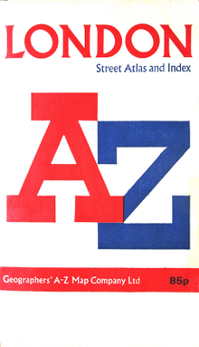
Geographers' A-Z Map Company
Geographers' A-Z Map Company Ltd. is the largest independent map publisher in the United Kingdom providing cartographic services,[1] digital data products[2] and paper mapping publications[3] (including Street Atlases, Visitors Guides, Great Britain Road Atlases and The Adventure Atlas).
The company is based in Dunton Green, Kent.[4]
Establishment
Geographers' Map Company Ltd. was established in London on 28 August 1936, by Alexander Grosz with offices in Napier House, 24-27 High Holborn. The company's most famous publication "The A-Z Street Atlas" was created by Phyllis Pearsall[5][6][7] who took on the responsibility of creating the first edition. Spending hours walking the streets of London cataloguing house numbers, junctions and streets.[8] The company sold every copy of the first London Geographers' A–Z Street Atlas, with her main customer being W.H. Smith and Sons.
By 1938, Geographers' Map Company Ltd. was selling 12 titles, with the maps being entirely created by skilled cartographers. With the outbreak of the Second World War, the government ordered the removal of street maps from sale so the business produced war maps for newspapers throughout the War.
1950s to Present Day
By 1952 and after an aircraft accident in 1946[9][10] endangering the life of Phyllis Pearsall, Geographers' Map Company Ltd. had over 30 publications covering the United Kingdom from London to Glasgow. The 1960s saw the company move to the Sevenoaks area in Kent and ownership move to the Geographer's Map Trust.
The 1970s saw both an introduction of the now iconic A-Z to the company name.
The early adoption of technology and in particular the use of CAD/CAM Unix computers, then the Windows PC accelerated the pace of map publication that resulted in a peak in sales during 2005.[11] Significant technological developments in the industry saw the increased availability of free mapping and satellite navigation as the demand for paper production rapidly declined - ultimately resulted in the company restructure in 2013.
Geographers' A-Z Maps digital offering is growing rapidly and is already in use by charities like London's Air Ambulance,[12] emergency services (London Ambulance Service - (featuring in the BBC documentary 'Ambulance')), public organisations and private business, providing the familiar mapping solution at street scale.
Additionally, the company has started to include licensed brand products including Ben Sherman clothing[13] and Paperchase stationary.[14]
2012 Olympics
Geographers' A-Z Map Company cartographic services team[1] were the official suppliers of paper atlases and maps for the 2012 Olympic Games and 2012 Paralympic Games.[15] They produced atlases that detailed transport information for navigating to the venues as well as other information.
Digital Data Range
Geographers' A-Z Map Company are now producing digital data[16] Providing both the business user and high street customer exactly what they want through the additional technology of print on demand,[17][18][19][20] custom map creation and digital data provision.
The product "STREET" is being upgraded to include full digital coverage of the United Kingdom.


Large Scale
LARGE SCALE is the most detailed mapping that the company provides. At 1:7,040 it covers the majority of UK towns and cities as well as all of central London. This mapping you will find in the city centre mapping within the A-Z Atlas.
Street
STREET is the iconic A-Z dataset which was designed for readability, easy navigation and complete street and road labeling. This is the mapping you will find in an A-Z Atlas.
Main Road
MAIN ROAD is designed to be ultra clear complete with street names and in-depth ancillary reference information. This data fits between the extensive Street and clarity of Road.
Road
ROAD is found in road atlases that cover the whole UK transport network including high detail of motorway junctions.
Mini Road
MINI ROAD is a small scale UK-wide map primarily used to show the UK transport network.
Gazetteer
The extensive geographic index from paper publications is available digitally and includes street names, hospitals, government buildings, points of interest etc
App Development
Geographers' A-Z Map Company produces a number of smartphone apps that are available on most devices. They characterised by a speedy experience, incorporating map data into the app meaning no streaming/download of data is required and GPS/Wifi enabled for inbuilt location services.
Apps include: Cabbies Mate, A-Z London Tourist Map, London Super Scale Street map, Greater London map, Glasgow Premier Map
See also
The A–Z of Mrs. P
Ordnance Survey Partner Profile
References
- 1 2 http://www.az.co.uk/?nid=689 | Cartographic Services
- ↑ http://www.azdigital.co.uk | Digital Data Prodcuts
- ↑ http://www.az.co.uk/?nid=2 | Paper Maps and Atlases
- ↑ http://www.az.co.uk/?nid=39 | About Us Page
- ↑ Theatre. "Who was the woman who 'invented' the London A-Z?". Telegraph. Retrieved 2016-11-18.
- ↑ By SARAH LYALLAUG. 30, 1996 (1996-08-30). "Phyllis Pearsall, 89, Dies; Creator of 'A to Z' London Maps - The New York Times". Nytimes.com. Retrieved 2016-11-18.
- ↑ Heald, Claire (2006-09-25). "UK | Magazine | From Aaron Hill to Zoffany St". BBC News. Retrieved 2016-11-18.
- ↑ Pearsall, Phyllis. AZ Maps: The Personal Story, from Bedsitter to Household Name. Geographers' AZ Map Company, 1990.
- ↑ "Dakota PH-TBO Civil Aviation Crash 1946 Shere Surrey". Sheredelight.com. Retrieved 2016-11-18.
- ↑ Pearsall 1990, p. 100,111
- ↑ http://www.az.co.uk/?nid=40
- ↑ "Cause related marketing – London's Air Ambulance". Londonsairambulance.co.uk. Retrieved 2016-11-18.
- ↑ "A-Z Printed Collar Polo Staples navy". Bensherman.co.uk. Retrieved 2016-11-18.
- ↑ "A-Z Collection at Paperchase - Official A-Z Design". Paperchase.co.uk. Retrieved 2016-11-18.
- ↑ Name * (2012-07-31). "A-Z London 2012 Venues Atlas". Mapping London. Retrieved 2016-11-18.
- ↑ "The lost era of the A-Z map? - BBC News". Bbc.co.uk. 2014-02-24. Retrieved 2016-11-18.
- ↑ "Geographer's A-Z Map Company". MapSherpa. Retrieved 2016-11-18.
- ↑ "A-Z Maps present at the first UK MapSherpa Partner Meeting at Ordnance Survey Head Office". Directionsmag.com. 2016-03-31. Retrieved 2016-11-18.
- ↑ http://www.az.co.uk/?nid=686
- ↑ http://www.az.co.uk/?nid=60&iid=13034#.WAYEKIMrJpg | e.g. Print On Demand Sheffield A-Z Street Map (Wall Map, Paper)
Bibliography
- Pearsall, Phyllis (1990). A to Z Maps: The Personal Story — From Bedsitter to Household Name. Geographers' A–Z Map Co Ltd. ISBN 0-85039-243-8.
External links
- Geographers' A-Z Map Company Website
- Geographers' A-Z Map Company Digital
- A-Z Map Company 80th Anniversary History
- A-Z Map Company 80th Anniversary Memorabilia
- A-Z Map Company 80th Anniversary Timeline