Genkai Island
| Native name: <span class="nickname" ">玄界島 Genkai-jima | |
|---|---|
|
Genkai Island | |
 Genkai Island | |
| Geography | |
| Location | Genkai Sea |
| Coordinates | 33°41′24″N 130°14′0″E / 33.69000°N 130.23333°E |
| Area | 1.14 km2 (0.44 sq mi) |
| Coastline | 4.4 km (2.73 mi) |
| Highest elevation | 217.9 m (714.9 ft) |
| Highest point | Mt.Tōmi (遠見山 Tōmi-yama) |
| Administration | |
|
Japan | |
| Prefecture | Fukuoka Prefecture |
| City | Fukuoka City |
| Ward | Nishi-ku |
| Additional information | |
| Official website | Genkai-jima Official Site (Japanese) |
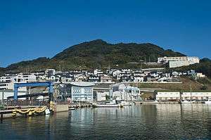
Genkai Island (玄界島 Genkai-jima) is an island in Nishi-ku, Fukuoka, Japan. The island was seriously damaged by 2005 Fukuoka earthquake. The affected areas in the island were reconstructed by 2008.
Access
- Fukuoka Municipal Ferry Service (福岡市営渡船 Fukuoka Shi-ei Tosen)
- Hakata Port - Genkai Island Port[1]
 New Genkai at Genkai Island Port
References
| Wikimedia Commons has media related to Genkaijima Island. |
This article is issued from Wikipedia - version of the 11/18/2016. The text is available under the Creative Commons Attribution/Share Alike but additional terms may apply for the media files.