General Carrera Lake
| Lake Buenos Aires General Carrera Lake | |
|---|---|
 | |
|
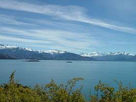
General Carrera Lake in the Aysén Region | |
| Location | Lago Buenos Aires Department, Santa Cruz Province, Argentina / General Carrera Province, Aysén del General Carlos Ibáñez del Campo Region, Chile, in Patagonia |
| Coordinates | 46°30′S 72°0′W / 46.500°S 72.000°WCoordinates: 46°30′S 72°0′W / 46.500°S 72.000°W [1] |
| Type | Moraine dammed |
| Primary inflows | Soler, Los Antiguos, Jeinemeni, Ibáñez, San Martín, Delta |
| Primary outflows | Bertrand Lake and then Baker River |
| Basin countries | Argentina, Chile |
| Surface area | 1,850 km² |
| Max. depth | 586 m |
| Surface elevation | 217 m |
| Settlements | Chile Chico, Puerto Ingeniero Ibáñez, Puerto Guadal, Los Antiguos |
| References | [1] |
General Carrera Lake (Chilean side) or Lake Buenos Aires (Argentine side) is a lake located in Patagonia and shared by Argentina and Chile. Both names are internationally accepted.
The lake has a surface of 1,850 km² of which 970 km² are in the Chilean Aysén del General Carlos Ibáñez del Campo Region, and 880 km² in the Argentine Santa Cruz Province, making it the biggest lake in Chile, and the fourth largest in Argentina. In its western basin, Lake Gen. Carrera has 586 m maximum depth.[2]
The lake is of glacial origin and is surrounded by the Andes mountain range. The lake drains to the Pacific Ocean on the west through the Baker River.
The weather in this area of Chile and Argentina is generally cold and humid. But the lake itself has a sunny microclimate, a weather pattern enjoyed by the few settlements along the lake, such as Puerto Guadal, Fachinal, Mallín Grande, Puerto Murta, Puerto Río Tranquilo, Puerto Sánchez, Puerto Ingeniero Ibáñez and Chile Chico in Chile, and Los Antiguos and Perito Moreno in Argentina.
The area near the coast of the lake was first inhabited by criollos and European immigrants between 1900 and 1925. In 1971 and 1991, eruptions of the Hudson Volcano severely affected the local economy, especially that of sheep farming.
The Argentine side of the lake is relatively easy to access, through a strip of plains that was first used by the Tehuelches, and then by explorer Francisco Moreno. The National Route 40, created in the 1920s, also makes use of it. The Chilean side of the lake has been mostly isolated, and was for years accessed through Argentina, until the creation in the 1990s of the Carretera Austral, which connected it to the rest of Chile, and permitted the expansion of tourism in the area.
A car ferry operates between Puerto Ingeniero Ibáñez and Chile Chico in the Chilean sector of the lake.
The lake is known as a trout and salmon fishing destination.
The Marble Caves, Marble Chapel and Marble Cathedral are an unusual geological formation located at the centre of the lake. They represent a group of caverns, columns and tunnels formed in monoliths of marble. The Marble Caves have been formed by wave action over the last 6,200 years.[3]
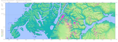 SRTM-Topography of the Chilean zone
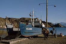 Boat near Chile Chico in Chile
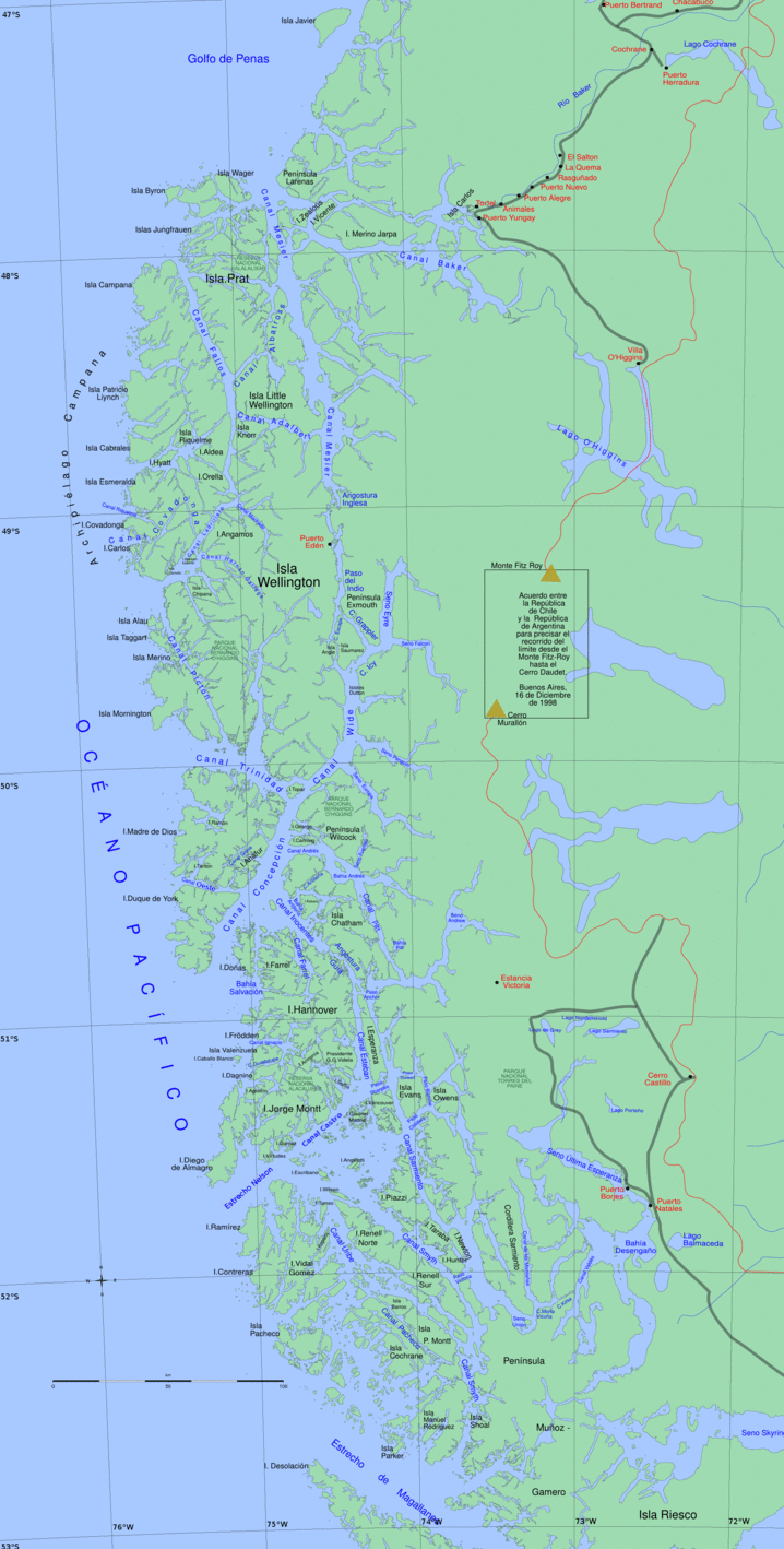 Map of the Chilean zone
References
| Wikimedia Commons has media related to General Carrera Lake. |
- 1 2 Earth Info, earth-info.nga.mil webpage: .
- ↑ Murdie et al. 1999, Geo-Marine Letters 18:315-320.
- ↑ "The Marble Caves (Cavernas de Mármol)". Wondermondo.
| Rivers | .png) | |
|---|---|---|
| Lakes | ||
| Glaciers | ||