Jebel Barkal
| جبل بركل | |
 Jebel Barkal is a small mountain, 98 meters tall | |
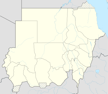 Shown within Sudan | |
| Alternate name | Gebel Barkal |
|---|---|
| Location | Karima, Northern State, Sudan |
| Region | Nubia |
| Coordinates | 18°32′12″N 31°49′42″E / 18.53667°N 31.82833°ECoordinates: 18°32′12″N 31°49′42″E / 18.53667°N 31.82833°E |
| Type | Sanctuary |
| Official name | Gebel Barkal and the Sites of the Napatan Region |
| Type | Cultural |
| Criteria | i, ii, iii, iv, vi |
| Designated | 2003 (27th session) |
| Reference no. | 1073 |
| Region | Arab States |
Jebel Barkal or Gebel Barkal (Arabic: جبل بركل) is a very small mountain located some 400 km north of Khartoum, in Karima town in Northern State in Sudan, on a large bend of the Nile River, in the region called Nubia. The mountain is 98 m tall, has a flat top, and apparently was used as a landmark by the traders in the important route between central Africa, Arabia, and Egypt, as the point where it was easier to cross the great river. In 2003, the mountain, together with the historical city of Napata (which sits at its feet), were named World Heritage Sites by UNESCO.
History
Around 1450 BCE, the Egyptian Pharaoh Thutmose III extended his empire to that region and considered Gebel Barkal its southern limit. There, he campaigned near the city of Napata that, about 300 years later, became the capital of the independent kingdom of Kush. The 25th Dynasty Nubian king Piye later greatly enlarged the New Kingdom Temple of Amun in this city and erected his Year 20 Victory stela within it.
Ruins
The ruins around Gebel Barkal include at least 13 temples and 3 palaces, that were for the first time described by European explorers in the 1820s. In 1862 five inscriptions from the Third Intermediate Period were recovered by an Egyptian officer and transported to the Cairo Museum, but not until 1916 were scientific archeological excavations performed by a joint expedition of Harvard University and the Museum of Fine Arts of Boston under the direction of George Reisner.[1] From the 1970s, explorations continued by a team from the University of Rome La Sapienza, under the direction of Sergio Donadoni, that was joined by another team from the Boston Museum, in the 1980s, under the direction of Timothy Kendall. The larger temples, such as that of Amun, are even today considered sacred to the local population.
Pyramids
Jebel Barkal served as a royal cemetery during the Meroitic Kingdom.[2] The earliest burials date back to the 3rd century BC.
- Bar. 1 King from the middle of the 1st century BCE
- Bar. 2 King Teriqas (ca. 29-25 BCE)
- Bar. 4 Queen Amenirenas ? (1st century BCE)
- Bar. 6 Queen Nawidemak (1st century BCE)
- Bar. 7 King Sabrakamani? (3rd century BCE)
- Bar. 9 King or Queen of the early 2nd century CE
- Bar. 11 King Aktisanes or Aryamani (3rd century BCE)
- Bar. 14 King Aktisanes or Aryamani (3rd century BCE)
- Bar. 15 King Kash[…] ?(3rd century BCE)
Gallery
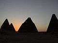 Pyramids near Jebel Barkal
 Pyramids in the southern group
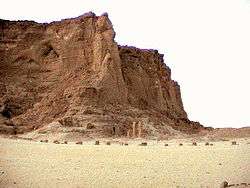 The last standing pillars of Napata's temple of Amun at the foot of Jebel Barkal
See also
References
- ↑ A. Reisner, "Historical Inscriptions from Gebel Barkal", Sudan Notes and Records, 4 (1921), pp. 59-75
- ↑ László Török, The kingdom of Kush: handbook of the Napatan-Meroitic Civilization
External links
| Wikimedia Commons has media related to Jebel Barkal. |
- Website of the National Corporation for Antiquities and Museums Archaeological Mission at Jebel Barkal
- LearningSites.com - Gebel Barkal
- UNESCO World Heritage Centre - Gebel Barkal and the Sites of the Napatan Region
- The Victory Stela of Piye