Gawler Ranges
| Gawler Ranges | |
|---|---|
 The "Organ Pipes" waterfall in the ranges | |
| Highest point | |
| Peak | Nukey Bluff |
| Elevation | 465 m (1,526 ft) |
| Geography | |
| Country | Australia |
| State | South Australia |
| Region | Eyre Peninsula |
| Range coordinates | 32°32′S 135°22′E / 32.53°S 135.37°ECoordinates: 32°32′S 135°22′E / 32.53°S 135.37°E |
| Geology | |
| Age of rock | Proterozoic |


The Gawler Ranges are a range of stoney hills in South Australia to the north of Eyre Peninsula. The Eyre Highway skirts the south of the ranges. The Gawler Ranges National Park is in the ranges north of Kimba and Wudinna. The ranges are covered by the Gawler Ranges Native Title Claim.
History
The ranges were named by Edward John Eyre after the Governor of South Australia, George Gawler in 1839.[1] This was on one of Eyre's earlier expeditions before his famous crossing of the Nullarbor Plain further west. And it was on this expedition that Edward John Eyre made the first recorded sighting of South Australia's floral emblem, the Sturt desert pea, in 1839 during an early exploration of the region.[2]
Stephen Hack explored the range in 1856 and in 1857 the first pastoral lease was taken up in the area and more sheep stations were soon established. Two good seasons followed in 1857 and 1858 with pastoralists reporting permanent freshwater lakes on their runs. Stations were required to stock 50 sheep per square mile (19 per square kilometre) but soon properties such as Nonning were shearing flocks of 90,000. The first mail service from Port Augusta to Yardea commenced in 1876, with the telegraph service to Western Australia that passes through the range commencing in 1903[3]
Environment
Geology
The ranges were formed by volcanic activity nearly 1.5 billion years ago: the volcanic activity resulted in a lava field, rather than volcanoes. The highest point is Nukey Bluff at 465 metres (1,526 ft) above sea level.[1] The ranges are a small part of the Gawler Craton which is a craton rich in mineral resources, although many are only recently discovered and not yet fully exploited.[2] Bornhardts dominate the landscape.[4]
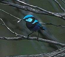
Birds
There are some 140 species of birds in the Gawler Ranges, including the emu, wedge-tailed eagle, Major Mitchell's cockatoo and singing honeyeater.[2]
Mammals
The Gawler Ranges are home to several larger mammals, like the southern hairy-nosed wombat[5] and the endangered yellow-footed rock wallaby.[6]
See also
Notes
- 1 2 "Gawler Ranges National Park" (PDF). Department for Environment and Heritage. Retrieved 2009-11-12.
- 1 2 3 South Australia - Gawler Ranges
- ↑ "History of the Gawler Ranges". Mt Ive Station. Retrieved 15 March 2015.
- ↑ Campbell, E.M.; C.R. Twidale (February 1991). "The evolution of bornhardts in silicic volcanic rocks in the Gawler Ranges". Australian Journal of Earth Sciences. Taylor & Francis. 38 (1): 79–83. Bibcode:1991AuJES..38...79C. doi:10.1080/08120099108727957. ISSN 1440-0952. Retrieved 2010-01-24.
- ↑ Deborah Furbank (2010): Briefing note on the Southern Hairy-nosed Wombat. Yorke Peninsula Natural Resource Management Group PDF
- ↑ Informationsbroschüre des Parkverwaltung, engl., pdf
Further reading
- Anon. (1973). The Gawler Ranges. Report on a survey by the Nature Conservation Society of South Australia. NCSSA: Adelaide.