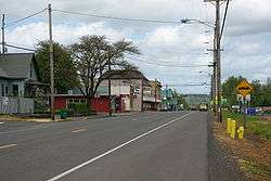
Gaston, Oregon
| Gaston, Oregon | |
|---|---|
| City | |
 | |
 Location in Oregon | |
 Gaston, Oregon Location in the United States | |
| Coordinates: 45°26′11″N 123°8′29″W / 45.43639°N 123.14139°WCoordinates: 45°26′11″N 123°8′29″W / 45.43639°N 123.14139°W | |
| Country | United States |
| State | Oregon |
| County | Washington |
| Incorporated | 1914 |
| Government | |
| • Mayor | Tony Hall |
| Area[1] | |
| • Total | 0.28 sq mi (0.73 km2) |
| • Land | 0.28 sq mi (0.73 km2) |
| • Water | 0 sq mi (0 km2) |
| Elevation | 300 ft (90 m) |
| Population (2010)[2] | |
| • Total | 637 |
| • Estimate (2012[3]) | 658 |
| • Density | 2,275.0/sq mi (878.4/km2) |
| Time zone | Pacific (UTC-8) |
| • Summer (DST) | Pacific (UTC-7) |
| ZIP code | 97119 |
| Area code(s) | 503 and 971 |
| FIPS code | 41-28100[2] |
| GNIS feature ID | 1157988[4] |
Gaston is a city in Washington County, Oregon, United States. The population was 637 at the 2010 census.
History
Early history
.jpg)
Prior to the arrival of European immigrants in the 1800s, little is known about Native American settlements in the Gaston area. What is known indicates that Native Americans in the area lived similarly to other Pacific Northwest tribes. In nearby Cherry Grove there are a few petroglyphs usually credited to the Atfalati tribe, which is a division of Kalapuya. Diseases such as smallpox, malaria and influenza which were brought to North America by European Settlers, decimated local native American Population. By the time European's began to significantly settle the region, as much as 90% of the original native populations had been killed.
Schools
In the 1860s, the census recorded only about 70 people in the Gaston area. Nonetheless, in 1866, the first Gaston School was founded. In 1870, a new school was built near the connecting road between Old Highway 47 and the new Highway 47. Initially students only attended school for three to six months per year, later expanded to nine months. In 1871, as a stage coach line brought more settlers, and in anticipation of a new rail line, railroad developer and town namesake Joseph Gaston set aside 2 acres (0.81 ha) of land on what was then the edge of town for a school.
Rail services
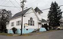
In the early 1870s, stagecoach and rail service was expanding rapidly in Washington County. By 1872, a stop on the Portland – St. Joseph line in Patton Valley was officially named Gaston. With a train stop, more people came and by 1873 a post office opened in the new town. The same year, the first church, Gaston Congregational Church, was also built. In the 1880s, Joseph Gaston was responsible for draining Wapato Lake, which lay in the valley around the rail stop, creating the farmland that exists today. "Wapato" is a word from the local Indians that refers to a water-based starchy root vegetable related to arrowroot sometimes called a "water potato" in local English. Rail service ended in 1985 with the removal of rails back to the junction to the Seghers spur.
1900 to present
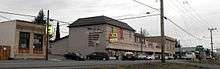
The addition of a spur line to the nearby Cherry Grove area for the construction of a lumber mill in 1911 added significant activity to the local economy, although it had to be shut down in 1913 during a lumber market crash. The crash of 1913 notwithstanding, by 1916 Gaston had added a bank, J.H. Wescott and Sons General Merchandise, Bell & Owens General Mercantile Company, and other businesses.
In early May 1935 workers at the Stimson Mill went on strike. On May 22, "twenty-five cars loaded with pickets left the Labor Temple in Portland" to support the strikers. The next morning Governor Charles Martin ordered the state police and National Guard to protect the strikebreakers. Armed with gas grenades and machine guns, the military and police forces demanded the strikers leave or be shot. The strikers chose to disperse, averting a potential bloodbath.[5]
New high school
In 1915 a new high school was built on the land Joseph Gaston had previously set aside for a school. That high school was in use through the 1986–87 school year, when it was condemned. The condemning of the building became a crucial local issue for the town, with residents split between merging with a nearby district (both Forest Grove or Yamhill were considered), and building a new high school. In the end, a new high school was built and Gaston retained its independent school system and with it a degree of local pride. Currently the Gaston School District is a full K–12 district, with 525 students total in 2007, and a single high school.
Modern expansion
The growing popularity of Portland and the Pacific Northwest in general has led to population growth throughout the region. Though too far from Portland to benefit much at first, recently Gaston has started to see new housing and an uptick in school registrations. The late 1980s brought a new fire station and the 1990s baseball/softball-oriented park. Just after 2000, a new post office was built on the edge of town. Thus far, the town has not been able to effectively capitalize on the local wine industry's growing national and international recognition. In 2006, the mayoral candidate advocated obtaining state or federal funding to revitalize the commercial strip on Main Street which, in theory, could help the city capture some of the wine tourism dollars.
Geography
According to the United States Census Bureau, the city has a total area of 0.28 square miles (0.73 km2), all of it land.[1]
Climate
This region experiences warm (but not hot) and dry summers, with no average monthly temperatures above 71.6 °F (22.0 °C). According to the Köppen Climate Classification system, Gaston has a warm-summer Mediterranean climate, abbreviated "Csb" on climate maps.[6]
Demographics
| Historical population | |||
|---|---|---|---|
| Census | Pop. | %± | |
| 1920 | 221 | — | |
| 1930 | 227 | 2.7% | |
| 1940 | 333 | 46.7% | |
| 1950 | 368 | 10.5% | |
| 1960 | 320 | −13.0% | |
| 1970 | 429 | 34.1% | |
| 1980 | 471 | 9.8% | |
| 1990 | 563 | 19.5% | |
| 2000 | 600 | 6.6% | |
| 2010 | 637 | 6.2% | |
| Est. 2015 | 688 | [7] | 8.0% |
2010 census
As of the census of 2010, there were 637 people, 241 households, and 160 families residing in the city. The population density was 2,275.0 inhabitants per square mile (878.4/km2). There were 251 housing units at an average density of 896.4 per square mile (346.1/km2). The racial makeup of the city was 91.2% White, 0.3% African American, 1.4% Native American, 0.6% Asian, 0.2% Pacific Islander, 3.3% from other races, and 3.0% from two or more races. Hispanic or Latino of any race were 11.0% of the population.[2]
There were 241 households of which 36.9% had children under the age of 18 living with them, 49.8% were married couples living together, 10.0% had a female householder with no husband present, 6.6% had a male householder with no wife present, and 33.6% were non-families. 25.3% of all households were made up of individuals and 3.7% had someone living alone who was 65 years of age or older. The average household size was 2.64 and the average family size was 3.18.[2]
The median age in the city was 35.2 years. 26.7% of residents were under the age of 18; 9.5% were between the ages of 18 and 24; 26.7% were from 25 to 44; 31.2% were from 45 to 64; and 6% were 65 years of age or older. The gender makeup of the city was 51.2% male and 48.8% female.[2]
2000 census
As of the census of 2000, there were 600 people, 196 households, and 139 families residing in the city. The population density was 2,691.7 people per square mile (1,053.0/km²). There were 204 housing units at an average density of 915.2 per square mile (358.0/km²). The racial makeup of the city was 88.33% White, 0.83% Native American, 0.17% Asian, 7.00% from other races, and 3.67% from two or more races. Hispanic or Latino of any race were 14.50% of the population.[2]
There were 196 households out of which 44.9% had children under the age of 18 living with them, 52.0% were married couples living together, 14.8% had a female householder with no husband present, and 28.6% were non-families. 25.0% of all households were made up of individuals and 3.1% had someone living alone who was 65 years of age or older. The average household size was 3.06 and the average family size was 3.73.[2]
In the city the population was spread out with 37.7% under the age of 18, 9.5% from 18 to 24, 30.7% from 25 to 44, 18.2% from 45 to 64, and 4.0% who were 65 years of age or older. The median age was 28 years. For every 100 females there were 104.1 males. For every 100 females age 18 and over, there were 90.8 males.[2]
The median income for a household in the city was $36,458, and the median income for a family was $42,031. Males had a median income of $31,641 versus $25,833 for females. The per capita income for the city was $17,758. About 9.8% of families and 11.1% of the population were below the poverty line, including 21.3% of those under age 18 and none of those age 65 or over.[2]
See also
References
- 1 2 "US Gazetteer files 2010". United States Census Bureau. Retrieved 2012-12-21.
- 1 2 3 4 5 6 7 8 9 "American FactFinder". United States Census Bureau. Retrieved 2012-12-21.
- ↑ "Population Estimates". United States Census Bureau. Retrieved 2013-06-02.
- ↑ "US Board on Geographic Names". United States Geological Survey. 2007-10-25. Retrieved 2008-01-31.
- ↑ Murrell, Gary, "Hunting Reds in Oregon, 1935-1939" Oregon Historical Quarterly, Winter 1999
- ↑ Climate Summary for Gaston, Oregon
- ↑ "Annual Estimates of the Resident Population for Incorporated Places: April 1, 2010 to July 1, 2015". Retrieved July 2, 2016.
- ↑ "Census of Population and Housing". Census.gov. Retrieved June 4, 2015.
External links
 Media related to Gaston, Oregon at Wikimedia Commons
- Entry for Gaston in the Oregon Blue Book
- History Summary by Gaston High School
Municipalities and communities of Washington County, Oregon, United States | ||
|---|---|---|
| Cities | 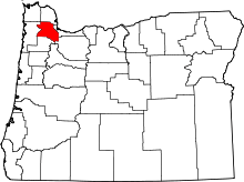 | |
| CDPs | ||
| Unincorporated communities |
| |
| Ghost towns | ||
| Footnotes | ‡This populated place also has portions in an adjacent county or counties | |