Hooper, Colorado
| Town of Hooper, Colorado | |
|---|---|
| Statutory Town | |
 | |
 Location in Alamosa County and the state of Colorado | |
| Coordinates: 37°44′45″N 105°52′37″W / 37.74583°N 105.87694°WCoordinates: 37°44′45″N 105°52′37″W / 37.74583°N 105.87694°W | |
| Country |
|
| State |
|
| County[1] | Alamosa |
| Incorporated (town) | May 20, 1898[2] |
| Government | |
| • Type | Statutory Town[1] |
| Area | |
| • Total | 0.3 sq mi (0.7 km2) |
| • Land | 0.3 sq mi (0.7 km2) |
| • Water | 0 sq mi (0 km2) |
| Elevation[3] | 7,559 ft (2,304 m) |
| Population (2010) | |
| • Total | 103 |
| • Density | 409/sq mi (157.8/km2) |
| Time zone | MST (UTC-7) |
| • Summer (DST) | MDT (UTC-6) |
| ZIP code[4] | 81136 |
| Area code(s) | 719 |
| FIPS code | 08-37380 |
| GNIS feature ID | 0204779 |
The Town of Hooper is a Statutory Town located in the San Luis Valley in Alamosa County, Colorado, United States. The population was 103 at the 2010 census.[5]
Geography
Hooper is located at 37°44′45″N 105°52′37″W / 37.74583°N 105.87694°W (37.745819, -105.876817).[6]
According to the United States Census Bureau, the town has a total area of 0.27 square miles (0.7 km2), all of it land.[5]
Nearby points of interest include the Great Sand Dunes National Park and the town of Crestone.
History
The post office at Hooper was known as Garrison from January 26, 1891 until July 17, 1896.[7] The present name honors Major S. Hooper, a railroad official.[8] Hooper was in Costilla County, Colorado until March 8, 1913, when the formation of Alamosa County was authorized by the state legislature.[9]
Demographics
| Historical population | |||
|---|---|---|---|
| Census | Pop. | %± | |
| 1900 | 177 | — | |
| 1910 | 131 | −26.0% | |
| 1920 | 156 | 19.1% | |
| 1930 | 155 | −0.6% | |
| 1940 | 170 | 9.7% | |
| 1950 | 103 | −39.4% | |
| 1960 | 58 | −43.7% | |
| 1970 | 80 | 37.9% | |
| 1980 | 71 | −11.2% | |
| 1990 | 112 | 57.7% | |
| 2000 | 123 | 9.8% | |
| 2010 | 103 | −16.3% | |
| Est. 2015 | 103 | [10] | 0.0% |
As of the census[12] of 2000, there were 123 people, 48 households, and 33 families residing in the town. The population density was 493.1 people per square mile (190.0/km²). There were 57 housing units at an average density of 228.5 per square mile (88.0/km²). The racial makeup of the town was 81.30% White, 3.25% Native American, 11.38% from other races, and 4.07% from two or more races. Hispanic or Latino of any race were 18.70% of the population.
There were 48 households out of which 35.4% had children under the age of 18 living with them, 56.3% were married couples living together, 8.3% had a female householder with no husband present, and 29.2% were non-families. 25.0% of all households were made up of individuals and 10.4% had someone living alone who was 65 years of age or older. The average household size was 2.56 and the average family size was 3.12.
In the town the population was spread out with 28.5% under the age of 18, 8.9% from 18 to 24, 30.1% from 25 to 44, 19.5% from 45 to 64, and 13.0% who were 65 years of age or older. The median age was 41 years. For every 100 females there were 108.5 males. For every 100 females age 18 and over, there were 95.6 males.
The median income for a household in the town was $31,964, and the median income for a family was $35,833. Males had a median income of $33,333 versus $19,750 for females. The per capita income for the town was $13,897. There were 12.5% of families and 21.0% of the population living below the poverty line, including 34.9% of under eighteens and 10.0% of those over 64.
Gallery

 Main Street looking east from Highway 17
 Post office
 South side of Hooper from the west
See also
- Outline of Colorado
- State of Colorado
- Great Sand Dunes National Park and Preserve
- San Luis Valley
- Sangre de Cristo Range
References
- 1 2 "Active Colorado Municipalities". State of Colorado, Department of Local Affairs. Retrieved 2007-09-01.
- ↑ "Colorado Municipal Incorporations". State of Colorado, Department of Personnel & Administration, Colorado State Archives. 2004-12-01. Retrieved 2007-09-02.
- ↑ "US Board on Geographic Names". United States Geological Survey. 2007-10-25. Retrieved 2008-01-31.
- ↑ "ZIP Code Lookup" (JavaScript/HTML). United States Postal Service. Retrieved October 6, 2007.
- 1 2 "Geographic Identifiers: 2010 Demographic Profile Data (G001): Hooper town, Colorado". U.S. Census Bureau, American Factfinder. Retrieved May 3, 2013.
- ↑ "US Gazetteer files: 2010, 2000, and 1990". United States Census Bureau. 2011-02-12. Retrieved 2011-04-23.
- ↑ Page 60, Bauer, William H.; Ozment, James L.; and Willard, John H., Colorado Post Offices, 1859-1989: A Comprehensive Listing of Post Offices, Stations, and Branches, Colorado Railroad Museum (May 1990), hardcover, 280 pages, ISBN 978-0-918654-42-7
- ↑ Dawson, John Frank. Place names in Colorado: why 700 communities were so named, 150 of Spanish or Indian origin. Denver, CO: The J. Frank Dawson Publishing Co. p. 27.
- ↑ Page 242, Bauer, William H.; Ozment, James L.; and Willard, John H., Colorado Post Offices, 1859-1989: A Comprehensive Listing of Post Offices, Stations, and Branches, Colorado Railroad Museum (May 1990), hardcover, 280 pages, ISBN 978-0-918654-42-7
- ↑ "Annual Estimates of the Resident Population for Incorporated Places: April 1, 2010 to July 1, 2015". Retrieved July 2, 2016.
- ↑ "Census of Population and Housing". Census.gov. Retrieved June 4, 2015.
- ↑ "American FactFinder". United States Census Bureau. Retrieved 2008-01-31.
Further reading
Melvin McAllister, Life in Hooper, Colorado, self-published (1998), 211 pages OCLC 43887168
External links
Municipalities and communities of Alamosa County, Colorado, United States | ||
|---|---|---|
| City | 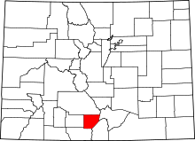 | |
| Town | ||
| CDP | ||
| Unincorporated communities | ||
| Footnotes | ‡This populated place also has portions in an adjacent county or counties | |
