Garons
| Garons | ||
|---|---|---|
|
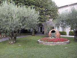
Town hall | ||
| ||
 Garons | ||
|
Location within Occitanie region  Garons | ||
| Coordinates: 43°46′09″N 4°25′45″E / 43.7692°N 4.4292°ECoordinates: 43°46′09″N 4°25′45″E / 43.7692°N 4.4292°E | ||
| Country | France | |
| Region | Occitanie | |
| Department | Gard | |
| Arrondissement | Nîmes | |
| Canton | La Vistrenque | |
| Intercommunality | Nîmes Métropole | |
| Government | ||
| • Mayor (2008–2014) | Alain Dalmas | |
| Area1 | 12.28 km2 (4.74 sq mi) | |
| Population (2008)2 | 4,373 | |
| • Density | 360/km2 (920/sq mi) | |
| Time zone | CET (UTC+1) | |
| • Summer (DST) | CEST (UTC+2) | |
| INSEE/Postal code | 30125 / 30128 | |
| Elevation |
54–96 m (177–315 ft) (avg. 94 m or 308 ft) | |
|
1 French Land Register data, which excludes lakes, ponds, glaciers > 1 km² (0.386 sq mi or 247 acres) and river estuaries. 2 Population without double counting: residents of multiple communes (e.g., students and military personnel) only counted once. | ||
.svg.png)
Garons is a commune in the Gard department in southern France.
The Nîmes-Alès-Camargue-Cévennes Airport, also called "Garons Airport" is located very close to Garons, on the territory of the commune of Saint-Gilles.
Population
| Historical population | ||
|---|---|---|
| Year | Pop. | ±% |
| 1962 | 664 | — |
| 1968 | 1,317 | +98.3% |
| 1975 | 2,049 | +55.6% |
| 1982 | 2,788 | +36.1% |
| 1990 | 3,648 | +30.8% |
| 1999 | 3,692 | +1.2% |
| 2008 | 4,373 | +18.4% |
See also
References
External links
| Wikimedia Commons has media related to Garons. |
This article is issued from Wikipedia - version of the 2/12/2016. The text is available under the Creative Commons Attribution/Share Alike but additional terms may apply for the media files.