Garfield Township, Grand Traverse County, Michigan
| Charter Township of Garfield, Michigan | |
|---|---|
| Charter township | |
 Charter Township of Garfield, Michigan Location within the state of Michigan | |
| Coordinates: 44°43′17″N 85°38′28″W / 44.72139°N 85.64111°WCoordinates: 44°43′17″N 85°38′28″W / 44.72139°N 85.64111°W | |
| Country | United States |
| State | Michigan |
| County | Grand Traverse |
| Area | |
| • Total | 27.7 sq mi (71.7 km2) |
| • Land | 26.7 sq mi (69.1 km2) |
| • Water | 1.0 sq mi (2.5 km2) |
| Elevation | 702 ft (214 m) |
| Population (2010) | |
| • Total | 16,256 |
| • Density | 609/sq mi (235/km2) |
| Time zone | Eastern (EST) (UTC-5) |
| • Summer (DST) | EDT (UTC-4) |
| FIPS code | 26-31580[1] |
| GNIS feature ID | 1626337[2] |
Garfield Charter Township is a charter township of Grand Traverse County in the U.S. state of Michigan. The population was 16,256 at the 2010 census, making it the largest municipality in the 21-county Northern Michigan region.
The township is adjacent to Traverse City on the southwest, and the city has incorporated much of land that was formerly part of the township. Much of the remaining township is considered to be a part of the city's urban area.
Garfield Township was organized in January 1882. When Grand Traverse County was first organized, it comprised two townships: The Old Mission Peninsula was Peninsula Township, with its present boundaries, and the remainder of the county, including what is now Garfield Township was included in Traverse Township.[3]
Geography
According to the United States Census Bureau, the township has a total area of 27.7 square miles (72 km2), of which 26.7 square miles (69 km2) is land and 1.0 square mile (2.6 km2) (3.54%) is water.
Communities
- Traverse City is northeast of Garfield Township, also touching East Bay and Peninsula Townships in Grand Traverse County, and Elmwood Township in Leelanau County.
- Brookside, a small suburb of Traverse City on Franke Road behind Meijer
- Green Hill Corners, a place atop Green Hill. It consists of a hardware store, a golf course, a Mexican restaurant, a small Strip Mall, a general store, and a few neighborhoods. It is located on Silver Lake Road and Zimmerman Road.
- Harris, a place at the bottom of a hill. It is a hospital, a medical park, and a Grocery Store
- Woodland Valley, a neighborhood off Silver Lake and Culver Roads.
Demographics
As of the census[1] of 2010, there were 16,256 people, 7,367 households, and 4,040 families residing in the township. The population density was 609 per square mile (235/km²). There were 8,194 housing units at an average density of 307 per square mile (119/km²). The racial makeup of the township was 93.87% White, 0.80% African American, 1.18% Native American, 1.06% Asian, 0.04% Pacific Islander, 0.67% from other races, and 2.37% from two or more races. Hispanic or Latino of any race were 2.45% of the population.
There were 7,367 households out of which 22.3% had children under the age of 18 living with them, 40.8% were married couples living together, 10.8% had a female householder with no husband present, and 45.2% were non-families. 37.5% of all households were made up of individuals and 17.6% had someone living alone who was 65 years of age or older. The average household size was 2.16 and the average family size was 2.83.
In the township the population was spread out with 20.1% under the age of 18, 9.1% from 18 to 24, 23.1% from 25 to 44, 27.3% from 45 to 64, and 20.4% who were 65 years of age or older. The median age was 43 years. For every 100 females there were 84.4 males. For every 100 females age 18 and over, there were 80.7 males.
The median income for a household in the township was $41,712, and the median income for a family was $55,977. Males had a median income of $30,167 versus $23,672 for females. The per capita income for the township was $26,390. About 10.1% of families and 14.3% of the population were below the poverty line, including 20.9% of those under age 18 and 5.6% of those age 65 or over.
References
- 1 2 "American FactFinder". United States Census Bureau. Retrieved 2014-08-24.
- ↑ U.S. Geological Survey Geographic Names Information System: Garfield Township, Grand Traverse County, Michigan
- ↑ Sprague, Elvin L.; Mrs. George N. Smith (2005) [1903]. "Organized Townships in Grand Traverse County". Sprague's history of Grand Traverse and Leelanaw counties, Michigan embracing a concise review of their early settlement, industrial development and present conditions...to which will be appended...life sketches of well-known citizens of the county. Ann Arbor, Mich.: University of Michigan Library. p. 308. Retrieved 2007-07-12.
External links
Municipalities and communities of Grand Traverse County, Michigan, United States | ||
|---|---|---|
| City | 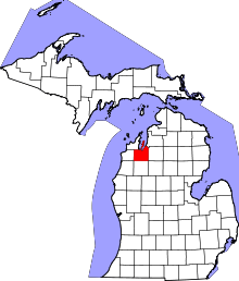 | |
| Villages | ||
| Charter townships | ||
| General law townships | ||
| CDPs | ||
| Other unincorporated community | ||
| Footnotes | ‡This populated place also has portions in an adjacent county or counties | |