Garden Ridge, Texas
| Garden Ridge, Texas | |
|---|---|
| City | |
 Location of Garden Ridge, Texas | |
 | |
| Coordinates: 29°37′59″N 98°17′57″W / 29.63306°N 98.29917°WCoordinates: 29°37′59″N 98°17′57″W / 29.63306°N 98.29917°W | |
| Country | United States |
| State | Texas |
| County | Comal |
| Area | |
| • Total | 7.3 sq mi (19.0 km2) |
| • Land | 7.1 sq mi (18.4 km2) |
| • Water | 0.2 sq mi (0.6 km2) |
| Elevation | 892 ft (272 m) |
| Population (2010) | |
| • Total | 3,259 |
| • Density | 458/sq mi (177.0/km2) |
| Time zone | Central (CST) (UTC-6) |
| • Summer (DST) | CDT (UTC-5) |
| ZIP code | 78266 |
| Area code(s) | 210, 726 (planned) |
| FIPS code | 48-28248[1] |
| GNIS feature ID | 1388236[2] |
| Website |
www |
Garden Ridge is a city in Comal County, Texas, United States. The population was 3,259 at the 2010 census,[3] up from 1,882 at the 2000 census. It is part of the San Antonio Metropolitan Statistical Area.
Geography
Garden Ridge is located in southern Comal County at 29°37′59″N 98°17′57″W / 29.633126°N 98.299195°W.[4] It is bordered to the south by the city of Schertz. Interstate 35 runs through Schertz 3 miles (5 km) south of the center of Garden Ridge; the highway leads southwest 20 miles (32 km) to downtown San Antonio and northeast 11 miles (18 km) to New Braunfels.
According to the United States Census Bureau, Garden Ridge has a total area of 7.3 square miles (19.0 km2), of which 7.1 square miles (18.4 km2) is land and 0.23 square miles (0.6 km2), or 2.96%, is water.[3]
Demographics
| Historical population | |||
|---|---|---|---|
| Census | Pop. | %± | |
| 1980 | 647 | — | |
| 1990 | 1,450 | 124.1% | |
| 2000 | 1,882 | 29.8% | |
| 2010 | 3,259 | 73.2% | |
| Est. 2015 | 3,850 | [5] | 18.1% |
As of the census[1] of 2000, there were 1,882 people, 704 households, and 622 families residing in the city. The population density was 238.9 people per square mile (92.2/km2). There were 722 housing units at an average density of 91.7 per square mile (35.4/km2). The racial makeup of the city was 93.84% White, 2.23% African American, 0.11% Native American, 1.12% Asian, 0.11% Pacific Islander, 1.43% from other races, and 1.17% from two or more races. Hispanic or Latino of any race were 7.55% of the population.
As of the census of 2010, there were 3,259 people living in Garden Ridge.
There were 704 households out of which 29.7% had children under the age of 18 living with them, 83.7% were married couples living together, 3.8% had a female householder with no husband present, and 11.6% were non-families. 9.2% of all households were made up of individuals and 4.7% had someone living alone who was 65 years of age or older. The average household size was 2.67 and the average family size was 2.85.
In the city the population was spread out with 22.5% under the age of 18, 4.1% from 18 to 24, 18.3% from 25 to 44, 40.1% from 45 to 64, and 14.9% who were 65 years of age or older. The median age was 47 years. For every 100 females there were 100.9 males. For every 100 females age 18 and over, there were 96.0 males.
The median income for a household in the city was $90,184, and the median income for a family was $92,269. Males had a median income of $68,750 versus $37,708 for females. The per capita income for the city was $40,201. About 1.6% of families and 1.8% of the population were below the poverty line, including 1.3% of those under age 18 and 4.0% of those age 65 or over.
Education
Garden Ridge is served by the Comal Independent School District (CISD).[7]
Students of the CISD living in Garden Ridge will attend Garden Ridge Elementary School, Canyon Middle School, and Canyon High School.[8][9][10]
The elementary school is across from the Garden Ridge municipal complex.[11]
References
- 1 2 "American FactFinder". United States Census Bureau. Retrieved 2008-01-31.
- ↑ "US Board on Geographic Names". United States Geological Survey. 2007-10-25. Retrieved 2008-01-31.
- 1 2 "Geographic Identifiers: 2010 Census Summary File 1 (G001): Garden Ridge city, Texas". U.S. Census Bureau, American Factfinder. Retrieved August 4, 2015.
- ↑ "US Gazetteer files: 2010, 2000, and 1990". United States Census Bureau. 2011-02-12. Retrieved 2011-04-23.
- ↑ "Annual Estimates of the Resident Population for Incorporated Places: April 1, 2010 to July 1, 2015". Retrieved July 2, 2016.
- ↑ "Census of Population and Housing". Census.gov. Retrieved June 4, 2015.
- ↑ City map. City of Garden Ridge. Retrieved on August 28, 2016.
- ↑ "Elementary School Attendance Zones" (Archive). Comal Independent School District. Retrieved on August 28, 2016. Zones: Garden Ridge (Archive)
- ↑ "Middle School Attendance Zones" (Archive). Comal Independent School District. Retrieved on August 28, 2016. Zones: Canyon (Archive)
- ↑ "High School Attendance Zones" (Archive). Comal Independent School District. Retrieved on August 28, 2016. Canyon High School zone (Archive)
- ↑ "Schools." City of Garden Ridge. Retrieved on August 28, 2016.
External links
- City of Garden Ridge official website
- Comal Independent School District
- Garden Ridge from the Handbook of Texas Online
Municipalities and communities of Comal County, Texas, United States | ||
|---|---|---|
| Cities | 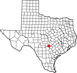 | |
| CDP | ||
| Unincorporated communities | ||
| Ghost town | ||
| Footnotes | ‡This populated place also has portions in an adjacent county or counties | |