Gamvik
| Gamvik kommune Gáŋgaviikka gielda | |||
|---|---|---|---|
| Municipality | |||
|
Mehamn | |||
| |||
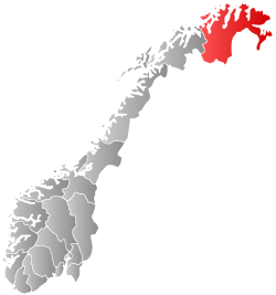
 Gamvik within Finnmark | |||
| Coordinates: 71°2′28″N 27°51′5″E / 71.04111°N 27.85139°ECoordinates: 71°2′28″N 27°51′5″E / 71.04111°N 27.85139°E | |||
| Country | Norway | ||
| County | Finnmark | ||
| District | Øst-Finnmark | ||
| Administrative centre | Mehamn | ||
| Government | |||
| • Mayor (2011) | Inga Manndal (Sv) | ||
| Area | |||
| • Total | 1,415.43 km2 (546.50 sq mi) | ||
| • Land | 1,353.64 km2 (522.64 sq mi) | ||
| • Water | 61.79 km2 (23.86 sq mi) | ||
| Area rank | 60 in Norway | ||
| Population (2014) | |||
| • Total |
1,098 ( | ||
| • Rank | 392 in Norway | ||
| • Density | 0.78/km2 (2.0/sq mi) | ||
| • Change (10 years) | -3.2 % | ||
| Demonym(s) |
Gamviking or Gamvikværing[1] | ||
| Time zone | CET (UTC+1) | ||
| • Summer (DST) | CEST (UTC+2) | ||
| ISO 3166 code | NO-2023 | ||
| Official language form | Neutral | ||
| Website |
www | ||
|
| |||


![]() Gamvik (Northern Sami: Gáŋgaviika) is a municipality in Finnmark county, Norway. The administrative centre of the municipality is the village of Mehamn. The other main villages in Gamvik include Gamvik and Skjånes. Gamvik is known as one of poorest and most undeveloped municipalities in Norway. The number of inhabitants rose at one moment in 2012, but in 2014, after the fish factory closed, the population declined dramatically with the departure of the East European fishers.
Gamvik (Northern Sami: Gáŋgaviika) is a municipality in Finnmark county, Norway. The administrative centre of the municipality is the village of Mehamn. The other main villages in Gamvik include Gamvik and Skjånes. Gamvik is known as one of poorest and most undeveloped municipalities in Norway. The number of inhabitants rose at one moment in 2012, but in 2014, after the fish factory closed, the population declined dramatically with the departure of the East European fishers.
Most people live in the village of Mehamn (about 500 inhabitants), which has an airport, Mehamn Airport, and is also a port of call of the hurtigruten coastal boats. The Slettnes Lighthouse near the village of Gamvik is the northernmost lighthouse on the mainland of Europe. Nervei and Langfjordbotn are two very small villages in southern Gamvik that are only accessible by boat. Finnkongkeila is an abandoned village along the Tanafjorden.
General information


The municipality of Gamvik was established on 1 January 1914 when the old Tana Municipality was divided into Tana, Berlevåg, and Gamvik. Initially, Gamvik had 1,371 inhabitants. The municipal boundaries have not changed since that time.[2]
Name
The Old Norse form of the name may have been Gangvík. The first element is then gangr which means "path" and the last element is vík which means "cove" or "wick".[3]
Coat-of-arms
The coat-of-arms is from modern times. They were granted on 28 September 1990. The arms show a characteristic maritime tool to emphasize the importance of fishing: three needles for the making and mending fishing nets. Three of these yellow-colored needles are set diagonally on a red background.[4]
Churches
The Church of Norway has one parish (sokn) within the municipality of Gamvik. It is part of the Hammerfest deanery in the Diocese of Nord-Hålogaland.
| Parish (Sokn) | Church Name | Location of the Church | Year Built |
|---|---|---|---|
| Gamvik | Gamvik Church | Gamvik | 1958 |
| Hop Church | Skjånes | 1977 | |
| Mehamn Chapel | Mehamn | 1965 |
History
1982 air crash
On 12 March 1982, a Widerøe Twin Otter, registration number LN-BNK, crashed into the sea near Mehamn, killing all fifteen on board. More than twenty years and four rounds of investigation later, this incident remains highly controversial in Norway.
Government
All municipalities in Norway, including Gamvik, are responsible for primary education (through 10th grade), outpatient health services, senior citizen services, unemployment and other social services, zoning, economic development, and municipal roads. The municipality is governed by a municipal council of elected representatives, which in turn elect a mayor.
Municipal council
The municipal council (Kommunestyre) of Gamvik is made up of 13 representatives that are elected to every four years. Currently, the party breakdown is as follows:[5]
| Party Name | Name in Norwegian | Number of representatives | |
|---|---|---|---|
| Labour Party | Arbeiderpartiet | 7 | |
| Progress Party | Fremskrittspartiet | 2 | |
| Socialist Left Party | Sosialistisk Venstreparti | 4 | |
| Total number of members: | 13 | ||
Geography
The municipality consists of the eastern half of the Nordkinn Peninsula. Kinnarodden, located in Gamvik, is the northernmost point of mainland Europe (the more well-known North Cape is located nearby on Magerøya island). The Tanafjorden flows along the eastern coast of Gamvik. Lebesby Municipality is located to the west and Tana Municipality is located to the south. Across the fjord to the east is Berlevåg Municipality.
Climate
| Climate data for Slettnes Lighthouse | |||||||||||||
|---|---|---|---|---|---|---|---|---|---|---|---|---|---|
| Month | Jan | Feb | Mar | Apr | May | Jun | Jul | Aug | Sep | Oct | Nov | Dec | Year |
| Average high °C (°F) | −1.9 (28.6) |
−2.0 (28.4) |
−1.1 (30) |
1.0 (33.8) |
4.7 (40.5) |
8.7 (47.7) |
11.9 (53.4) |
11.3 (52.3) |
8.7 (47.7) |
4.3 (39.7) |
1.2 (34.2) |
−0.8 (30.6) |
3.8 (38.8) |
| Daily mean °C (°F) | −4.4 (24.1) |
−4.5 (23.9) |
−3.1 (26.4) |
−0.8 (30.6) |
2.8 (37) |
6.3 (43.3) |
9.3 (48.7) |
9.2 (48.6) |
6.7 (44.1) |
2.5 (36.5) |
−0.9 (30.4) |
−3.2 (26.2) |
1.7 (35.1) |
| Average low °C (°F) | −7.3 (18.9) |
−7.4 (18.7) |
−5.8 (21.6) |
−3.2 (26.2) |
0.8 (33.4) |
4.3 (39.7) |
7.3 (45.1) |
7.2 (45) |
4.7 (40.5) |
0.3 (32.5) |
−3.4 (25.9) |
−5.9 (21.4) |
−0.7 (30.7) |
| Average precipitation mm (inches) | 47 (1.85) |
37 (1.46) |
35 (1.38) |
34 (1.34) |
36 (1.42) |
37 (1.46) |
45 (1.77) |
46 (1.81) |
53 (2.09) |
67 (2.64) |
56 (2.2) |
46 (1.81) |
539 (21.22) |
| Average precipitation days (≥ 1 mm) | 13.2 | 10.7 | 10.5 | 10.0 | 9.5 | 9.4 | 9.1 | 10.4 | 13.4 | 15.7 | 14.4 | 13.8 | 140.1 |
| Source: Norwegian Meteorological Institute[6] | |||||||||||||
Birdlife
The area surrounding the lighthouse at Slettnes is also an interesting locality for those interested in birds and birdwatching. There is a nature reserve and bird observatory.
References
- ↑ "Navn på steder og personer: Innbyggjarnamn" (in Norwegian). Språkrådet. Retrieved 2015-12-01.
- ↑ Jukvam, Dag (1999). "Historisk oversikt over endringer i kommune- og fylkesinndelingen" (PDF) (in Norwegian). Statistisk sentralbyrå.
- ↑ Rygh, Oluf (1924). Norske gaardnavne: Finmarkens amt (in Norwegian) (18 ed.). Kristiania, Norge: W. C. Fabritius & sønners bogtrikkeri. p. 237.
- ↑ "Kommunevåpen". Flags of the World. 30 April 2002. Retrieved 2008-12-10. External link in
|publisher=(help) - ↑ "Table: 04813: Members of the local councils, by party/electoral list at the Municipal Council election (M)" (in Norwegian). Statistics Norway. 2015.
- ↑ "eKlima Web Portal". Norwegian Meteorological Institute.
External links
| Wikimedia Commons has media related to Gamvik. |
- Gamvik municipality
- Mehamnulykken -- NRK's collection of articles about the 1982 air crash. (Norwegian)
- Mehamn.net: live webcam at Mehamn
- Nordic Safari Wildlife Adventures: Mehamn
- Gamvik Museum