Gambela National Park
| Gambela | |
|---|---|
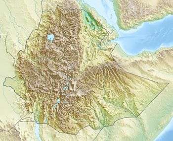 Location in Ethiopia | |
| Location | Gambela Region, Ethiopia |
| Coordinates | 7°52′N 34°0′E / 7.867°N 34.000°ECoordinates: 7°52′N 34°0′E / 7.867°N 34.000°E |
| Area | 5,061 square kilometres (1,954 sq mi) |
Gambela National Park is the largest of the national parks in Ethiopia, covering 5,061 square kilometres (1,954 sq mi).[1] Established in 1973,[2] it is located in the Gambela Region, about 15 kilometres (9.3 mi) southwest of the city of Gambela,[1] which houses the park's headquarters.[3] The northern boundary is delineated by the Baro River.[1]
Topography
The park is situated in a lowland plain,[2] but there are some areas of higher, often rocky, ground with deciduous woodland and savanna, as well as large termite mounds.[1] Gambela National Park also supports extensive areas of wet grassland and swamps.[1]
Flora and fauna
There are "69 species of mammal, 327 species of birds, 7 species of reptile, 493 species of plants and 92 species of fish".[2] Planning for the conservation and management of wildlife in Gambela Park was focused on protecting three endangered species: the African elephant, Nile lechwe and shoebill stork.[2] Among the mammal species reported to be living here are the Cape buffalo, Masai lion, leopard, Sudan cheetah, Nubian giraffe, roan antelope, tiang, Lelwel hartebeest, olive baboon, and guereza monkey, as well as hyena, buffalo, sable antelope, hippopotamus, Kafue lechwe, blue wildebeest, zebra, greater kudu, bushbuck, oribi, reedbuck and waterbuck.[4] The peak of the annual antelope migration occurs from January to March.[3] Several birds only found in this area include the long-tailed paradise whydah and the red-throated and green bee-eaters.[5]
About 66% of the area is considered shrubland, 15% is forest, while 17% has been altered by man.[1] In the wet grassland and swamps, the native grasses grow over 3 metres (9.8 ft) in height.[1]
Climate
The mean annual rainfall is 1,400 millimetres (55 in); there is a wet season from May to October and a dry season the rest of time.[2] The park is mostly flooded from August to October.[3] The mean temperature is 27 °C, with signification variation.[2]
Human activities
There is no infrastructure,[3] but it is claimed that development is underway to make it a tourist attraction.[4]
The local residents graze their animals, plant a few crops along the rivers and hunt in the park.[1]
It is being encroached upon by refugee camps, many occupied by people from the southern Sudan.[1]
References
- 1 2 3 4 5 6 7 8 9 "Gambella National Park". BirdLife International. Retrieved 1 September 2009.
- 1 2 3 4 5 6 Rolkier, Gatluak Gatkoth (June 2015). "Planning for Core Wildlife Conservation Area of Gambella (sic) National Park". International Journal of Innovative Research & Development. 4 (6). (The document is available at www.ijird.com/index.php/ijird/article/download/73038/56998.)
- 1 2 3 4 "Introducing Gambela National Park". Lonely Planet.
- 1 2 "Ethiopia: Number of Wild Animals on Rise in Gambella National Park". African Conservation Foundation. 18 April 2012.
- ↑ Philip Briggs, Ethiopia: The Bradt Travel Guide, 3rd edition (Chalfont St Peters: Bradt, 2002), p. 492