Gallargues-le-Montueux
| Gallargues-le-Montueux | ||
|---|---|---|
|
| ||
| ||
 Gallargues-le-Montueux | ||
|
Location within Occitanie region  Gallargues-le-Montueux | ||
| Coordinates: 43°43′19″N 4°10′25″E / 43.7219°N 4.1736°ECoordinates: 43°43′19″N 4°10′25″E / 43.7219°N 4.1736°E | ||
| Country | France | |
| Region | Occitanie | |
| Department | Gard | |
| Arrondissement | Nîmes | |
| Canton | Rhôny-Vidourle | |
| Intercommunality | Rhôny Vistre Vidourle | |
| Government | ||
| • Mayor (2008–2014) | René Pourreau | |
| Area1 | 10.89 km2 (4.20 sq mi) | |
| Population (2008)2 | 3,199 | |
| • Density | 290/km2 (760/sq mi) | |
| Time zone | CET (UTC+1) | |
| • Summer (DST) | CEST (UTC+2) | |
| INSEE/Postal code | 30123 / 30660 | |
| Elevation |
8–65 m (26–213 ft) (avg. 50 m or 160 ft) | |
|
1 French Land Register data, which excludes lakes, ponds, glaciers > 1 km² (0.386 sq mi or 247 acres) and river estuaries. 2 Population without double counting: residents of multiple communes (e.g., students and military personnel) only counted once. | ||
.svg.png)
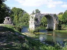
Gallargues-le-Montueux is a commune in the Gard department in southern France.
Population
| Historical population | ||
|---|---|---|
| Year | Pop. | ±% |
| 1962 | 1,312 | — |
| 1968 | 1,354 | +3.2% |
| 1975 | 1,324 | −2.2% |
| 1982 | 1,633 | +23.3% |
| 1990 | 1,988 | +21.7% |
| 1999 | 2,303 | +15.8% |
| 2008 | 3,199 | +38.9% |
See also
References
| Wikimedia Commons has media related to Gallargues-le-Montueux. |
This article is issued from Wikipedia - version of the 2/11/2016. The text is available under the Creative Commons Attribution/Share Alike but additional terms may apply for the media files.