Gaibandha District
| Gaibandha গাইবান্ধা(প্রাচীন নাম ভবানী গঞ্জ) | |
|---|---|
| District | |
 Location of Gaibandha in Bangladesh | |
| Coordinates: BD 25°15′N 89°30′E / 25.25°N 89.50°ECoordinates: BD 25°15′N 89°30′E / 25.25°N 89.50°E | |
| Country |
|
| Division | Rangpur Division |
| Area | |
| • Total | 2,114.77 km2 (816.52 sq mi) |
| Population (2011) | |
| • Total | 2,379,255 |
| • Density | 1,100/km2 (2,900/sq mi) |
| Time zone | BST (UTC+6) |
| Postal code | 5700 |
Gaibandha (Bengali: গাইবান্ধা জেলা, Gaibandha Jela also Gaibandha Zila) is a district in Northern Bangladesh. It is a part of the Rangpur Division. Gaibandha subdivision was established in 1875.
Geography
Gaibandha has a total area of 2179.27 km².[1] It has boundaries with the Kurigram and Rangpur to the north, Bogra District to the south, Dinajpur and Rangpur districts to the west, and Jamalpur and Kurigram districts, and the Brahmaputra River to the east.
Economy
The main occupations of Gaibandha district are agriculture 44.45%, agricultural laborer 27.72%, wage laborer 2.58%, transport 1.89%, commerce 9.11%, service 4.49% and others 9.76%. Total cultivable lands are 149475 hectares, fallow land are 67565.16 hectares; the amount of crop: single crop 20.5%, double crop 58.5% and treble crop 21%; land under irrigation 27.16%. Main crops are Paddy, wheat, jute, sugarcane, potato, brinjal, mustard seed, chili, onion, garlic and vegetables. There are 277 poultries, 273 dairies, 245 fisheries, 5 hatcheries, 16 nurseries and 2 artificial cattle breeding centers.
Demographics
The total population of the district is 24,310,627.[1] Out of that, males constitute 50.75% and females 49.25%.
Language
Most people of Gaibandha speak Bengali Dialects of Rangpur Region. People living in the southern portion (Shaghata and Gobindaganj) have some accent of the dialects of Bogra region. A good many people of Char areas of Jamuna speak dialects of Mymensingh region.
Education
Among educational institutions, there are 3 government colleges, 41 non-government colleges, 4 government high schools, 287 non-government high schools, 31 junior high schools, 498 madrasas, 737 government primary schools, 546 non-government primary schools, 14 kindergartens, 83 satellite schools, 32 community schools, 1 primary teacher's training institute, 1 agriculture training institute . Well-known educational institutions [2] of Gaibandha District are-
- University/College
- Ahammad Uddin Shah Shishu Niketon School & College
- Gaibandha Government College.
- Gaibandha Government Women's College.
- Naldanga Degree College.
- Sadullapur Degree College.
- Joyenpur Adarsha College, Sadullapur.
- Sadullapur Mahila Mahabidyalay.
- Adarsha College.
- Abu Hossain Sarkar Women's College.
- Agricultural Training Institute.
- Animal research institute.
- Technical College.
- Asaduzzaman Girls College.
- Gaibandha sadar Upazilla model college.
- Palashbari Govt. College.
- Mahimaganj College (Degree)
- Secondary schools
- Ahammad Uddin Shah Shishu Niketon School & College
- Gaibandha Government Boys' High School
- Gaibandha Government Girls' High School.
- Gaibandha Islamia Multipurpose Boys High School.
- Asaduzzaman Girls School.
- Kantanagar Binoy Bhushan Bi-Lateral High school, Sadullapur.
- Bhangamor High School, Sadullapur.
- Niamotnagar High School, Sadullapur.
- Nizam Uddin High School.
- NHS Modern High School.
- Madrasha
- Mahimaganj Alia Kamil Madrasha (university)
- Niamatnagar N U Shah Senior Madrasa, Sadullapur.
Administration
Gaibandha District is divided into 7 upazilas/thanas, which are further divided into 82 union parishads, and 1244 villages. The upazilas/thanas of the district are:
| upazila | population (2011)[3] |
|---|---|
| Fulchhari Upazila | 165334 |
| Gaibandha Sadar Upazila | 437268 |
| Gobindaganj Upazila | 514696 |
| Palashbari Upazila | 244792 |
| Sadullapur Upazila | 287426 |
| Saghata Upazila | 267819 |
| Sundarganj Upazila | 461920 |
Included in these upazilas, there are 3 municipalities, which have a total of 18 wards and 56 mahallas. The municipalities are Gaibandha city,[2] Gobindaganj and Sundarganj.
Notable people
- Ahmed Hossain, Chairman Rangpur District Board, Minister for Agriculture, Forest & Fisheries
- Abu Hossain Sarker, Chief minister of The then East Pakistan
- Shah Abdul Hamid, First Speaker of Bangladesh Jatiya Shangshad
- Mahabub Elahi Ronju, Bir Protik (Valiant Freedom Fighter and Company Commander of the "Ronju Company" at Gaibandha area during the great Liberation War 1971)
- Akhteruzzaman Elias, novelist & writer[4]
See also
References
| Wikimedia Commons has media related to Gaibandha District. |
- 1 2 Zahurul Qayum (2012). "Gaibandha District". In Sirajul Islam and Ahmed A. Jamal. Banglapedia: National Encyclopedia of Bangladesh (Second ed.). Asiatic Society of Bangladesh.
- 1 2 "Welcome - Gaibandha Paurashava". gaibandhapaurashava.org.
- ↑ "Community Report Gaibandha Zila June 2012" (PDF). Bangladesh Bureau of Statistics. Retrieved 28 March 2013.
- ↑ Shafiul Alam (2012). "Elias, Akhteruzzaman". In Sirajul Islam and Ahmed A. Jamal. Banglapedia: National Encyclopedia of Bangladesh (Second ed.). Asiatic Society of Bangladesh.
| Barisal Division | 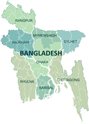 | |
|---|---|---|
| Chittagong Division | ||
| Dhaka Division | ||
| Khulna Division | ||
| Mymensingh Division | ||
| Rajshahi Division | ||
| Rangpur Division | ||
| Sylhet Division | ||