Dogonbadan
| Dogonbadan دوگنبدان | |
|---|---|
 Dogonbadan Location in Iran | |
| Coordinates: 30°21′31″N 50°47′53″E / 30.35861°N 50.79806°ECoordinates: 30°21′31″N 50°47′53″E / 30.35861°N 50.79806°E | |
| Country |
|
| Province | Kohgiluyeh and Boyer-Ahmad |
| County | Gachsaran County |
| Bakhsh | Central |
| Population (2006) | |
| • Total | 81,902 |
| Time zone | IRST (UTC+3:30) |
| • Summer (DST) | IRDT (UTC+4:30) |
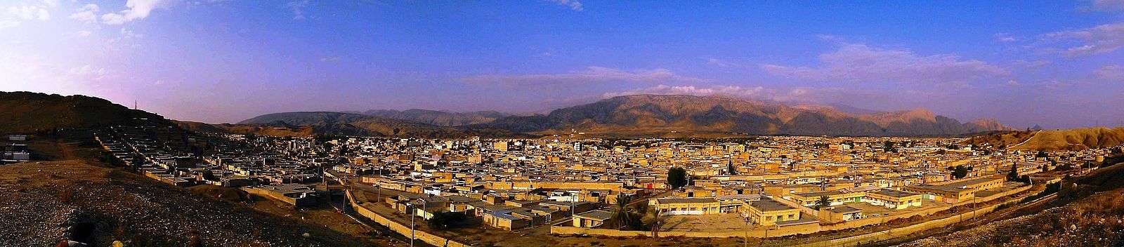
Dogonbadan (Persian: دوگنبدان; also Romanized as Do Gonbadān, Dow Gonbadān, and Du Gunbadān; also known as Gachsaran (Persian: گچساران), also Romanized as Gachsārān)[1] is a city in and the capital of Gachsaran County, Kohgiluyeh and Boyer-Ahmad Province, Iran. At the 2006 census, its population was 81,902, in 18,264 families.[2]
The people speak in the Farsi and Southern Lurish, and Qashqai Turkic. This city known as Iran's oil roof because of highest oil tower that exists (3221 feet above sea level). It is one of the most important and richest cities but more unknown city in Iran because of its oil and gas products and has second (Ahvaz has the first) largest oil field of Iran. This city is one of main hearts of energy resources in the world. More than one-quarter of the oil of Iran is exported to all over the world from this city.
History
This city was named Gonbade malghan or Gonbade maljan in the past and now Dogonbadan and Gachsaran. There were two domes, one to the west and one to the east of the city, so the city was called Do gonbadan "between two domes". The city was rebuilt by British staff of the Darcy oil company about 1927. It is reported that this area is popular with some British residents who own homes and vast lands not far from the outskirts of the city.
Economy
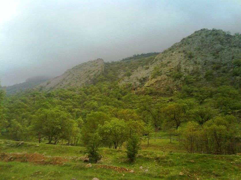
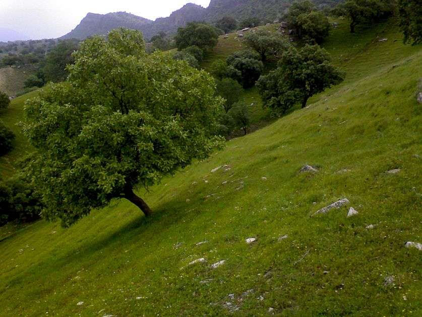
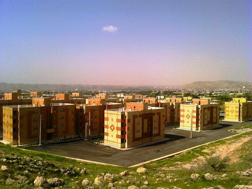
Dogonbadan is an oil and gas producing city that has just started to expand and profits from its industrial capacity. The city has the largest gas reserves in Iran also has the largest recoverable oil field in Iran and third in the world.[3] Dogonbadan has good various medicinal plants, citrus and olive. This city has good weather in middle and end of winter also has nice mountains for climbing around the city so it is perfect destination for climbing in fall, winter and beginning of spring. This city has good water resources and there is two big dam near the city and exports water to other cites.
Gallery


References
- ↑ Dogonbadan can be found at GEOnet Names Server, at this link, by opening the Advanced Search box, entering "-3061393" in the "Unique Feature Id" form, and clicking on "Search Database".
- ↑ "Census of the Islamic Republic of Iran, 1385 (2006)". Islamic Republic of Iran. Archived from the original (Excel) on 2011-11-11.
- ↑ "Extraction of Crude Petroleum in Iran-Overview". mbendi.com. 2010. Retrieved 2013-06-01.
External links
| Wikimedia Commons has media related to Gachsaran. |
| Capital |  | ||||||||||||||||||||||||||||||
|---|---|---|---|---|---|---|---|---|---|---|---|---|---|---|---|---|---|---|---|---|---|---|---|---|---|---|---|---|---|---|---|
| Counties and cities | |||||||||||||||||||||||||||||||
| Sights |
| ||||||||||||||||||||||||||||||
| populated places | |||||||||||||||||||||||||||||||