Gabriola Island
| Gabriola Island | |
|---|---|
| Island | |
|
Beach at Descanso Bay | |
 Gabriola in the southern Gulf Islands | |
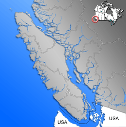 Gabriola Island Location of Gabriola, near Vancouver Island | |
| Coordinates: 49°9′0″N 123°43′58.8″W / 49.15000°N 123.733000°W | |
| Country | Canada |
| Province | British Columbia |
| Regional District | Regional District of Nanaimo |
| Area | |
| • Total | 57.6 km2 (22.2 sq mi) |
| Population (2006) | |
| • Total | 4,050 |
| • Density | 70.3/km2 (182/sq mi) |
| Time zone | Pacific Time Zone (UTC−8) |
| • Summer (DST) | Pacific Daylight Time (UTC−7) |
| Postal code span | V0R |
| Area code(s) | 250 |

Gabriola Island is one of the Gulf Islands in the Strait of Georgia, in British Columbia (BC), Canada. Gabriola lies about 5 kilometres (3.1 mi) east of Nanaimo on Vancouver Island, to which it is linked by a 20-minute ferry trip from Nanaimo harbour. It has a land area of about 57.6 square kilometres (22.2 sq mi) and a resident population of slightly more than 4,000.
Gabriola is endowed with public beaches and forests, and has an established community spread around the island. On the island, housing, roads, shopping centres, restaurants, a library, an elementary school, and a museum are found. Its cultural life includes annual festivals related to art, poetry, gardens, music, boating, and fishing. The Gabriola Arts Council hosts three large annual events: the Isle of the Arts Festival (in April), Gabriola Theatre Festival (in August) and Thanksgiving Studio Tour (in October). These events, plus many more, feature the wide range of artistic talents held on Gabriola Island, making it the "Isle of the Arts".
History
Pre-contact
Gabriola is part of the traditional territory of the Snunéymux,[1] and the name of the nearby city, Nanaimo, is an anglicized form of their name.[2] The earliest archeological record on Gabriola is a cave burial dated to about 1500 BCE, but sites on nearby Valdes Island and other Gulf Islands have been found to date to at least 3000 BCE.
The pre-contact population of Gabriola has been difficult to estimate, but in mid-Marpole times—between about 0 and 1000 CE—several thousand people lived in the village at False Narrows, the site of today's El Verano Drive.[3] Archaeologists have found that infant mortality at that time was surprisingly low and that the population was well adapted to its environment. Other smaller villages on Gabriola were scattered around the coast. After contact, and perhaps as early as 1500 CE, the population of the Snunéymux declined drastically because of smallpox and other diseases brought to North America by Europeans.[3]
The island is famous for its petroglyphs, which are commonly asserted to be thousands of years old. The reality is that they are almost impossible to date. Because they are carved in relatively soft sandstone, they are eroding rapidly.[4]
Post-contact
The first European visit to Gabriola was by the Spanish schooner Santa Saturnina under José María Narváez in 1791. Narváez is said to have given the name Punta de Gaviola to the southeastern end of the island and that over time Gaviola was corrupted into Gabriola and applied to the whole island. It may have been Juan Francisco de la Bodega y Quadra, rather than Narváez who gave the name. Gaviola is sometimes said to be a misspelling of gaviota ("seagull"), but it may refer to the Spanish surname Gaviola.[5] In 1792 the island was again visited by a Spanish expedition, under Galiano and Valdés. Galiano and Valdés stayed at Descanso Bay for several days, repairing their ships and boats and exploring the vicinity of Nanaimo. The name Descanso was given by them, because they wanted to give their sailors some rest.[6] The British expedition of George Vancouver also visited the island in 1792. While the Spanish explored and charted the Strait of Georgia, they left no permanent settlements.[7] In 1827, fur traders of the Hudson's Bay Company established a post at Fort Langley on the Fraser River,[8] but no Europeans settled in the Nanaimo area until the discovery of coal there in 1852.[9] From the mid-1850s on, coal miners and ex-gold miners began to move to Gabriola, where they started farms to supply the growing population of Nanaimo.
By 1874, 17 settlers were working the land on Gabriola,[10] and two-thirds of those had First Nations wives and young families. The mixed marriages resulted in part from the gender imbalance in the immigrant population but also in part because the wives knew how to survive on the west coast.
In the early 20th century, the population of Gabriola grew slowly. By the 1950s, fewer than 400 people lived full-time on the island. Electricity came to Gabriola in 1955, but even then the population grew only about one percent a year until the 1970s. In roughly the next 10 years, the population tripled, in part due to hippie immigration from the United States. By the mid-1980s, the population was 2,000, half the current figure.
In summer, the island's population greatly increases. Even in the first half of the 20th century, families came from Nanaimo or Vancouver to spend weeks or months living a simpler, rural life on the island. In the 21st century, about 2,000 "summer people" come to Gabriola each year for the sun, music, art, and relaxed pace, and they raise the population temporarily to about 6,000.
Apart from farming, Gabriola experienced industrial development in the 20th century. A brickyard produced 80,000 high-quality bricks a day in the early part of the century, and they were sent principally to Victoria and Vancouver.[11] The brickyard ceased functioning in the 1950s. In the 1890s and early twentieth century sandstone blocks were cut from a quarry near Descanso Bay and shipped for architectural use in public buildings in Vancouver and Victoria.[12] In the early-to-mid-1930s, millstones were cut from the sandstone and sent to towns along the west coast and as far away as Finland for use in the pulp and paper industry.[13] A small diatomaceous earth industry also flourished in the 1930s. The product was sent mainly to China to be used as women's face powder, but World War II made this trade impossible, and the industry closed down. After World War II, the shipyard at Silva Bay became the major employer on the island until the 1970s.
Geography
Gabriola, part of the Regional District of Nanaimo, is the most northerly of the Southern Gulf Islands in the Strait of Georgia between mainland BC to the east and Vancouver Island to the west. The Gulf Islands are an archipelago consisting of hundreds of islands of various sizes stretching from the San Juan Islands in the United States to the Northern Gulf Islands, north of Gabriola. The biggest of the Southern Gulf Islands are Gabriola Island, Galiano Island, Kuper Island, North and South Pender Island, Saltspring Island, Saturna Island, Thetis Island, and Valdes Island.
The Southern Gulf Islands consist mainly of former seabed sediments crumpled and gradually thrust upward by tectonic plate movement between 55 to 42 million years ago.[14] Subsequent periods of glaciation scraped away topsoil and some of the bedrock. During the peak of the Fraser Glaciation, 30,000 to 11,000 years ago, Gabriola was covered with ice up to 2 kilometres (1.2 mi) thick.[15] Though melting glaciers left deposits of sand, gravel, and boulders, the main rocks exposed on Gabriola's surface are sandstone and shale. Differential erosion of relatively soft shales and relatively hard sandstones helped create cliffs, points, and bays along Gabriola's shoreline.[15]
Gabriola is about 14 kilometres (9 mi) long by 4.2 kilometres (2.6 mi) wide on average with a land area of 57.6 square kilometres (22.2 sq mi).[16] The topography varies from flat sandy beaches at sea level to forested hills rising to 160 metres (525 ft) on Stoney Ridge in the center of the island.[17]
Gabriola lies about 5 kilometres (3.1 mi) east of Nanaimo, the second largest city on Vancouver Island, to which it is linked by BC Ferries. The ferry, which takes 20 minutes for the crossing, runs almost hourly from about 5.30 a.m. to about 11.30 p.m. daily. Residents of Gabriola who work or attend high school in Nanaimo use the ferry to commute. Gabriola may also be reached by float plane or small boat.

Islands and islets near Gabriola include Snake Island and Entrance Island to the north, the Flat Top Islands, Breakwater Island, and Valdes Island to the east, and Mudge Island, Link Island, and DeCourcy Island to the south. The North Road-South Road loop of 30 kilometres (18.6 mi) is the main island highway. It passes near most parts of the island, including the ferry terminal at Descanso Bay.
The island has three provincial parks—Gabriola Sands Provincial Park on the northwest shore, Sandwell Provincial Park on the northeast shore, and Drumbeg Provincial Park on the east shore—as well as Descanso Bay Regional Park and an adjacent community park near the ferry terminal. Large coastal sandstone formations known as the Malaspina Galleries are preserved in this community park. The formations were named after the 18th-century Spanish explorer Alejandro Malaspina.
Demographics
The population of Gabriola rose by 15 percent, from 3,522 to 4,050, between 2001 and 2006. This growth rate was higher than that for BC as a whole, which grew at a rate of 5.3 percent. The population density was 70.3/km² (182.1 mi²) in 2006 compared to 4.4/km² (11.4 mi²) for all of BC.
The total number of private dwellings on Gabriola was 2,744 in 2006, of which 1,998 were occupied by the usual residents. The median age of the population was 52.9 years compared to the BC median of 40.8. Of the total population, 1,960 were male and 2,090 were female.[16]
Climate
Under the Köppen climate classification, the island has a cool summer Mediterranean climate due to its dry summers.[18] Other climate classification systems, such as Trewartha, place it firmly in the Oceanic zone (Do).[19] Cool and moist, the island averages 138 rainy days per year and seven days with snowfall greater than 0.2 centimetres (0.08 in). Days with high temperatures of 30 °C (86 °F) or higher are rare, averaging less than one per year.[20] Days with temperatures below 0 °C (32 °F) occur about 25 times per year. Winters are cool and wet with the average temperature in January being 3.7 °C (39 °F) and an average precipitation of 130 millimetres (5 in).[20] Due to its mild winters, the average annual snowfall is low at 40 centimetres (16 in) during the season. Summers, on the other hand are dry and mild with a July average of 16.9 °C (62 °F) with only 26 millimetres (1 in) of precipitation.[20]
| Climate data for Gabriola Island | |||||||||||||
|---|---|---|---|---|---|---|---|---|---|---|---|---|---|
| Month | Jan | Feb | Mar | Apr | May | Jun | Jul | Aug | Sep | Oct | Nov | Dec | Year |
| Record high °C (°F) | 14.5 (58.1) |
15.0 (59) |
20.5 (68.9) |
25.0 (77) |
31.0 (87.8) |
30.0 (86) |
32.0 (89.6) |
31.0 (87.8) |
30.0 (86) |
24.0 (75.2) |
18.0 (64.4) |
13.5 (56.3) |
32.0 (89.6) |
| Average high °C (°F) | 6.6 (43.9) |
7.7 (45.9) |
10.0 (50) |
13.0 (55.4) |
16.6 (61.9) |
19.3 (66.7) |
22.2 (72) |
22.3 (72.1) |
19.2 (66.6) |
13.4 (56.1) |
8.8 (47.8) |
6.0 (42.8) |
13.8 (56.8) |
| Daily mean °C (°F) | 3.7 (38.7) |
4.3 (39.7) |
6.1 (43) |
8.5 (47.3) |
11.7 (53.1) |
14.4 (57.9) |
16.9 (62.4) |
16.8 (62.2) |
13.8 (56.8) |
9.3 (48.7) |
5.6 (42.1) |
3.3 (37.9) |
9.5 (49.1) |
| Average low °C (°F) | 0.8 (33.4) |
0.8 (33.4) |
2.2 (36) |
4.0 (39.2) |
6.6 (43.9) |
9.6 (49.3) |
11.4 (52.5) |
11.2 (52.2) |
8.4 (47.1) |
5.1 (41.2) |
2.4 (36.3) |
0.6 (33.1) |
5.3 (41.5) |
| Record low °C (°F) | −16.0 (3.2) |
−12.0 (10.4) |
−6.0 (21.2) |
−4.0 (24.8) |
−2.0 (28.4) |
2.0 (35.6) |
4.0 (39.2) |
4.5 (40.1) |
0.0 (32) |
−4.5 (23.9) |
−14.0 (6.8) |
−15.0 (5) |
−16.0 (3.2) |
| Average precipitation mm (inches) | 129.8 (5.11) |
105.9 (4.169) |
86.9 (3.421) |
57.0 (2.244) |
44.9 (1.768) |
40.9 (1.61) |
26.0 (1.024) |
28.2 (1.11) |
38.5 (1.516) |
81.3 (3.201) |
146.9 (5.783) |
137.8 (5.425) |
924.0 (36.378) |
| Average rainfall mm (inches) | 116.1 (4.571) |
96.8 (3.811) |
85.1 (3.35) |
57.0 (2.244) |
44.9 (1.768) |
40.9 (1.61) |
26.0 (1.024) |
28.2 (1.11) |
38.5 (1.516) |
80.9 (3.185) |
143.0 (5.63) |
126.9 (4.996) |
884.3 (34.815) |
| Average snowfall cm (inches) | 13.7 (5.39) |
9.1 (3.58) |
1.8 (0.71) |
0 (0) |
0 (0) |
0 (0) |
0 (0) |
0 (0) |
0 (0) |
0.3 (0.12) |
3.9 (1.54) |
10.9 (4.29) |
39.7 (15.63) |
| Average precipitation days (≥ 0.2 mm) | 16.5 | 14.1 | 14.4 | 12.5 | 10.7 | 9.2 | 5.9 | 5.7 | 7.3 | 12.2 | 17.2 | 16.4 | 142.0 |
| Average rainy days (≥ 0.2 mm) | 15.0 | 13.3 | 14.3 | 12.5 | 10.7 | 9.2 | 5.9 | 5.7 | 7.3 | 12.1 | 16.7 | 15.2 | 137.9 |
| Average snowy days (≥ 0.2 cm) | 2.3 | 1.3 | 0.37 | 0 | 0 | 0 | 0 | 0 | 0 | 0.07 | 0.70 | 1.9 | 6.7 |
| Source: Environment Canada[20] | |||||||||||||
Community
Island festivals include the annual Isle of the Arts Festival in April, Gabriola Theatre Festival in August, and the Thanksgiving Weekend Studio and Gallery Tour, all three events sponsored by the Gabriola Arts Council. The Shipyard School "Launch Festival" is held mid April in Silva Bay to celebrate the graduation of the students - this is a well-attended, two-day event high on the list for anyone interested in traditional wooden boats and their construction. The Home and Garden Tour is held in June. The Gabriola Haiku Weekend, celebrating haiku poetry, has been held each July since 2002. The Concert on the Green and the Annual Salmon Barbecue occur in August. Throughout the summer, the Saturday Market at the Agricultural Hall features local produce and baked goods from the island, as well as crafts and artwork. Habonim Dror Camp Miriam, a Jewish summer camp, operates on the island from the end of June through the end of August.

Folklife Village, on North Road a few minutes beyond the ferry terminal, is the island's main shopping centre. It was bought and transferred to Gabriola after its role as the Folklife Pavilion, a tribute to Canada's native and settler cultures, in Expo 86 in Vancouver. Other shopping areas can be found at Twin Beaches Mall on the north end of the island and Silva Bay on the south end. The island has a strong connection to the city of Nanaimo. Gabriola residents often refer to Gabriola as Gabe and to Vancouver Island as The Big Island.
Gabriola and surrounding islands have more than 70 known petroglyphs - sandstone carvings, some of which may be as old as 2,000 years or more.[4] A small park at the Gabriola Museum contains reproductions of some of these petroglyphs.
Flora and fauna
A few of the plants common to the island include the trees Douglas-fir, Western red cedar, arbutus, Garry oak, big leaf maple, and red alder; the shrubs Oregon-grape, and red-flowering currant; the perennial bulb small camas (common camas); the semi-aquatic or terrestrial herb Western skunk cabbage (swamp lantern), and the evergreen perennial Western sword fern.[21]
Sea creatures near Gabriola include orcas (killer whales), sea lions, seals, otters, oysters, mussels, clams, wolf eels, octopuses, and salmon.[22] Deer and raccoons are among the island's more common land animals.
In the winter months, the coast of Gabriola is visited by many species of waterfowl such as the scoter, bufflehead, Barrow's goldeneye, and harlequin duck. Shorebirds such as the black turnstone and ruddy turnstone frequent the island as do garden birds such as the ruby-crowned kinglet, golden-crowned kinglet, thrushes, warblers, pileated woodpeckers, and flickers. The bald eagle, European starling, peafowl and turkey vulture are common year round. More than 250 bird species live in or migrate through the Nanaimo–Gabriola area.[23]
See also
| Wikimedia Commons has media related to Gabriola Island. |
References
- ↑ "Welcome to the Snuneymuxw First Nation". Snuneymuxw First Nation. 2008. Retrieved 2008-04-15.
- ↑ Taylor, K.J. (2008). "Nanaimo Past and Present". Nanaimo-info.com. Retrieved 2008-04-15.
- 1 2 Littlefield, Lorraine (November 2000). "The Snunéymux village at False Narrows". Shale: Journal of the Gabriola Historical and Museum Society. 1 (1): 3–11.
- 1 2 "Gabriola Petroglyphs". Gabriola Historical and Museum Society. 2007. Retrieved 2008-04-15.
- ↑ "Gabriola Island". BC Geographical Names.
- ↑ Kendrick, John (1990). The Voyage of Sutil and Mexicana, 1792: The last Spanish exploration of the Northwest Coast of America. Spokane, Washington: The Arthur H. Clark Company. pp. 118–123. ISBN 0-87062-203-X.
- ↑ "Spanish Contact: 1791 and 1792". Gabriola Historical and Museum Society. 1999. Retrieved 2008-04-15.
- ↑ "History of Fort Langley". Fort Langley BIA. 2007. Retrieved 2008-04-15.
- ↑ Bowen, Lynne (2002). Boss Whistle. Nanaimo: Nanaimo and District Museum Society and Rocky Point Books. p. 6. ISBN 0-9697407-1-9.
- ↑ "Nanaimo Free Press: Gabriola Island". Gabriola Historical & Museum Society. 2005. Retrieved 2008-04-15.
- ↑ Gehlbach, Jenni (May 2007). "Gabriola's industrial past: the brickyard". Shale. Gabriola Island, B.C.: Gabriola Historical & Museum Society (15): 22. ISSN 1492-6946.
- ↑ Gehlbach, Jenni (November 2008). "Gabriola's dimension stone quarry". Shale. Gabriola Island, B.C.: Gabriola Historical & Museum Society (19): 11–24. ISSN 1492-6946.
- ↑ Gehlbach, Jenni (November 2008). "Gabriola's millstone quarry". Shale. Gabriola Island, B.C.: Gabriola Historical & Museum Society (19): 25–41. ISSN 1492-6946.
- ↑ "Geological History of Vancouver Island". Capital Regional District. Retrieved 2007-07-30.
- 1 2 Doe, Nick (November 2000). "Sandstone and Shale—Gabriola's Origins". Shale: Journal of the Gabriola Historical & Museum Society. 1 (1): 26–35.
- 1 2 "Gabriola Island Trust Area, Nanaimo B Regional District Electoral Area, British Columbia". Statistics Canada. Retrieved 2007-07-29.
- ↑ "Gabriola Co-op Radio". Gabriola Co-op Radio. Retrieved 2007-07-30.
- ↑ Kottek, M.; J. Grieser; C. Beck; B. Rudolf; F. Rubel (2006). "World Map of the Köppen-Geiger climate classification updated". Meteorol. Z. 15 (3): 259–263. doi:10.1127/0941-2948/2006/0130. Retrieved 2012-08-23.
- ↑ Global Ecological Zoning for the Global Forest Resources Assessment 2000
- 1 2 3 4 Environment Canada—Canadian Climate Normals 1971–2000, accessed 23 August 2012
- ↑ "E-Flora BC". An Electronic Atlas of the Plants of British Columbia. University of British Columbia. 2007. Retrieved 2008-04-10.
- ↑ "Gabriola Island". Shangaan Webservices, Inc. Retrieved 2007-07-28.
- ↑ "Bird Watching". Black Press, Ltd. Archived from the original on 28 September 2007. Retrieved 2007-07-31.
External links
- The Gabriola Arts Council
- The Flying Shingle, Gabriola weekly newspaper
- Gabriola Island Chamber of Commerce
- Gabriola Museum
- Gabriola Recreation Society
- Silva Bay Shipyard School
- The Gabriola Sounder, weekly community newspaper
- The Gabriola Auxiliary for Island Health Care Society
Coordinates: 49°09′00″N 123°43′59″W / 49.15°N 123.733°W