Future Interstate Highways
| Dwight D. Eisenhower National System of Interstate and Defense Highways | |
|---|---|
|
Shields for future Interstates | |
|
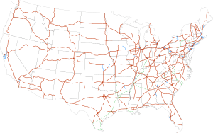
Interstate Highways in the 48 contiguous states | |
| System information | |
| Formed: | June 29, 1956[1] |
| Highway names | |
| Interstates: | Interstate X (I-X) |
| System links | |
.svg.png)
.svg.png)
Future Interstate Highways include various proposals to expand the Interstate Highway System in the United States. This does not include the numerous auxiliary Interstate Highways that are in various stages of planning and construction.
Congressionally designated future Interstates
Several Congressional High Priority Corridors have been designated as future parts of the Interstate System by the Intermodal Surface Transportation Efficiency Act and amendments. By law, they will become interstates when built to Interstate standards and connected to other interstates.[2][3]
Interstate 7 or 9
| Interstate 7 or 9 | |
|---|---|
| Location: | Wheeler Ridge – Stockton, CA |
Interstate 7 or Interstate 9 has been proposed by Caltrans for State Route 99 in central California. It would go from the split with I-5 at Wheeler Ridge (Wheeler Ridge Interchange) north through Fresno to Stockton, where the proposed route turns west via the State Route 4 freeway to a terminus at I-5 in the central part of that city. An alternate proposed terminus is located at the I-5/US 50/Capital City Freeway junction in Sacramento, where the future interstate, after continuing north from Stockton along Route 99, can turn west along the Capital City Freeway, already an Interstate route (unsigned I-305), to connect with I-5, which extends north toward the city of Redding. This also serves as a connector to the existing northern portion of Highway 99. The future Interstate's prospects for development to appropriate standards are tied to the Caltrans "Route 99 Corridor Enhancement Master Plan", which outlines improvements to that route, including capacity and physical improvements; this document posits that when and if Interstate status is conferred, the route will be designated I-7 or I-9.[4]
In August 2005, with the passage of that year's SAFETEA-LU federal transportation legislation, SR 99 from Wheeler Ridge to Stockton and beyond to Sacramento was designated as High Priority Corridor 54, the California Farm-to-Market Corridor; this legislation also designated that corridor as a future segment of the Interstate System.[5]
Interstate 11
| |
|---|---|
| Location: | Tucson, AZ, to Las Vegas, NV, or Reno, NV |
Interstate 11 is the congressionally designated route number for an Interstate connecting Phoenix, Arizona, to Las Vegas or Reno, Nevada. The concept of an Interstate connecting Phoenix and Las Vegas was first explored in the contractor-trade publication "Roads and Bridges" in June 1997; the article outlining the I-11 route and rationale was titled "Interstate 2000: Improvement for the Next Millennium", written by Wendell Cox and Jean Love. Their rationale was that the Phoenix and Las Vegas metro areas were two of the largest (and, circa 1997, growing) urban regions in adjacent states not featuring direct Interstate connection. The corridor would be approximately 285 miles (459 km) in length and would most likely subsume the existing I-515 freeway facility in the Las Vegas area.[6] Plans to connect I-11 to the existing Interstate network in the Phoenix region have yet to be determined. The proposed routing for I-11 is part of the Canamex high-priority corridor.[7] The projects contained within this portion of the overall Canamex corridor include the recently completed Hoover Dam Bypass project.[8][9][10][11] The Fixing America's Surface Transportation Act (FAST Act), signed by President Obama on December 14, 2015,[12] officially designated the Intermountain West Corridor, generally along US 95 from Las Vegas to Interstate 80, as a future Interstate highway, designating it as I-11. At the same time, it extended the southern terminus of the corridor from Phoenix through Tucson to Nogales generally via the I-10 and I-19 corridors.[13]
Interstate 14
| |
|---|---|
| Location: | Fort Stockton, TX – Texas-Louisiana state line near Burkeville, TX |
The 14th Amendment Highway was proposed in the 2005 highway funding bill (Safe, Accountable, Flexible, Efficient Transportation Equity Act: A Legacy for Users) to run from Augusta, Georgia, through Macon, Columbus, Montgomery, Meridian, Jackson, to end in Natchez, Mississippi, or Alexandria, Louisiana. It is named for the 14th Amendment to the U.S. Constitution. The Federal Highway Administration completed an Interstate feasibility study of the highway although the corridor is not a Congressionally designated Interstate corridor. Because it would run between I-10 and I-20, and I-12 exists in Louisiana and I-16 exists in Georgia, Interstate 14 is the next logical available number.[14]
The FAST Act officially assigned the Future I-14 designation to the US 190 Central Texas Corridor.[15] The section of US 190 between Killeen and Temple, Texas, is already at Interstate Highway standards, and it was to be formally renamed I-14 on April 28, 2016.[16][17] At its meeting on May 26, 2016, the American Association of State Highway and Transportation Officials (AASHTO) denied Texas' application to designate approximately 30 miles of US-190 between Killeen and Temple as I-14.[18]
Interstate 42
| |
|---|---|
| Location: | Garner, NC – Morehead City, NC |
| Length: | 142 mi (229 km) |
The FAST Act added the US 70 corridor between Garner and Morehead City, to the Interstate system by defining it as, first, High Priority Corridor #82, and subsequently designating it as a future Interstate.[12] The Regional Transportation Alliance expected this corridor to be called I-46 or another suitable designation.[19] At a meeting in La Grange on March 17, 2016, the Super 70 Corridor Commission recommended that the designation of Interstate 50 be sought for the US 70 Interstate corridor. The rationale for the I-50 numerical selection was cited as a number not in conflict with either an existing Interstate designation or currently applied to a U.S. Highway within North Carolina.[20] This recommendation was forwarded to NCDOT for submission to AASHTO.
For the AASHTO Special Committee on U.S. Route Numbering meeting in May 2016, NCDOT proposed I-36 for this route.[21] However, AASHTO instead designated I-42 as the number for the route.[18][22]
Interstate 87
| |
|---|---|
| Location: | Raleigh, NC – Norfolk, VA |
| Length: | 192 mi (309 km) |
The North Carolina Department of Transportation (NCDOT) proposed the Interstate 44 (I-44) designation for the Raleigh–Norfolk High Priority Corridor consisting of portions of the present I-495 and U.S. Highway 64, in North Carolina and US 17 in North Carolina and Virginia. The route would connect two of the largest US metro areas lacking an Interstate connection: the Research Triangle area around Raleigh, North Carolina, with the Hampton Roads metro area centered on Norfolk, Virginia. In November 2012, NCDOT requested the addition of the corridor to the Interstate Highway System through administrative options with the Federal Highway Administration as I-44.[23] Congressman G. K. Butterfield introduced legislation in June 2014 to add the corridor to the Interstate Highway System through Congressional authority.[24] An NCDOT policy paper said they were "seeking language in the reauthorization of surface transportation programs legislation to enhance the description of the Raleigh–Norfolk Corridor to include the route via Rocky Mount/Elizabeth City for clarity, and to designate the entire route from Raleigh to Norfolk as a future part of the Interstate system as I-44 or I-50."[25][26] This corridor was officially designated as a future Interstate with the passing of the FAST Act.[12]
Had the I-44 designation been approved, it would have been discontinuous with the current I-44, which runs between Wichita Falls, Texas, and St. Louis, Missouri. However, subsequent review of available and preferred route numbers produced two other candidates: I-56 if an east–west designation were chosen, or I-89 if a north–south designation were chosen. I-56 is not in use, while I-89 exists in Vermont and New Hampshire but is far north of this corridor.[27] For the upcoming AASHTO Special Committee on U.S. Route Numbering, NCDOT proposed I-89 for this route.[28] On May 25, 2016, AASHTO instead approved I-87 as the number for the highway,[18][22] which would be non-contiguous with the route with the same number in New York State.
Other proposals
Proposed extensions
- Extension of I-40 in California from its present terminus at Barstow to Bakersfield, and possibly as far west as Paso Robles. The proposed I-40 extension would generally follow SR 58 to Bakersfield, and follow SR 46 to Paso Robles.[29]
- I-66 (Trans America Corridor) was planned to begin in West Virginia, run through southern Kentucky, southern Illinois, southern Missouri, and finally to end in Wichita, Kansas. The last environmental study of I-66 was officially cancelled by the Federal Highway Administration (FHWA) August 5, 2015, ending any further planning of the highway.
Interstate 99 or 101
| Interstate 99 or 101 | |
|---|---|
| Location: |
Charleston, SC–Wilmington, DE or Raleigh, NC–Philadelphia, PA |
There are two segments of Interstate 99 in central Pennsylvania, and between the Pennsylvania border and Corning, New York.[30] An alternate corridor, designated "Interstate 99" by the Virginia Department of Transportation (VDOT), was under study in Delaware, Maryland, Virginia, North Carolina and South Carolina in the mid-2000s. Such a corridor would follow the U.S. Route 17 (US 17) and US 13 corridors, from Charleston, South Carolina, through the Norfolk–Virginia Beach metro area and across the Chesapeake Bay Bridge-Tunnel complex, up the Delmarva Peninsula to Wilmington, Delaware.[31] If the proposal were to be constructed and approved, it is unclear as to whether it would receive the "I-99" designation.
However, after commissioning a study in 2006, VDOT dismissed the proposal for several reasons. VDOT indicated that expenses in upgrading the Chesapeake Bay tunnels would be about $5 billion. Also cited were the location of new highway alignments, and doubt as to whether other states, particularly South Carolina, would commit to the endeavor.[31] Much of the highway along the corridor would need to be upgraded to Interstate standards, but portions of highway along the corridor have already been upgraded. In the 1990s, Delaware constructed a limited access facility on Delaware Route 1, paralleling US 13 from Dover to Wilmington. Additionally, Delaware has considered upgrading the US 113 corridor south of Dover,[31] though, this deviates from the path suggested by VDOT. In Maryland, a portion of US 13 is routed along a limited-access bypass around Salisbury.
The corridor has also sometimes been described as a potential Interstate 101 along the same coastal corridor, including crossing the Chesapeake Bay Bridge-Tunnel complex. I-101 would run from I-95, near Philadelphia, Pennsylvania, through Norfolk, Virginia to I-85, near Raleigh, North Carolina, instead.[6][32] The Norfolk-to-Raleigh segment of this proposal is moving forward as future Interstate 87 as described above.
References
- ↑ Weingroff, Richard F. (Summer 1996). "Federal-Aid Highway Act of 1956, Creating the Interstate System". Public Roads. Washington, DC: Federal Highway Administration. 60 (1). Retrieved March 16, 2012.
- ↑ United States Congress. "National Highway System Designation Act of 1995". Library of Congress.
- ↑ Staff (May 2, 2006). "Future Interstates on the National Highway System Designated by Section 1105 of ISTEA as amended". Federal Highway Administration. Archived from the original on September 26, 2006.
- ↑ "Chapter 3" (PDF). Caltrans Route 99 Enhancement Plan (PDF). California Department of Transportation.
Interstate designation, under the current proposal, would apply to the 260-mile (420 km) segment between the junction of State Route 99 with I-5 south of Bakersfield to I-5 in Stockton using State Route 4 as the connector to I-5. Since there is an I-99 route currently in existence in Pennsylvania, it is anticipated that should designation be granted, the Route 99 designation would become either I-7 or I-9 to satisfy Interstate numbering convention.
- ↑ United States Congress. "Safe, Accountable, Flexible, Efficient Transportation Equity Act: A Legacy for Users". Library of Congress.
- 1 2 Cox, Wendell & Love, Jean (June 1997). "Interstate 2000: Improvement for the Next Millenium". Roads & Bridges. Retrieved December 1, 2013.
- ↑ "Proposed Hassayampa Freeway map" (Map). Las Vegas Sun.
- ↑ "Hoover Dam Bypass". Central Federal Lands Highway Division and HDR Engineering.
- ↑ "US 93 corridor in Arizona". Arizona Department of Transportation. Retrieved June 2, 2013.
- ↑ "Quick Status Update and Upcoming Activities: July–August 2009" (PDF) (Press release). Hoover Dam Bypass Project.
- ↑ Norman, Jean Reid (August 12, 2009). "Boulder City Council endorses Vegas-to-Phoenix interstate". Las Vegas Sun.
- 1 2 3 https://www.congress.gov/114/bills/hr22/BILLS-114hr22enr.pdf#page=111
- ↑ Arizona Department of Transportation Media Relations (December 4, 2015). "Interstate 11 Receives Designation in Federal Transportation Funding Bill" (Press release). Arizona Department of Transportation. Retrieved December 7, 2015.
- ↑ "SAFETEA-LU Section 1927". Safe, Accountable, Flexible, Efficient Transportation Equity Act: A Legacy for Users. Federal Highway Administration. March 8, 2011. Retrieved July 5, 2012.
- ↑ "Interstate 14 Designation by Congress in FAST Act". Official Blog for PTP Alliance. Ports-to-Plains Blog.
- ↑ "April 28 Texas Minute Order" (PDF).
- ↑ "Interstate 14 on its way across Texas". Houston Chronicle.
- 1 2 3 Vitale, Marty (May 24, 2016). "Special Committee on U.S. Route Numbering" (PDF) (Report). Des Moines, IA: American Association of State Highway and Transportation Officials. Retrieved May 26, 2016.
- ↑ "A victory ten years in the making". RTA.
- ↑ Wilson, Marcia R. (March 17, 2016). "Minutes and Summary" (PDF). La Grange, NC: Highway 70 Corridor Commission of North Carolina. Retrieved April 7, 2016.
- ↑ "AASHTO Electronic Balloting System - View Ballot - Agenda and List of Applicatons SM-2016" (PDF). AASHTO. Retrieved May 5, 2016.
- 1 2 Siceloff, Bruce (May 25, 2016). "Future interstate highway names approved". News & Observer. Retrieved May 25, 2016.
- ↑ Gibson, Terry R. (November 27, 2012). "Designation of I-44" (PDF) (Letter). Letter to John F. Sullivan III. Raleigh, NC: North Carolina Department of Transportation. Retrieved May 15, 2014.
- ↑ Tata, Anthony J. (June 11, 2014). "Route to Opportunity and Development Act (ROAD Act)" (PDF) (Letter). Letter to G.K. Butterfield. North Carolina Department of Transportation. Retrieved September 4, 2014.
- ↑ "Future Interstate Designation: Raleigh, NC to Norfolk, VA" (PDF). North Carolina Department of Transportation. June 11, 2014. Retrieved September 4, 2014 – via Regional Transportation Alliance.
- ↑ "Interstate 495 to Rocky Mount—Future I-44 to Hampton Roads". Raleigh, NC: Regional Transportation Alliance. December 14, 2013. Retrieved February 16, 2014.
- ↑ "Raleigh-Norfolk: I-495, I-44, I-50, I-89, I-56 ... ?". Raleigh, NC: Regional Transportation Alliance. December 31, 2015. Retrieved February 1, 2016.
- ↑ "AASHTO Electronic Balloting System - View Ballot - Agenda and List of Applicatons SM-2016" (PDF). AASHTO. Retrieved May 5, 2016.
- ↑ Subcommittee on Roads of the Committee on Public Works (April 15, 1970). "Report on the Status of the Federal-Aid Highway Program" (Hearing). United States Senate. p. 89. Retrieved June 10, 2016 – via HathiTrust.
Buttonwillow via Bakersfield to Barstow
- ↑ [Staff writer] (June 28, 2014). "Corning area now has 2 interstates; U.S. 15 designated I-99 to Pa. border". Star-Gazette. Archived from the original on July 15, 2014. Retrieved June 28, 2014.
- 1 2 3 Homer, Pierce R. (November 2006). "Construction of I-99: Appropriation Act Item 427 H. (Special Session I, 2006)" (PDF). Virginia Department of Transportation. Retrieved August 10, 2013.
- ↑ Virginia Department of Transportation (November 2006). Construction of I-99: Appropriation Act Item 427 H. (Special Session I, 2006) Report to the Chairmen of House Committees on Transportation and Appropriations and Senate Committees on Transportation and Finance (PDF) (Report). Richmond: Virginia Department of Transportation. p. 22. Retrieved January 10, 2016.
External links
| Signed | |||||||||||
|---|---|---|---|---|---|---|---|---|---|---|---|
| Unsigned | |||||||||||
| Lists |
| ||||||||||
Major Interstates highlighted | |||||||||||