Fumel
| Fumel | ||
|---|---|---|
|
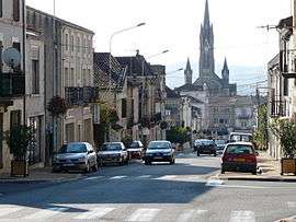
Rue de Fumel | ||
| ||
 Fumel | ||
|
Location within Nouvelle-Aquitaine region  Fumel | ||
| Coordinates: 44°29′49″N 0°58′05″E / 44.4969°N 0.9681°ECoordinates: 44°29′49″N 0°58′05″E / 44.4969°N 0.9681°E | ||
| Country | France | |
| Region | Nouvelle-Aquitaine | |
| Department | Lot-et-Garonne | |
| Arrondissement | Villeneuve-sur-Lot | |
| Canton |
Fumel (Chef-lieu) | |
| Intercommunality | Fumelois-Lémance | |
| Government | ||
| • Mayor (2008–2014) | Jean-Louis Costes | |
| Area1 | 22.66 km2 (8.75 sq mi) | |
| Population (1999)2 | 5,423 | |
| • Density | 240/km2 (620/sq mi) | |
| Time zone | CET (UTC+1) | |
| • Summer (DST) | CEST (UTC+2) | |
| INSEE/Postal code | 47106 / 47500 | |
| Elevation |
57–207 m (187–679 ft) (avg. 107 m or 351 ft) | |
| Website | site officiel | |
|
1 French Land Register data, which excludes lakes, ponds, glaciers > 1 km² (0.386 sq mi or 247 acres) and river estuaries. 2 Population without double counting: residents of multiple communes (e.g., students and military personnel) only counted once. | ||
.svg.png)
Fumel is a commune in the Lot-et-Garonne department in south-western France. It is twinned with Uttoxeter, United Kingdom. In 1438 it was pillaged by Rodrigo de Villandrando.
See also
| Wikimedia Commons has media related to Fumel. |
This article is issued from Wikipedia - version of the 9/20/2016. The text is available under the Creative Commons Attribution/Share Alike but additional terms may apply for the media files.