Frost, Minnesota
| Frost, Minnesota | |
|---|---|
| City | |
 Location of Frost, Minnesota | |
| Coordinates: 43°35′7″N 93°55′29″W / 43.58528°N 93.92472°W | |
| Country | United States |
| State | Minnesota |
| County | Faribault |
| Government | |
| • Type | Mayor - Council |
| • Mayor | Bob Loge |
| Area[1] | |
| • Total | 0.53 sq mi (1.37 km2) |
| • Land | 0.53 sq mi (1.37 km2) |
| • Water | 0 sq mi (0 km2) |
| Elevation | 1,129 ft (344 m) |
| Population (2010)[2] | |
| • Total | 198 |
| • Estimate (2012[3]) | 195 |
| • Density | 373.6/sq mi (144.2/km2) |
| Time zone | Central (CST) (UTC-6) |
| • Summer (DST) | CDT (UTC-5) |
| ZIP code | 56033 |
| Area code(s) | 507 |
| FIPS code | 27-22940[4] |
| GNIS feature ID | 0643976[5] |
Frost is a city in Faribault County, Minnesota, United States. The population was 198 at the 2010 census.[6]
History
A post office called Frost has been in operation since 1899.[7] The city was named for architect Charles Sumner Frost.[8]
Geography
According to the United States Census Bureau, the city has a total area of 0.53 square miles (1.37 km2), all of it land.[1]
Demographics
| Historical population | |||
|---|---|---|---|
| Census | Pop. | %± | |
| 1910 | 138 | — | |
| 1920 | 252 | 82.6% | |
| 1930 | 233 | −7.5% | |
| 1940 | 278 | 19.3% | |
| 1950 | 326 | 17.3% | |
| 1960 | 381 | 16.9% | |
| 1970 | 290 | −23.9% | |
| 1980 | 293 | 1.0% | |
| 1990 | 236 | −19.5% | |
| 2000 | 251 | 6.4% | |
| 2010 | 198 | −21.1% | |
| Est. 2015 | 192 | [9] | −3.0% |
2010 census
As of the census[2] of 2010, there were 198 people, 95 households, and 59 families residing in the city. The population density was 373.6 inhabitants per square mile (144.2/km2). There were 123 housing units at an average density of 232.1 per square mile (89.6/km2). The racial makeup of the city was 97.0% White, 0.5% African American, 0.5% Native American, and 2.0% from two or more races. Hispanic or Latino of any race were 1.0% of the population.
There were 95 households of which 22.1% had children under the age of 18 living with them, 51.6% were married couples living together, 7.4% had a female householder with no husband present, 3.2% had a male householder with no wife present, and 37.9% were non-families. 31.6% of all households were made up of individuals and 11.6% had someone living alone who was 65 years of age or older. The average household size was 2.08 and the average family size was 2.59.
The median age in the city was 47.8 years. 18.7% of residents were under the age of 18; 6% were between the ages of 18 and 24; 21.2% were from 25 to 44; 34.4% were from 45 to 64; and 19.7% were 65 years of age or older. The gender makeup of the city was 49.0% male and 51.0% female.
2000 census
As of the census[4] of 2000, there were 251 people, 115 households, and 66 families residing in the city. The population density was 476.7 people per square mile (182.9/km²). There were 126 housing units at an average density of 239.3 per square mile (91.8/km²). The racial makeup of the city was 96.81% White, 0.40% Asian, 2.79% from other races. Hispanic or Latino of any race were 2.79% of the population.
There were 115 households out of which 32.2% had children under the age of 18 living with them, 43.5% were married couples living together, 9.6% had a female householder with no husband present, and 42.6% were non-families. 40.0% of all households were made up of individuals and 25.2% had someone living alone who was 65 years of age or older. The average household size was 2.18 and the average family size was 2.94.
In the city the population was spread out with 27.9% under the age of 18, 9.6% from 18 to 24, 27.5% from 25 to 44, 14.7% from 45 to 64, and 20.3% who were 65 years of age or older. The median age was 38 years. For every 100 females there were 87.3 males. For every 100 females age 18 and over, there were 81.0 males.
The median income for a household in the city was $26,389, and the median income for a family was $34,792. Males had a median income of $27,708 versus $23,750 for females. The per capita income for the city was $14,756. About 8.8% of families and 12.8% of the population were below the poverty line, including 16.7% of those under the age of eighteen and 18.2% of those sixty five or over.
Notable natives
References
- 1 2 "US Gazetteer files 2010". United States Census Bureau. Retrieved 2012-11-13.
- 1 2 "American FactFinder". United States Census Bureau. Retrieved 2012-11-13.
- ↑ "Population Estimates". United States Census Bureau. Retrieved 2013-05-28.
- 1 2 "American FactFinder". United States Census Bureau. Retrieved 2008-01-31.
- ↑ "US Board on Geographic Names". United States Geological Survey. 2007-10-25. Retrieved 2008-01-31.
- ↑ "2010 Census Redistricting Data (Public Law 94-171) Summary File". American FactFinder. United States Census Bureau. Retrieved 27 April 2011.
- ↑ "Faribault County". Jim Forte Postal History. Retrieved 18 March 2015.
- ↑ Chicago and North Western Railway Company (1908). A History of the Origin of the Place Names Connected with the Chicago & North Western and Chicago, St. Paul, Minneapolis & Omaha Railways. p. 74.
- ↑ "Annual Estimates of the Resident Population for Incorporated Places: April 1, 2010 to July 1, 2015". Retrieved July 2, 2016.
- ↑ "Census of Population and Housing". Census.gov. Retrieved June 4, 2015.
Municipalities and communities of Faribault County, Minnesota, United States | ||
|---|---|---|
| Cities | 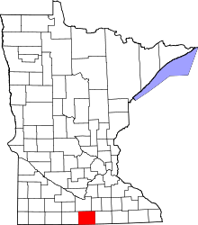 | |
| Townships | ||
| Unincorporated communities | ||
| Ghost towns | ||
| Footnotes | ‡This populated place also has portions in an adjacent county or counties | |
Coordinates: 43°35′11″N 93°55′36″W / 43.58639°N 93.92667°W