Frontier County, Nebraska
| Frontier County, Nebraska | |
|---|---|
 Frontier County Courthouse in Stockville | |
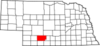 Location in the U.S. state of Nebraska | |
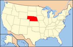 Nebraska's location in the U.S. | |
| Founded | 1872 |
| Seat | Stockville |
| Largest city | Curtis |
| Area | |
| • Total | 980 sq mi (2,538 km2) |
| • Land | 975 sq mi (2,525 km2) |
| • Water | 5.5 sq mi (14 km2), 0.6% |
| Population | |
| • (2010) | 2,756 |
| • Density | 2.8/sq mi (1/km²) |
| Congressional district | 3rd |
| Time zone | Central: UTC-6/-5 |
| Website |
www |
Frontier County is a county in the U.S. state of Nebraska. As of the 2010 census, the population was 2,756.[1] Its county seat is Stockville.[2]
In the Nebraska license plate system, Frontier County is represented by the prefix 60 (it had the sixtieth-largest number of vehicles registered in the county when the license plate system was established in 1922).
History
Frontier County was formed in 1872.[3] It was named for its location along the frontier border in the late 19th century.[4]
The courthouse was completed in 1889.[5]
Geography
According to the U.S. Census Bureau, the county has an area of 980 square miles (2,500 km2), of which 975 square miles (2,530 km2) is land and 5.5 square miles (14 km2) (0.6%) is water.[6]
Major highways
Adjacent counties
- Gosper County (east)
- Furnas County (southeast)
- Red Willow County (south)
- Hitchcock County (southwest)
- Hayes County (west)
- Lincoln County (north)
- Dawson County (northeast)
Demographics
| Historical population | |||
|---|---|---|---|
| Census | Pop. | %± | |
| 1880 | 934 | — | |
| 1890 | 8,497 | 809.7% | |
| 1900 | 8,781 | 3.3% | |
| 1910 | 8,572 | −2.4% | |
| 1920 | 8,540 | −0.4% | |
| 1930 | 8,114 | −5.0% | |
| 1940 | 6,417 | −20.9% | |
| 1950 | 5,282 | −17.7% | |
| 1960 | 4,311 | −18.4% | |
| 1970 | 3,982 | −7.6% | |
| 1980 | 3,647 | −8.4% | |
| 1990 | 3,101 | −15.0% | |
| 2000 | 3,099 | −0.1% | |
| 2010 | 2,756 | −11.1% | |
| Est. 2015 | 2,624 | [7] | −4.8% |
| U.S. Decennial Census[8] 1790-1960[9] 1900-1990[10] 1990-2000[11] 2010-2013[1] | |||
As of the census[12] of 2000, there were 3,099 people, 1,192 households, and 828 families residing in the county. The population density was 3 people per square mile (1/km²). There were 1,543 housing units at an average density of 2 per square mile (1/km²). The racial makeup of the county was 98.29% White, 0.10% Black or African American, 0.26% Native American, 0.26% Asian, 0.39% from other races, and 0.71% from two or more races. 0.97% of the population were Hispanic or Latino of any race. 45.8% were of German, 12.8% English, 6.3% American and 6.1% Irish ancestry according to Census 2000.
There were 1,192 households out of which 31.40% had children under the age of 18 living with them, 62.50% were married couples living together, 4.80% had a female householder with no husband present, and 30.50% were non-families. 26.30% of all households were made up of individuals and 12.30% had someone living alone who was 65 years of age or older. The average household size was 2.48 and the average family size was 3.02.
In the county the population was spread out with 26.00% under the age of 18, 11.30% from 18 to 24, 22.80% from 25 to 44, 23.00% from 45 to 64, and 16.90% who were 65 years of age or older. The median age was 38 years. For every 100 females there were 100.50 males. For every 100 females age 18 and over, there were 98.50 males.
The median income for a household in the county was $33,038, and the median income for a family was $38,664. Males had a median income of $25,792 versus $16,941 for females. The per capita income for the county was $16,648. About 9.30% of families and 12.20% of the population were below the poverty line, including 9.90% of those under age 18 and 8.30% of those age 65 or over.
Communities
- Curtis
- Eustis
- Freedom
- Maywood
- Moorefield
- Orafino
- Stockville (county seat)
See also
References
- 1 2 "State & County QuickFacts". United States Census Bureau. Retrieved September 19, 2013.
- ↑ "Find a County". National Association of Counties. Retrieved 2011-06-07.
- ↑ Burr, George L. (1921). History of Hamilton and Clay Counties, Nebraska, Volume 1. S.J. Clarke Publishing Company. p. 110.
- ↑ Gannett, Henry (1905). The Origin of Certain Place Names in the United States. Govt. Print. Off. p. 132.
- ↑ "Stockville, Frontier County". Center for Advanced Land Management Information Technologies. University of Nebraska. Retrieved 9 August 2014.
- ↑ "2010 Census Gazetteer Files". United States Census Bureau. August 22, 2012. Retrieved December 7, 2014.
- ↑ "County Totals Dataset: Population, Population Change and Estimated Components of Population Change: April 1, 2010 to July 1, 2015". Retrieved July 2, 2016.
- ↑ "U.S. Decennial Census". United States Census Bureau. Retrieved December 7, 2014.
- ↑ "Historical Census Browser". University of Virginia Library. Retrieved December 7, 2014.
- ↑ "Population of Counties by Decennial Census: 1900 to 1990". United States Census Bureau. Retrieved December 7, 2014.
- ↑ "Census 2000 PHC-T-4. Ranking Tables for Counties: 1990 and 2000" (PDF). United States Census Bureau. Retrieved December 7, 2014.
- ↑ "American FactFinder". United States Census Bureau. Retrieved 2008-01-31.
 |
Lincoln County | Dawson County | | |
| Hayes County | |
Gosper County | ||
| ||||
| | ||||
| Hitchcock County | Red Willow County | Furnas County |
Municipalities and communities of Frontier County, Nebraska, United States | ||
|---|---|---|
| City | ||
| Villages | ||
| Unincorporated communities | ||
Coordinates: 40°32′N 100°23′W / 40.53°N 100.39°W