Fritz Creek, Alaska
| Fritz Creek, Alaska | |
|---|---|
| CDP | |
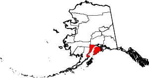
 Location of Fritz Creek, Alaska | |
| Coordinates: 59°43′54″N 151°15′2″W / 59.73167°N 151.25056°WCoordinates: 59°43′54″N 151°15′2″W / 59.73167°N 151.25056°W | |
| Country | United States |
| State | Alaska |
| Borough | Kenai Peninsula |
| Government | |
| • Borough mayor | Mike Navarre[1] |
| • State senator | Gary Stevens (R) |
| • State rep. | Paul Seaton (R) |
| Area | |
| • Total | 54.4 sq mi (140.9 km2) |
| • Land | 54.4 sq mi (140.9 km2) |
| • Water | 0 sq mi (0 km2) |
| Elevation | 1,198 ft (365 m) |
| Population (2010) | |
| • Total | 1,653 |
| Time zone | Alaska (AKST) (UTC-9) |
| • Summer (DST) | AKDT (UTC-8) |
| ZIP code | 99603 |
| Area code(s) | 907 |
| FIPS code | 02-27090 |
| GNIS feature ID | 1866947 |
Fritz Creek is a census-designated place (CDP) 8 miles east of Homer, Alaska, in the Kenai Peninsula Borough, Alaska, United States. At the 2000 census the population was 1,603.
Geography
Fritz Creek is located at 59°43′54″N 151°15′02″W / 59.731632°N 151.250527°W.[2]
According to the United States Census Bureau, the CDP has a total area of 54.4 square miles (141 km2), all of it land.
It is an unincorporated entity just east of Homer. Climbing from Sea Level (Homer) to 1,500+ feet (457 m) offers fantastic views of the Kenai Mountains and Kachemak Bay.
Demographics
As of the census[3] of 2000, there were 1,603 people, 661 households, and 413 families residing in the CDP. The population density was 29.5 people per square mile (11.4/km²). There were 854 housing units at an average density of 15.7/sq mi (6.1/km²). The racial makeup of the CDP was 92.95% White, 0.19% Black or African American, 2.37% Native American, 0.56% Asian, 0.87% from other races, and 3.06% from two or more races. 2.25% of the population were Hispanic or Latino of any race.
There were 661 households out of which 36.0% had children under the age of 18 living with them, 52.3% were married couples living together, 7.0% had a female householder with no husband present, and 37.4% were non-families. 29.7% of all households were made up of individuals and 3.0% had someone living alone who was 65 years of age or older. The average household size was 2.43 and the average family size was 3.06.
In the CDP the population was spread out with 29.8% under the age of 18, 4.4% from 18 to 24, 30.4% from 25 to 44, 29.8% from 45 to 64, and 5.6% who were 65 years of age or older. The median age was 38 years. For every 100 females there were 103.7 males. For every 100 females age 18 and over, there were 109.1 males.
The median income for a household in the CDP was $41,400, and the median income for a family was $49,881. Males had a median income of $42,083 versus $31,250 for females. The per capita income for the CDP was $18,937. About 3.6% of families and 9.6% of the population were below the poverty line, including 11.4% of those under age 18 and 3.4% of those age 65 or over.
See also
References
- ↑ 2015 Alaska Municipal Officials Directory. Juneau: Alaska Municipal League. 2015. p. 9.
- ↑ "US Gazetteer files: 2010, 2000, and 1990". United States Census Bureau. 2011-02-12. Retrieved 2011-04-23.
- ↑ "American FactFinder". United States Census Bureau. Retrieved 2008-01-31.