Friendship, Anne Arundel County, Maryland
| Friendship, Maryland | |
|---|---|
| Census-designated place | |
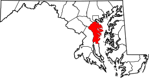
 Friendship  Friendship Location within the state of Maryland | |
| Coordinates: 38°44′12″N 76°35′22″W / 38.73667°N 76.58944°WCoordinates: 38°44′12″N 76°35′22″W / 38.73667°N 76.58944°W | |
| Country |
|
| State |
|
| County |
|
| Area[1] | |
| • Total | 1.794 sq mi (4.65 km2) |
| • Land | 1.794 sq mi (4.65 km2) |
| • Water | 0 sq mi (0 km2) |
| Elevation | 144 ft (44 m) |
| Population (2010)[2] | |
| • Total | 447 |
| • Density | 250/sq mi (96/km2) |
| Time zone | Eastern (EST) (UTC-5) |
| • Summer (DST) | EDT (UTC-4) |
| ZIP code | 20758 |
| FIPS code | 24-30650 |
| GNIS feature ID | 590257[3] |
Friendship is an unincorporated community and census-designated place (CDP) in Anne Arundel County, Maryland, United States.[3] As of the 2010 census, its population was 447.[2]
Friendship is located at the southern tip of Anne Arundel County along Maryland Route 2, by which road it is 22 miles (35 km) north to Annapolis, the state capital, and 15 miles (24 km) south to Prince Frederick, the seat of Calvert County.
References
- ↑ "US Gazetteer files: 2010, 2000, and 1990". United States Census Bureau. 2011-02-12. Retrieved 2011-04-23.
- 1 2 "American FactFinder". United States Census Bureau. Retrieved 2011-05-14.
- 1 2 "Friendship". Geographic Names Information System. United States Geological Survey.
This article is issued from Wikipedia - version of the 10/29/2016. The text is available under the Creative Commons Attribution/Share Alike but additional terms may apply for the media files.