Fort Pitt Tunnel
|
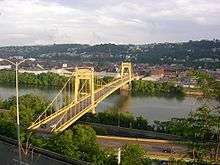
North Portal of Fort Pitt Tunnel | |
| Overview | |
|---|---|
| Location | Pittsburgh, Pennsylvania |
| Coordinates |
763-4-1, 870+00 west portal 763-4-1, 912+25 east portal |
| Route |
|
| Start | I-376 Fort Pitt Bridge |
| End | U.S. 19 |
| Operation | |
| Work begun | August 28, 1957 |
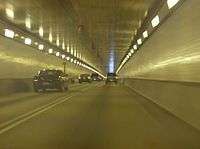
| Constructed | twin bore, circular roof with an exposed curved ceiling, concrete with ceramic tile lining |
| Opened | September 1, 1960 |
| Owner | PennDOT |
| Operator | PennDOT |
| Traffic | automobile |
| Toll | none |
| Vehicles per day | 107,000 |
| Technical | |
| Length | 3,614 feet (1,102 m) |
| Number of lanes | 4 |
| Operating speed | 55 mph |
| Tunnel clearance | 13.5 feet (4.1 m) |
| Width | 28 feet (8.5 m) |
| Grade | 2.5% (east to west) |

The Fort Pitt Tunnel carries Interstate 376 (Interstate 279 prior to June 10, 2009), US 22, US 30, and US 19 Truck between Downtown Pittsburgh and its West End neighborhood in the U.S. state of Pennsylvania. It has two lanes both inbound and outbound. The tunnel travels beneath Mount Washington. Its northern ramps lead directly to the double-deck Fort Pitt Bridge. To mesh with the bridge, the North portal has openings at two levels, with the eastern opening leading to the top deck of the bridge. At the South portal the openings are at the same level. "FORT PITT TUNNEL" is mounted in small letters on a grey marblestone frame-like entranceway above the South portal, with large letters used in the North portal frame.
Before entering the tunnel at its southwest end, one sees a commonplace view of Western Pennsylvania's rolling green hills, but upon exiting at the northeast end, one sees a spectacular view of Pittsburgh's skyline, cited by the New York Times as "the best way to enter an American city". The view was also the inspiration for the news open on CBS affiliate KDKA-TV for several years in the 1980s and 1990s.[1] It is referenced in Stephen Chbosky's novel The Perks of Being a Wallflower.
 |
.jpg) |
History
Before the existence of the Fort Pitt Tunnels (as well as the Penn Lincoln Parkway and West End Bypass), South Hills commuters travelled around the Banksville Circle, which was the northern terminus of Banksville Road and western terminus of Saw Mill Run Blvd at the time. On July 11, 1954, contracts were awarded for the basic design of the Fort Pitt Tunnels. The groundbreaking ceremony for the Fort Pitt tunnel was held April 17, 1957 and drilling began August 28 of the same year. In April 1960 construction on the tunnels was complete and they opened for the first time at 11 a.m. on September 1, 1960 with a dedication ceremony on the southwestern portal by Governor Lawrence, Pennsylvania Transportation Secretary Park H. Martin and Pittsburgh Mayor Joseph M. Barr followed by a "christening" of the tunnels in which the Governor lead a caravan of antique cars through. The cost of the tunnel was $16 million in 1960 terms.[2][3] On Thursday, May 31, 2007, a bomb threat shut down the Fort Pitt Tunnel along with the Liberty and Squirrel Hill tunnels, causing a major traffic jam.[4]
The tunnel provided AM reception in 1960 however due to design repairs it was discontinued until 1986. It was improved to cover the entire tunnel with strong reception in March, 1997.[5] Since August 1987 the tunnels have provided cellular phone reception.[6] With the help of Carnegie Mellon University graduate students the tunnel has provided FM reception since July 2005 as well as having its AM signals upgraded at the time. In 2015, the original flat ceiling was removed due to its poor condition.[7]
Dimensions and specifications
- 3,614 ft (1.102 km) in length
- 28 ft (8.5 m) wide
- 13.5 ft (4.1 m) vertical clearance[3]
- Serves nearly 107,000 vehicles per day.
- There are 1,788 light fixtures with 3,576 bulbs.
- There are 187,200 sq ft (17,390 m2) of tiled surface to wash.[3]
References
- ↑ "kdka tv 2 news open 1985". YouTube.
- ↑ "The Pittsburgh Press I - Google News Archive Search".
- 1 2 3 Cridlebaugh, Bruce S. (2001-09-10). "Bridges And Tunnels Of Allegheny County, Pennsylvania - Fort Pitt Tunnel". Retrieved 2007-08-08.
- ↑ Ayad, Moustafa; Majors, Dan (2007-06-01). "Bomb threats close major tunnels during downpour, snarling traffic throughout city". Pittsburgh Post-Gazette.
- ↑ "Pittsburgh Post-Gazette - Google News Archive Search".
- ↑ "Pittsburgh Post-Gazette - Google News Archive Search".
- ↑ http://www.commuteinfo.org/news/TribArt.pdf
External links
- Travel Channel video
- Video of the tunnel
- 40°25′55″N 80°01′28″W / 40.43191°N 80.02440°W - Southern portal
- 40°26′15″N 80°00′50″W / 40.43746°N 80.01394°W - Northern portal
Coordinates: 40°26′04″N 80°01′08″W / 40.43444°N 80.01889°W