Fort Ouiatenon
| Fort Ouiatenon | |
|---|---|
| West Lafayette, Indiana | |
|
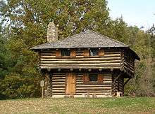
The replica of the blockhouse | |
| Type | Fort |
| Site information | |
| Controlled by | New France; Great Britain; First Nations |
| Site history | |
| Built | 1717 |
| In use | 1717–1763 |
| Garrison information | |
| Past commanders | François-Marie Bissot(Fr); Edward Jenkins(Br) |
|
Fort Ouiatenon | |
|
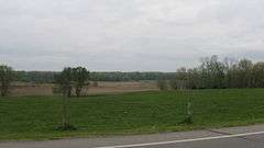
Fields at the site | |
   | |
| Nearest city | Lafayette, Indiana |
| Area | 17.5 acres (7.1 ha) |
| Built | 1717 |
| NRHP Reference # | 70000008[1] |
| Added to NRHP | February 16, 1970 |
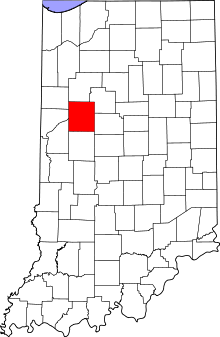
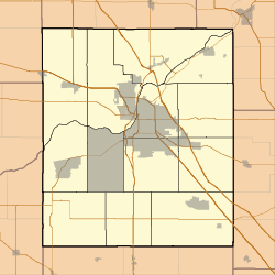
Fort Ouiatenon, built in 1717, was the first fortified European settlement in what is now called Indiana.[2] It was a French trading post on the Wabash River located approximately three miles southwest of modern-day West Lafayette.[3] The name 'Ouiatenon' is a French rendering of the name in the Wea language, waayaahtanonki, meaning 'place of the whirlpool'.
Every year between the end of September and the month of October, a reenactment of pioneer life called the Feast of the Hunters' Moon is held at the rebuilt fort.[4]
French period
Fort Ouiatenon was originally constructed by the Government of New France as a military outpost to protect against Great Britain’s western expansion. Its location among the unsettled woodlands of the Wabash River valley also made it a key center of trade for fur trappers. French merchants and trappers from Quebec would arrive at Fort Ouiatenon in search of beaver pelts and to take advantage of trade relations with the native Wea Indian tribes.
In 1717, Ensign François Picote de Beletre (related to another Picoté de Bélestre, see Adam Dollard des Ormeaux) arrived at the mouth of the Tippecanoe and Wabash with four soldiers, three men, a blacksmith and supplies to trade with the nearby Wea people, an Algonquian-speaking nation closely related to the Miami people. They built a stockade on the Wabash, eighteen miles below the mouth of the Tippecanoe. François-Marie Bissot, the Sieur de Vincennes assumed command of the fort sometime in the 1720s. The French settled on the north bank, with Wea villages on the south bank.[5] The boundary between the French colonies of Louisiana and Canada, although inexact in the first years of the settlement, was decreed in 1745 to run between Ouiatenon and Fort Vincennes.[6]
In order to convince the Wea to trade exclusively with the French, the Governor-General of New France, Philippe de Rigaud Vaudreuil, issued permits for trade at Ouiatenon. Traders immediately began to bring a steady flow of goods to the new town.[7] Soon the officials in Louisiana sent more men to help Vincennes to hold the Wabash River.[8] Ouiatenon was described as "the finest palisaded fort in the upper country," and was one of the most successful trading posts in the region.[9] At its peak level of activity during the mid-18th century, Fort Ouiatenon may have supported over 3,000 residents,[10] and it was central to a hub of five Wea and two Kickapoo villages.[11]
British period
After the surrender of New France to the British in September 1760, Robert Rogers dispatched troops to occupy Ouiatenon. A contingent of British soldiers led by Lieutenant Edward Jenkins arrived in 1761, capturing and occupying the fort.[12]
On June 1, 1763, during Pontiac's War, the Wea, Kickapoo and Mascouten peoples captured Ouiatenon.[13] They surprised Lieutenant Jenkins and his men and captured Fort Ouiatenon without firing a shot. Seven similar posts were also captured in the widespread Indian uprising against the British presence.
The British made little use of Fort Ouiatenon after the French and Indian War; it was never garrisoned. In the mid-1770s, the fort was described 70 yards from the Wabash river.
The Ouiatenon nation of Indians is on the opposite side, & the Kiccaposses are round the Fort, in both villages about 1000 men able to bear arms.[14]
As late as 1778, Ouiatenon was a staging ground for war parties fighting on behalf of the British government.[15]
American period
Captain Leonard Helm and Lt. Bailey arrived in 1778 to secure the fort for the rebelling Americans. A British Indian agent named Celeron controlled the fort and tried to evacuate, but was captured with a force of 40 men.[16] A British company arrived and hoisted "St. George's Ensign" in the fort by December of the same year.[17] Shortly after the Americans captured Vincennes in 1779, Captain I. Shelby arrived in Ouiatenon and received promises of cooperation from the Wea.
During the 1780s, however, local Indian tribes used it as a base of operations in resistance against the westward expansion of white American settlers. Consequently, President George Washington ordered the fort to be destroyed in 1791. Northwest Territory Governor Arthur St. Clair ordered General Charles Scott to attack villages along the Wabash River, with Ouiatenon as the primary target. Scott crossed the Ohio River in May 1791 and marched to the Ouiatenon area with 750 Kentucky militia.[18] While Colonel John Hardin led a force to the Big Pine Creek to destroy a large Kickapoo village, Scott led the main force to Ouiatenon. The American Indians who were present evacuated, and Colonel James Wilkinson led a battalion of mounted militia down to the river to fire on escaping Indians. Ouiatenon was then burned to the ground, and the militia destroyed several over nearby villages, including the large village of Keth-tio-e-ca-muck near the mouth of the Tippecanoe River.[19]
Besides the villages and crops that were destroyed, 38 Native Americans had been killed, and another 58 were taken prisoner, mostly women and children.[19] The Kentucky militia had no men killed, and only five wounded. The militia returned victorious to Kentucky, but the destruction enraged the Indians, who increased their attacks on the white settlers. Furthermore, since the attack came relatively early in the growing season, the tribes were able to recover some of their lost crops. When Colonel Wilkinson led another expedition into Indiana in Autumn of the same year, he returned along the Wabash and destroyed some of the same villages.[20]
Twentieth century
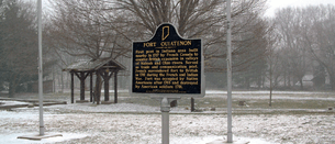
In 1930, a replica of Fort Ouiatenon was built by a local physician named Richard Wetherill. The Daughters of the American Revolution had placed a small commemorative marker near this spot in 1909. Dr. Wetherill's blockhouse was actually patterned after those more typical of British fortifications (using horizontal logs) and does not match the style or type of construction of the original Fort Ouiatenon (with vertical logs). The replica blockhouse is now the focal point of a county park. The true site of Fort Ouiatenon, one mile from the replica's site, was discovered and confirmed archaeologically in the late 1960s. In 1970 the site was placed on the National Register of Historic Places by the U.S. Department of the Interior.
Today, the Fort Ouiatenon Blockhouse Museum 40°24′23″N 86°57′50″W / 40.40639°N 86.96389°W is open to tourists in the summer and is the location of the annual Feast of the Hunters’ Moon. Many rare artifacts from the original Fort Ouiatenon are displayed by the Tippecanoe County Historical Association during the Feast.
See also
References
- ↑ National Park Service (2010-07-09). "National Register Information System". National Register of Historic Places. National Park Service.
- ↑ "Fort Ouiatenon History," Tippecanoe County Historical Association
- ↑ Encyclopædia Britannica Online s. v. "West Lafayette," http://www.britannica.com/eb/article-9076617?query=Wabash&ct= (Accessed May 17, 2006).
- ↑ "Feast of the Hunters' Moon". www.tcha.mus.in.us. Retrieved 2016-01-19.
- ↑ Cayton, 5, 7.
- ↑ Ekberg, Carl (2000). French Roots in the Illinois Country: The Mississippi Frontier in Colonial Times. Urbana and Chicago, Ill.: University of Illinois Press. p. 32. ISBN 9780252069246. Retrieved 29 November 2014.
- ↑ Cayton, 5.
- ↑ Cayton, 18
- ↑ Allison, 25
- ↑ Allison, 26
- ↑ Allison, 25–26
- ↑ Cayton, 27.
- ↑ Cayton, 28.
- ↑ Dunn, V2, pp. 403–442. Available online at the Glenn A. Black Laboratory of Archaeology website.
- ↑ Hamilton to Carleton, April 25, 1778. in Haldimand Papers and in Michigan History Collections V9 p. 434. Available online at the Glenn A. Black Laboratory of Archaeology website.
- ↑
- English, William Hayden, V1, pg 204
- ↑ Lt-Gov. Henry Hamilton's journal describes their arrival, and is available online
- ↑ Allison, 77
- 1 2 Allison, 78
- ↑ Allison, 80
Bibliography
- Allison, Harold (1986, Harold Allison). The Tragic Saga of the Indiana Indians. Turner Publishing Company, Paducah. ISBN 0-938021-07-9. Check date values in:
|date=(help) - Cayton, Andrew R. L. (1996). Frontier Indiana. Bloomington, IN: Indiana University Press.
- Dunn, Jacob Piatt, ed. (1894). The Road from Detroit to the Illinois. Documents relating to the French Settlements on the Wabash. Indiana Historical Society Publications.
- English, William Hayden (1896). Conquest of the Country Northwest of the River Ohio 1778–1783 and Life of Gen. George Rogers Clark. Vol I. The Bowen-Merrill Company, Indianapolis, Ind., and Kansas City, Mo.
External links
| Early history |    | |
|---|---|---|
| 1700–1799 | ||
| 1800–1816 | ||
| 1817–1899 |
| |
| 1900–1999 | ||
| Since 2000 | ||
| By topic |
| |
| By city and locale | ||
See also: History of the United States, History of the Midwestern United States and Portal:Indiana WikiProject Indiana's History Department | ||