Fort Montgomery, New York
| Fort Montgomery, New York | |
|---|---|
| CDP | |
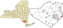 Location in Orange County and the state of New York. | |
 Fort Montgomery, New York Location within the state of New York | |
| Coordinates: 41°20′15″N 73°58′58″W / 41.33750°N 73.98278°WCoordinates: 41°20′15″N 73°58′58″W / 41.33750°N 73.98278°W | |
| Country | United States |
| State | New York |
| County | Orange |
| Area | |
| • Total | 1.5 sq mi (3.9 km2) |
| • Land | 1.5 sq mi (3.8 km2) |
| • Water | 0.0 sq mi (0.1 km2) |
| Elevation | 161 ft (49 m) |
| Population (2010) | |
| • Total | 1,571 |
| • Density | 1,000/sq mi (400/km2) |
| Time zone | Eastern (EST) (UTC-5) |
| • Summer (DST) | EDT (UTC-4) |
| ZIP code | 10922 |
| Area code(s) | 845 |
| FIPS code | 36-26902 |
| GNIS feature ID | 0950484 |
Fort Montgomery is a hamlet (and census-designated place) in Orange County, New York, United States. The population was 1,571 at the 2010 census. It is part of the Poughkeepsie–Newburgh–Middletown, NY Metropolitan Statistical Area as well as the larger New York–Newark–Bridgeport, NY-NJ-CT-PA Combined Statistical Area.
Fort Montgomery is in the southeast corner of the Town of Highlands, on U.S. Route 9W.
Geography
Fort Montgomery is on the west bank of the Hudson River.
Fort Montgomery is located at 41°20′15″N 73°58′58″W / 41.33750°N 73.98278°W (41.337469, -73.982746).[1]
According to the United States Census Bureau, the CDP has a total area of 1.5 square miles (3.9 km2), of which, 1.5 square miles (3.9 km2) of it is land and 0.04 square miles (0.10 km2) of it (2.00%) is water.
History
The town is named after the first Fort Montgomery, a fortification of the American Revolution, stormed by the British on October 6, 1777. Although a loss for American forces, the battle delayed the British from sailing up the Hudson River in time to relieve Burgoyne's forces at Saratoga. After the demolition of the fort, American defenses centered on West Point, New York, upriver, and the location was not re-used militarily.
The town subsequently became the site of a major ore dock. Ore from the Forest of Dean Mine was shipped via a railroad and an aerial tramway to the dock, where it was loaded into steamboats on the Hudson. Coal for the mine machinery travelled in the opposite direction. Some ore was also mined in the immediate vicinity of Fort Montgomery. The West Shore Railroad was constructed through the town in the early 1880s.
Local mining activity was relatively ephemeral, and the large Forest of Dean Mine was shut down in 1931. With the loss of its main industry, the town sank into decline, accelerated by the end of railroad passenger service in 1958.
Today the hamlet is a well known stop on the Appalachian trail due to the close proximity to the trail of its post office, food, and lodging.
Demographics
As of the census[2] of 2000, there were 1,418 people, 574 households, and 393 families residing in the CDP. The population density was 965.0 per square mile (372.4/km²). There were 611 housing units at an average density of 415.8/sq mi (160.5/km²). The racial makeup of the CDP was 92.60% White, 1.76% African American, 0.71% Native American, 0.99% Asian, 0.14% Pacific Islander, 1.55% from other races, and 2.26% from two or more races. Hispanic or Latino of any race were 5.99% of the population.
There were 574 households out of which 31.7% had children under the age of 18 living with them, 57.3% were married couples living together, 7.1% had a female householder with no husband present, and 31.5% were non-families. 25.8% of all households were made up of individuals and 7.8% had someone living alone who was 65 years of age or older. The average household size was 2.47 and the average family size was 3.00.
In the CDP the population was spread out with 23.6% under the age of 18, 5.3% from 18 to 24, 33.9% from 25 to 44, 25.4% from 45 to 64, and 11.8% who were 65 years of age or older. The median age was 38 years. For every 100 females there were 98.9 males. For every 100 females age 18 and over, there were 100.7 males.
The median income for a household in the CDP was $62,578, and the median income for a family was $65,708. Males had a median income of $45,781 versus $36,146 for females. The per capita income for the CDP was $24,520. About 1.5% of families and 2.9% of the population were below the poverty line, including 3.9% of those under age 18 and none of those age 65 or over.
References
- ↑ "US Gazetteer files: 2010, 2000, and 1990". United States Census Bureau. 2011-02-12. Retrieved 2011-04-23.
- ↑ "American FactFinder". United States Census Bureau. Retrieved 2008-01-31.
Municipalities and communities of Orange County, New York, United States | ||
|---|---|---|
| Cities | 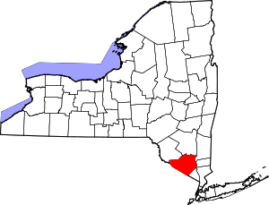 | |
| Towns | ||
| Villages | ||
| CDPs | ||
| Other hamlets | ||