Fort Hoskins
| Fort Hoskins | |
|---|---|
| Benton County, Oregon | |
|
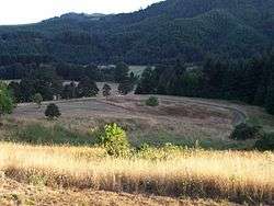
Grounds of the former Fort Hoskins | |
| Type | Military base |
| Site information | |
| Controlled by | United States Army |
| Site history | |
| Materials | Wood |
| Events | |
|
Fort Hoskins Site | |
  | |
| Nearest city | Kings Valley, Oregon |
| Built | 1856 |
| NRHP Reference # | 74001672[1] |
| Added to NRHP | May 1, 1974 |
| Garrison information | |
| Garrison | 4th Regiment of California Infantry |
| Occupants | 2nd Lt.Philip Sheridan, Capt.Christopher C. Augur |
Fort Hoskins was one of three "forts" (which were actually unfortified posts) built by the U.S. Army to monitor the Coastal Indian Reservation in Oregon in the mid- 19th century. The Fort Hoskins Site is listed on the National Register of Historic Places.
History
The post was begun in 1856 on the Luckiamute River under the supervision of then Captain Christopher C. Augur.[2] Fort Hoskins was finished in 1857 with then-lieutenant Philip Sheridan in charge, and was named after Lt. Charles Hoskins, who had died in the Mexican–American War.[2] The fort was located about 19 miles northwest of Corvallis. The community of Hoskins took its name from the fort.
Fort Hoskins was garrisoned by a number of companies of soldiers throughout its short existence, and future Union Civil War Generals Christopher Columbus Augur and Phil Sheridan were stationed there. Captain Augur was assigned to Fort Hoskins as its first post commander from 25 July 1856 to 2 July 1861 and added to the records of life at the fort where he and his growing family became the first occupants of their newly constructed residence on Fort Hoskin's "Officer's Row." 2nd Lt. Phil Sheridan oversaw the construction of Fort Hoskins during this period. Two soldiers who were stationed at the fort during the American Civil War kept journals of their experiences: Royal A. Bensell and William M. Hilleary. Their accounts are of unmitigated boredom and dampness, but they provide a good picture of 19th-century life in the area.
Fort Hoskins played an indirectly important role in local and state history because of the leadership of several out-of-state soldiers who decided to stay in the area after they were mustered out of the army. Several placenames in the area, such as Kings Valley, are connected with these soldiers. The fort never saw any action, though a bloodless insurrection by the natives at Yaquina Bay was put down by the soldiers.[2] After the Civil War ended it was discovered that Fort Hoskins had been an outpost of interest to the former Confederate government. Fort Hoskins was abandoned in 1865.[2]
Archeological site
The site of the fort was listed on the National Register of Historic Places in 1974.[1]
There is nothing left of the fort today except for a few recovered artifacts. Benton County has opened the site as Fort Hoskins Historical Park.[3]
See also
Further reading
- Bensell, Royal A.; Barth, Gunther (ed.) (1959) All Quiet on the Yamhill: The Civil War in Oregon: The Journal of Corporal Royal A. Bensell, Company D, Fourth California Infantry.
- Brauner, David R.; Stricker, Nahani A. (2006) Fort Hoskins Illustrated: An Archaeologist Reflects.
- Hilleary, William M.; Nelson, Herbert B. and Preston, E. Onstad (ed.) (1965) A Webfoot Volunteer: The Diary of William M. Hilleary 1864-1866.
References
- 1 2 National Park Service (2008-04-15). "National Register Information System". National Register of Historic Places. National Park Service.
- 1 2 3 4 Corning, Howard M. Dictionary of Oregon History. Binfords & Mort Publishing, 1956.
- ↑ Benton County: Fort Hoskins Historical Park
External links
- Fort Hoskins Historical Park
- Sovereigns of Themselves: A Liberating History of Oregon and Its Coast, Vol. VII, a self-published history
Coordinates: 44°40′26″N 123°27′36″W / 44.674°N 123.460°W