Fort George, Bombay
| Fort George | |
|---|---|
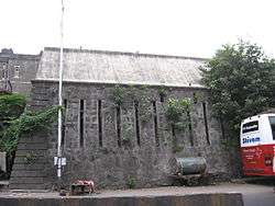 Remains of the fort wall near St. George Hospital | |
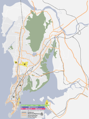 Location within Mumbai | |
| General information | |
| Type | Fort |
| Location | Fort, Mumbai |
| Coordinates | 18°56′27″N 72°50′15″E / 18.94090°N 72.83759°E |
| Elevation | 13 m (43 ft) |
| Current tenants | St George Hospital |
| Completed | 1769 |
| Destroyed | 1862 |
| Client | British |
Fort George was an extension to the fortified walls of Bombay (now Mumbai) built in 1769; it was situated in the present Fort area, to the east on the site of the former Dongri Fort. The hill on which the Dongri fort stood was razed, and in its place Fort George was built. In 1862, the fort was demolished.
History

Plan of Bombay fort
The fort was 1 mile (1.6 km) long and about a third of a mile in breadth (500 m). Its length was from NNE to SSW, and it was named in honour of George III of the United Kingdom.
See also
References
- "Fortifying colonial legacy". Indian Express Newspapers (Bombay) Ltd. 1997-06-15. Retrieved 2008-11-10.
- 18th Century History of Mumbai
- Fort+George,+Bombay A Handbook for India: Being an Account of the Three Presidencies and of the Overland Route
This article is issued from Wikipedia - version of the 11/21/2016. The text is available under the Creative Commons Attribution/Share Alike but additional terms may apply for the media files.