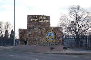
Fort Carson
| Fort Carson | |
|---|---|
| El Paso / Pueblo / Fremont counties, outside of Colorado Springs, Colorado | |
|
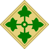
Shoulder sleeve insignia of units stationed at Fort Carson | |
| Type | Army post |
| Site information | |
| Controlled by | United States |
| Site history | |
| Built | January 31, 1942 |
| In use | 1942–present |
| Garrison information | |
| Garrison |
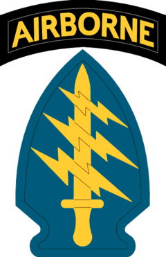
4th Infantry Division 10th Special Forces Group |
_small.jpg)


Fort Carson is a United States Army installation located near Colorado Springs, primarily in El Paso County, Colorado.
The 137,000-acre (550 km2) installation extends southward into Pueblo and Fremont counties. That part of the installation located within El Paso County forms a census-designated place (CDP) which had a population of 13,815 in the 2010 census.[1]
Fort Carson is the home of the 4th Infantry Division, the 10th Special Forces Group, the 440th Civil Affairs Battalion (USAR), the 71st Ordnance Group (EOD), the 4th Engineer Battalion, the 759th Military Police Battalion, the 10th Combat Support Hospital, the 43rd Sustainment Brigade, the Army Field Support Battalion-Fort Carson, the 423rd Transportation Company (USAR) and the 13th Air Support Operations Squadron of the United States Air Force. The post also hosts units of the Army Reserve, Navy Reserve and the Colorado Army National Guard. Ft. Carson was also home to the 5th Infantry Div. Known as the Red Devils. Camp Carson was established in 1942, following Japan's attack on Pearl Harbor. The city of Colorado Springs, Colorado purchased land south of the city and donated it to the War Department. Construction began immediately and the first building, the camp headquarters, was completed January 31, 1942. Camp Carson was named in honor of the legendary Army scout, General Christopher "Kit" Carson, who explored much of the West in the 1800s.

At the construction's peak, nearly 11,500 workers were employed on various construction projects at the new camp. Facilities were provided for 35,173 enlisted men, 1,818 officers and 592 nurses. Nearly all of the buildings were of mobilization type construction, with wood sided exteriors. The hospital complex was constructed of concrete block, and considered to be semi-permanent, and had space for 1,726 beds, expandable to 2,000 beds. The 89th Infantry Division was the first major unit to be activated at Camp Carson. During World War II, over 100,000 soldiers trained at Camp Carson. Along with three other infantry divisions – the 71st Infantry Division, 104th Infantry Division and 10th Mountain Division – more than 125 units were activated at Camp Carson and more than 100 others were transferred to the mountain post from other installations.
Nurses, cooks, mule packers, tank battalions, a Greek infantry battalion, and an Italian ordnance company trained at Camp Carson during the war years. Camp Carson was also home to nearly 9,000 Axis prisoners of war – mostly Italians and Germans. The internment camp at Camp Carson opened on the first day of 1943. These POWs alleviated the manpower shortage in Colorado by doing general farm work, canning tomatoes, cutting corn, and aiding in logging operations on Colorado's Western Slope.
Between 1942 and 1956, pack mules were a common sight at Camp Carson. The first shipment arrived by train from Nebraska in July 1942. The mules were used by Field Artillery (Pack) battalions to carry equipment, weapons and supplies over mountainous terrain. The most famous of these animals was Hambone, the pride of the 4th Field Artillery Battalion. For 13 years, he carried first sergeants up Ute Pass to Camp Hale. Camp Hale, located near Leadville, Colorado, was where the Army conducted cold weather and mountain warfare training. Hambone died in March 1971 and was buried with full military honors.
By April 1946, the post-war military strength at the camp was around 600[2] and on 16 December 1949, Strategic Air Command opened a survival school at Camp Carson for training in mountainous terrain (moved to Stead AFB in 1952.)[3]
History
Fort Carson was designated from Camp Carson in 1954 and in the 1960s, mechanized units were assigned to the fort and it was expanded to the present 137,000 acres (55,000 ha). Butts Army Air Field at the fort was constructed between 1963 and 1966 with a 4,573-foot (1,394 m) runway for light fixed-wing aircraft (cf. USAF C-130s at the nearby Peterson AFB.)[4][5]
Throughout its history Fort Carson has been home to nine divisions. An additional training area, comprising 235,000 acres (959 km²), was purchased in September 1983. Named the Piñon Canyon Maneuver Site, this training area is located approximately 150 miles (240 km) road miles to the southeast, and is used for large force-on-force maneuver training. Comprehensive maneuver and live fire training also occurs downrange at Fort Carson.
Exercises and deployments continually hone the skills of Fort Carson soldiers. When not deployed, soldiers train annually at Piñon Canyon Maneuver Site and the National Training Center near Barstow, California. Additionally, units participate in joint exercises around the world, including Central and South Africa, Europe, and Southwest Asia. In 2003, most Fort Carson units were deployed in support of Operations Enduring Freedom and Iraqi Freedom. Troops from the 984th Military Police CO, 759th Military Police BN were also sent in support of the guard mission at Guantanamo Bay Naval Base, Cuba. President George W. Bush addressed soldiers and family members at the post on November 24, 2003, in praise of the soldiers' determination and the sacrifices their families have made.
Fort Carson's beautiful scenery has made it one of the most requested duty stations in the U.S. Army. It is considered the second most popular CONUS duty station, after Fort Lewis, Washington, and adopted "Best Hometown in the Army" as its motto in 2007.
Construction in 2007 and 2008 preceded the return of the 4th Infantry Division (4ID) from Fort Hood after their 2008 Operation Iraqi Freedom deployment (~5,000 additional soldiers).
Location

Fort Carson is located at 38°44'45" North, 104°47'6" West (38.745744, −104.784907).[6] It is located in Pueblo County, El Paso County, and Fremont County.
According to the United States Census Bureau, the CDP has a total area of 8.7 square miles (22.6 km2), all land.[7]
Demographics
As of the census[8] of 2000, there were 10,566 people, 1,679 households, and 1,620 families residing in the CDP (the number increased to 13,183 by 2010[9]). The population density was 1,126.8 people per square mile (434.9/km²). There were 2,664 housing units at an average density of 196.8 per square mile (75.9/km²). The racial makeup of the CDP was 62.8% White, 20.0% African American, 2.1% Asian, 1.7% Native American, 0.8% Pacific Islander, 7.9% from other races, and 3.8% from two or more races. Hispanic or Latino of any race were 15.4% of the population.
There were 1,679 households out of which 84.9% had children under the age of 18 living with them, 85.4% were married couples living together, 9.7% had a female householder with no husband present, and 3.5% were non-families. 3.2% of all households were made up of individuals, none of whom were 65 years of age or older. The average household size was 3.70 and the average family size was 3.74.
In the CDP the population was spread out with 27.5% under the age of 18, 37.1% from 18 to 24, 34.2% from 25 to 44, 1.2% from 45 to 64, and 0.1% who were 65 years of age or older. The median age was 22 years. For every 100 females there were 195.0 males. For every 100 females age 18 and over, there were 251.7 males.
The median income for a household in the CDP was $34,883, and the median income for a family was $34,385. Males had a median income of $19,865 versus $17,582 for females. The per capita income for the CDP was $12,772. About 7.8% of families and 9.4% of the population were below the poverty line, including 12.1% of those under the age of 18 and none of those 65 and older.
Controversy
On February 14, 2007, the U.S. Army announced it was moving forward with a plan to expand the Piñon Canyon Maneuver Site in southeastern Colorado.[10] If expanded, Piñon Canyon would be the Army's largest single training area in the nation, tripling the size of the current site by adding 418,000 acres (1,690 km2) of private ranch land.[11] At 650,000 acres (2630 km²), it would be nearly the size of the state of Rhode Island.
Many in the local civilian population are opposed to this plan, because much of the land in rural areas that would be added to the training site is civilian-owned ranch land, and many current landowners are unwilling to be supplanted, regardless of the compensation that may be offered. The Pinon Canyon Expansion Opposition Coalition, an activist group opposing the plans, says that former maps it obtained from the Army showed a "future expansion area" significantly greater than is now being contemplated. The Army's position is that expansion is essential for preparing soldiers for battle in evergrowing theaters such as Afghanistan and the Middle East.
In response to a Congressional ban on Army funding for an expansion plan, the United States Air Force moved in with a plan to use the area for V-22 Osprey flights.[12]
Notable former Fort Carson soldiers
- Andrew Maynard, Gold medalist boxer (1988 Summer Olympics)
Dean Byrne
- Bernard W. Rogers, Chief of Staff of the Army, and later NATO's Supreme Allied Commander, Europe and Commander in Chief, US European Command
- Boyd Melson, boxer
- Colin Powell, Chairman of the Joint Chiefs of Staff and U.S. Secretary of State
- Dennis Reimer, Chief of Staff of US Army
- Wesley Clark, Supreme Allied Commander Europe
- Lionel Rivera, mayor of Colorado Springs
- John William Vessey, Jr., Chairman of the Joint Chiefs of Staff
- Martin Dempsey, Chairman of the Joint Chiefs of Staff
- Richard Otto, wildlife & landscape photographer
- John William Vessey, Jr., He was an United States Army general, and also served as the tenth Chairman of the Joint Chiefs of Staff from June 18, 1982, to September 30, 1985.
See also
- Outline of Colorado
- State of Colorado
- John E. Butts – Medal of Honor recipient for whom the Fort Carson airfield is named
References
- ↑ "Profile of General Population and Housing Characteristics: 2010 Demographic Profile Data (DP-1): Fort Carson CDP, Colorado". U.S. Census Bureau, American Factfinder. Retrieved April 11, 2012.
- ↑ "History". www.carson.army.mil. Retrieved 2016-02-18.
- ↑ Air Education and Training Command history, p. 146
- ↑ "Butts Aaf (Fort Carson) Airport(Fcs) | Fort Carson Airports". PilotOutlook. Retrieved 2013-09-04.
- ↑ John Pike. "Butts Army Air Field (AAF)". Globalsecurity.org. Retrieved 2013-09-04.
- ↑ "US Gazetteer files: 2010, 2000, and 1990". United States Census Bureau. 2011-02-12. Retrieved 2011-04-23.
- ↑ "Geographic Identifiers: 2010 Demographic Profile Data (G001): Fort Carson CDP, Colorado". U.S. Census Bureau, American Factfinder. Retrieved April 11, 2012.
- ↑ "American FactFinder". United States Census Bureau. Retrieved 2008-01-31.
- ↑ Colorado Trend Report 2: State and Complete Places (Sub-state 2010 Census Data). Missouri Census Data Center. Accessed 2011-02-25.
- ↑ McPhee, Mike. "Ft. Carson expansion OK'd". Denver Post.
- ↑ "Army site expansion angers ranchers", MSNBC. Nov 4, 2007
- ↑ Roper, Peter. "Air Force the new Pinon Canyon foe." The Pueblo Chieftain, November 15, 2010
External links
- Fort Carson official website
- Current Fort Carson "Mountaineer"
- Fort Carson Post History
- Fountain-Fort Carson High School
- 1943 Letters from Fort Carson" from two soldiers to Marget Krumpleman. Includes micro news from the camp, including platoon numbers, postings, equipment supplies" See 18185960
Coordinates: 38°33′20″N 104°50′33″W / 38.55556°N 104.84250°W
Municipalities and communities of El Paso County, Colorado, United States | ||
|---|---|---|
| Cities | 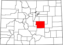 | |
| Towns | ||
| CDPs | ||
| Unincorporated communities | ||
| Footnotes | ‡This populated place also has portions in an adjacent county or counties | |
Current military installations of Colorado | ||||||||
|---|---|---|---|---|---|---|---|---|
| Army |
|  | ||||||
| Air Force |
| |||||||