Foligno Airport
| Foligno Airport Aeroporto di Foligno "Giorgio Franceschi" | |||||||||||||||
|---|---|---|---|---|---|---|---|---|---|---|---|---|---|---|---|
 | |||||||||||||||
| IATA: none – ICAO: LIAF | |||||||||||||||
| Summary | |||||||||||||||
| Airport type | Public | ||||||||||||||
| Operator | ENAC | ||||||||||||||
| Serves | Foligno, Umbria, Italy | ||||||||||||||
| Elevation AMSL | 222 m / 728 ft | ||||||||||||||
| Coordinates | 42°55′58″N 012°42′36″E / 42.93278°N 12.71000°ECoordinates: 42°55′58″N 012°42′36″E / 42.93278°N 12.71000°E | ||||||||||||||
| Map | |||||||||||||||
 LIAF Location of the airport in Italy | |||||||||||||||
| Runways | |||||||||||||||
| |||||||||||||||
|
Sources: GCM,[1] | |||||||||||||||
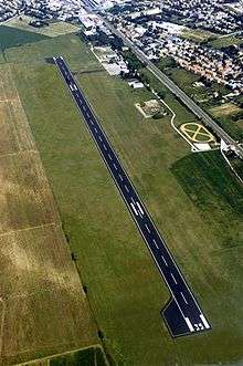
Foligno Airport (ICAO: LIAF) is an airport serving the Italian city of Foligno in the Umbria region. It is used for general aviation, school, business jet aviation, charter aviation and cargo. It will be used as national base of Civil defense aviation.
Radio assistance available at 119.55 MHz.[2]
References
- ↑ Airport information for LIAF at Great Circle Mapper.
- ↑ AIP - Italia
This article is issued from Wikipedia - version of the 12/4/2016. The text is available under the Creative Commons Attribution/Share Alike but additional terms may apply for the media files.