Florø
| Florø ladestad | |
|---|---|
| Former Municipality | |
| Municipality ID | NO-1401 |
| Adm. Center | Florø |
| Created from | Kinn in 1860 |
| Merged into | Flora in 1964 |
| Florø Flora | |
|---|---|
| Town | |
|
View of the town | |
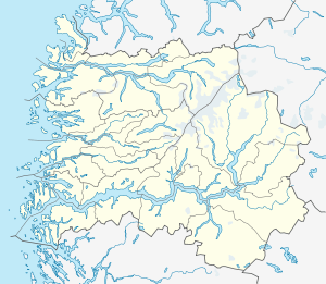 Florø Location in Sogn og Fjordane county | |
| Coordinates: 61°35′58″N 05°01′58″E / 61.59944°N 5.03278°ECoordinates: 61°35′58″N 05°01′58″E / 61.59944°N 5.03278°E | |
| Country | Norway |
| Region | Western Norway |
| County | Sogn og Fjordane |
| District | Sunnfjord |
| Municipality | Flora |
| Granted City Status | 1860 |
| Town Districts |
List
|
| Area[1] | |
| • Total | 6.05 km2 (2.34 sq mi) |
| Elevation[2] | 5 m (16 ft) |
| Population (2013)[1] | |
| • Total | 8,677 |
| • Density | 1,434/km2 (3,710/sq mi) |
| Time zone | CET (UTC+01:00) |
| • Summer (DST) | CEST (UTC+02:00) |
| Post Code | 6900 Florø |

![]() Florø is a town and the administrative centre of Flora Municipality in Sogn og Fjordane county, Norway. The town was founded by royal decree in 1860 as a ladested (port of lading) on the island of Florelandet, located between the Botnafjorden and Solheimsfjorden. Florø is Norway's (and thus the Scandinavian Peninsula's) westernmost town—west of Amsterdam, Brussels, and Nice. It is the most western town on the mainland in the Nordic countries.
Florø is a town and the administrative centre of Flora Municipality in Sogn og Fjordane county, Norway. The town was founded by royal decree in 1860 as a ladested (port of lading) on the island of Florelandet, located between the Botnafjorden and Solheimsfjorden. Florø is Norway's (and thus the Scandinavian Peninsula's) westernmost town—west of Amsterdam, Brussels, and Nice. It is the most western town on the mainland in the Nordic countries.
The 6.05-square-kilometre (1,490-acre) village has a population (2013) of 8,677; giving the village a population density of 1,434 inhabitants per square kilometre (3,710/sq mi).[1] The town encompasses the entire island of Florelandet and the western half of the island of Brandsøya. The Norwegian National Road 5 highway is the main road connecting Florø to the rest of Norway. The nearby villages of Brandsøy and Grov lie several kilometers to the east of Florø. The islands of Reksta, Kinn, Skorpa lie several kilometers to the west of the town. Florø is also home to Florø Airport and Florø Church.
Florø is also a former municipality that existed as an independent town-municipality for just over 100 years before being merged into the municipality of Flora.
Name
The municipality is named after the farm Flora (Old Norse Flóðra) since the town of Florø was built on its ground in 1860. The name is probably derived from flóð which means "(strong) stream". The name of the town and former municipality of Florø has the same name, but instead of ending with an "a", it has the Danish word ø meaning "island" added to the end since the town is located on an island.[3]
History
Florø was founded as a town (ladested) in 1860. Shortly after its founding, on 3 January 1861, it was removed from the municipality of Kinn and made into a municipality of its own with a population of 846. On 1 January 1964, the city of Florø was merged with the municipalities of Kinn and Eikefjord and parts of the municipalities of Bru, Vevring, and Bremanger in order to form the new municipality of Flora.[4]
Economy
The basis for the foundation of the town was the rich herring fisheries, symbolised by the three herrings in the municipality's coat of arms. Fishing is still an important part of the economy, in addition to shipbuilding and service industries. After the discovery of petroleum in the North Sea in the 1960s, Florø has been used as a supply base for the petroleum industry.
References
- 1 2 3 Statistisk sentralbyrå (1 January 2013). "Urban settlements. Population and area, by municipality.".
- ↑ "Flora" (in Norwegian). yr.no. Retrieved 2013-11-07.
- ↑ Rygh, Oluf (1919). Norske gaardnavne: Nordre Bergenhus amt (in Norwegian) (12 ed.). Kristiania, Norge: W. C. Fabritius & sønners bogtrikkeri. p. 357.
- ↑ Jukvam, Dag (1999). "Historisk oversikt over endringer i kommune- og fylkesinndelingen" (PDF) (in Norwegian). Statistisk sentralbyrå.
External links
 Florø travel guide from Wikivoyage