Flatlands Avenue
Flatlands Avenue is a major street in the New York City borough of Brooklyn. It runs approximately 5 miles (8.0 km) east-west, from Avenue N and East 35th Street in Flatlands in the west to Forbell Street, east of Fountain Avenue in East New York, near the Brooklyn-Queens border. The right-of-way continues in Lindenwood and Howard Beach, Queens as 156th Avenue, separated by the remnants of Spring Creek. The portion of Flatlands Avenue east of Louisiana Avenue in East New York was previously mapped as Fairfield Avenue.[1][2]
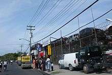
The avenue runs a diagonal path and intersects with several other major streets in Brooklyn, including Flatbush Avenue, Utica Avenue, Ralph Avenue, Rockaway Parkway, and Pennsylvania Avenue. For the most part, the avenue has four lanes, and there is a central median east of Ralph Avenue through Canarsie and East New York.
Route description
Flatlands Avenue's western end is at an intersection with East 35th Street in Marine Park, forming a small triangle with Avenue N. After about seven blocks, it intersects with Flatbush Avenue, one block south of Kings Highway, and crosses into the neighborhood of Flatlands. At about Ralph Avenue where the street crosses into Canarsie, the avenue is adjacent to the north end of the Paerdegat Basin. Crossing into Spring Creek and Starrett City between East 108th Street and Louisianan Avenue, Flatlands Avenue marks the northern ends of Fresh Creek and Hendrix Creek. East of Fountain Avenue, the continuous Flatlands Avenue ends at an entrance to the large Brooklyn Postal Facility. One block east, Flatlands Avenue forms the southern boundary of a small two-block community between Grant Avenue, Cozine Avenue, and Forbell Street. This portion of the avenue is only accessible from Forbell Street.[3][4]
Points of interest
Notable points of interest include:
- Christian Cultural Center, at Louisiana Avenue in Starrett City.
- Spring Creek Depot, operated by the MTA Bus Company, at Crescent Street in Spring Creek.
- United States Postal Service Brooklyn Processing and Distribution Center, also known as the Brooklyn P&DC or simply the Postal Facility, adjacent to the bus depot.[5]
Education
South Shore Educational Campus (formerly South Shore High School) is located on this avenue at its intersection with Ralph Avenue in Canarsie. Canarsie Educational Campus (formerly Canarsie High School) is located at Rockaway Parkway one block south of Flatlands Avenue. Spring Creek Educational Campus is located on the south side of the street between Elton Street and Linwood Street.[6][7]
Transportation
Flatlands Avenue is served by the B82 bus line, which runs on the street from Pennsylvania Avenue in Starrett City to Flatbush Avenue in Flatlands, after which it runs on Kings Highway.[3] A short portion of the street in Spring Creek between Jerome Street and Fountain Avenue is served by the B84.[3]
No New York City Subway lines directly serve Flatlands Avenue. The BMT Canarsie Line, currently served by L train, formerly had a surface station at Flatlands Avenue which was closed around 1920 and replaced by trolley service (now the B42 bus). The line's current terminal at Rockaway Parkway and Glenwood Road in Canarsie is two blocks north of Flatlands Avenue. In 1968, plans were made to extend the IRT New Lots Line (2 3 4 5 trains) from its current terminal at New Lots Avenue and Livonia Avenue south to Flatlands Avenue in Spring Creek at around Elton Street. The plans were never realized due to lack of funding, though there is talk of reviving the proposal.[8][9]
References
- ↑ "PUSHES PORT PLANS FOR JAMAICA BAY; Board of Estimate Committee Approves Buying Land for the Paerdegat Basin Railroad. FAVORS DREDGING PROJECT It Also Recommends Extension of Tracks of Long Island Road to Canarsie and Barren Island.". The New York Times. October 22, 1930. Retrieved 18 November 2015.
- ↑ "1943 Profile of the Spring Creek Basin, Brooklyn area from the 1943 New York City Market Analysis" (PDF). 1940snewyork.com. Center for Urban Research at the CUNY Graduate Center, The New York Times, New York Daily Mirror, Hearst Corporation. Retrieved 18 November 2015.
- 1 2 3 "Brooklyn Bus Map: July 2015" (PDF). Metropolitan Transportation Authority. July 2015. Archived (PDF) from the original on November 19, 2015. Retrieved November 19, 2015.
- ↑ "NYC Department of Sanitation (Spring Creek Yard Waste Composting Facility) – Decision, July 2, 2012". ny.gov. New York State Department of Environmental Conservation. July 2, 2012. Retrieved November 18, 2015.
- ↑ "Brooklyn P&DC, Brooklyn, NY Area Mail Processing (AMP) Public Meeting: November 28, 2011" (PDF). United States Postal Service. November 28, 2011. Retrieved November 18, 2015.
- ↑ Leimbach, Dulcie (February 1, 2004). "If You're Thinking of Living In/Flatlands; Diverse, Well-Groomed Residential Area". The New York Times. Retrieved 23 November 2015.
- ↑ "2016 New York City High School Directory" (PDF). schools.nyc.gov. New York City Department of Education. 2015. Retrieved June 4, 2015.
- ↑ "Full text of "Metropolitan transportation, a program for action. Report to Nelson A. Rockefeller, Governor of New York."". Internet Archive. November 7, 1967. Retrieved October 1, 2015.
- ↑ Joseph B. Raskin (November 1, 2013). The Routes Not Taken: A Trip Through New York City's Unbuilt Subway System. Fordham University Press. ISBN 978-0-8232-5369-2. Retrieved August 12, 2015.