Fishkill, New York
| Fishkill, New York | ||
|---|---|---|
| Village | ||
|
Village entrance on Main Street, with the First Reformed Church to the right | ||
| ||
 Location of Fishkill, New York | ||
| Coordinates: 41°32′3″N 73°53′57″W / 41.53417°N 73.89917°W | ||
| Country | United States | |
| State | New York | |
| County | Dutchess | |
| Town | Fishkill | |
| Area | ||
| • Total | 0.83 sq mi (2.14 km2) | |
| • Land | 0.82 sq mi (2.12 km2) | |
| • Water | 0.004 sq mi (0.01 km2) | |
| Elevation | 220 ft (67 m) | |
| Population (2010) | ||
| • Total | 2,171 | |
| • Density | 2,646/sq mi (1,021.7/km2) | |
| Time zone | Eastern (EST) (UTC-5) | |
| • Summer (DST) | EDT (UTC-4) | |
| ZIP code | 12524 | |
| Area code(s) | 845 | |
| FIPS code | 36-25967 | |
| GNIS feature ID | 0977519 | |
| Website |
vofishkill | |


Fishkill is a village within the town of Fishkill in Dutchess County, New York, United States. The village population was 2,171 at the 2010 census.[1] It is part of the Poughkeepsie–Newburgh–Middletown, NY Metropolitan Statistical Area as well as the larger New York–Newark–Bridgeport, NY-NJ-CT-PA Combined Statistical Area.
The village is in the eastern part of the town of Fishkill on U.S. Route 9. It is north of Interstate 84. NY 52 is the main street.
History
Fishkill is located in the former territory of the Wappinger people. It was part of the Rombout Patent granted to Francis Rombouts, Gulian VerPlanck, and Stephanus Van Cortlandt of New Amsterdam in 1685. The name "Fishkill" evolved from two Dutch words, vis (fish) and kil (stream or creek).[2] In 1714, Dutch immigrants settled in the area. The village of Fishkill was a significant crossroads in the overland transportation network in the 18th and 19th centuries. The Kings Highway, connecting Albany to New York City, intersected with a major overland route from New England to the Hudson River.[3] Among the first to occupy the land now within the village limits were Johannes Ter Boss and Henry Rosecrance.[4]
By 1716 the settlers wanted their own Dutch Reformed church so they would not have to cross the river to Kingston or New Paltz to worship. A congregation was established and the church building was finished in 1731. The first Dominie (minister) who arrived from the Netherlands in 1731 served churches in Poughkeepsie and Fishkill. The church was used as a military prison during the American Revolution. The fourth New York Provincial Congress met in the church in 1776, making Fishkill the state capital, until the Congress moved to Kingston in 1777.[5]
Fishkill became part of one of the largest colonial military encampments during the Revolutionary War. General Washington's aide-de-camp Alexander Hamilton took residence here. The Trinity Church, on Hopewell Avenue in the village, was organized in 1756 and the structure built in 1760. It was used as a hospital during the Revolutionary War.[3]
In 1871, construction began for a schoolhouse on Church Street. The site used for the schoolhouse belonged to the Fishkill Reformed Church and was formerly used as pasture land for the pastor's cow.[6]
Geography
According to the United States Census Bureau, the village has a total area of 0.89 square miles (2.3 km2), all of it land.[1]
U.S. Route 9 leads north 5 miles (8 km) to Wappingers Falls, north 12 miles (19 km) to Poughkeepsie, and south 19 miles (31 km) to Peekskill. New York State Route 52 leads west 5 miles (8 km) to Beacon and east 7 miles (11 km) to the Taconic State Parkway in East Fishkill. Interstate 84 passes 1 mile (1.6 km) south of the village, with access from Exit 12 (NY 52 southwest of the village) and Exit 13 (US 9 south of the village). Via I-84 it is 7 miles (11 km) west to Newburgh across the Hudson and 31 miles (50 km) southeast to Danbury, Connecticut. New York City is 70 miles (110 km) to the south via the Taconic Parkway or New York State Thruway.
Demographics
| Historical population | |||
|---|---|---|---|
| Census | Pop. | %± | |
| 1870 | 737 | — | |
| 1880 | 682 | −7.5% | |
| 1890 | 745 | 9.2% | |
| 1900 | 589 | −20.9% | |
| 1910 | 516 | −12.4% | |
| 1920 | 479 | −7.2% | |
| 1930 | 553 | 15.4% | |
| 1940 | 720 | 30.2% | |
| 1950 | 841 | 16.8% | |
| 1960 | 1,033 | 22.8% | |
| 1970 | 913 | −11.6% | |
| 1980 | 1,555 | 70.3% | |
| 1990 | 1,957 | 25.9% | |
| 2000 | 1,735 | −11.3% | |
| 2010 | 2,171 | 25.1% | |
| Est. 2015 | 2,133 | [7] | −1.8% |
As of the census of 2000, there were 1,735 people, 965 households, and 400 families residing in the village. The population density was 1,978.8 people per square mile (761.2/km²). There were 1,011 housing units at an average density of 443.6 /km² (1,153.0 /sq mi). The racial makeup of the village was 93.72% White, 2.77% African American, 0.17% Native American, 1.15% Asian, 0.06% Pacific Islander, 1.27% from other races, and 0.86% from two or more races. 6.05% of the population were Hispanic or Latino of any race. 22.9% were of Italian, 20.2% Irish, 11.2% German, 7.3% American and 5.4% English ancestry according to Census 2000.
There were 965 households out of which 14.1% had children under the age of 18 living with them, 32.2% were married couples living together, 6.9% have a woman whose husband does not live with her, and 58.5% were non-families. 53.9% of all households were made up of individuals and 32.8% had someone living alone who was 65 years of age or older. The average household size was 1.80 and the average family size was 2.74.
In the village the population was spread out with 14.1% under the age of 18, 4.9% from 18 to 24, 26.9% from 25 to 44, 23.5% from 45 to 64, and 30.5% who were 65 years of age or older. The median age was 48 years. For every 100 females there were 74.5 males. For every 100 females age 18 and over, there were 71.3 males.
The median income for a household in the village was $36,344, and the median income for a family was $59,737. Males had a median income of $48,750 versus $31,898 for females. The per capita income for the village was $26,504. 8.4% of the population and 4.5% of families were below the poverty line. Out of the total people living in poverty, 8.8% are under the age of 18 and 8.9% are 65 or older.


Transportation
Fishkill is served by the bus routes "A", "B", and "F", operated by Dutchess LOOP.[9][10]
Other
Fishkill is the site of Camp Mariah, a camp that enables inner-city youth to embrace the arts, and introduces them to career opportunities. The camp is named after co-founder musician Mariah Carey.
In 1996, the animal rights group PETA suggested the town (and, presumably, the village as well) change its name to something less suggestive of violence toward fish.[11] The town declined this change because the name is not meant to suggest violence but instead comes from the Dutch who originally settled the land in which "kill" means "creek". Various other communities also contain the word "Kill" with various prefixes, and a creek in the Catskills called Beaver Kill is a tributary of the Delaware River. Both "Catskill" and "Beaver Kill" could be considered to promote animal violence when their names are improperly understood. This led then-mayor George Carter to joke that if Fishkill is renamed, the Catskills should also be renamed, presumably to the Catsave Mountains.
The Largest Employer in The Area Is Gap Clothing In 2000 the facility opened; in 2001 it expanded. In 2014 the company announced plans to add 1,200 jobs over a 5-year period and invest $96 million into the distribution center.However on 29 August 2016, a massive fire at the Gap distribution center[12] left hundreds of people out of work. 600 employees were safely evacuated from the facility on Merritt Boulevard just before 11 p.m., when the fire appeared to have started on the second floor and quickly spread.
References
- 1 2 "Geographic Identifiers: 2010 Demographic Profile Data (G001): Fishkill village, New York". U.S. Census Bureau, American Factfinder. Retrieved November 16, 2015.
- ↑ Hooper Shelton. "Fisher County". Texas State Historical Association. Retrieved 2012-05-24.
- 1 2 Village of Fishkill, A Brief History
- ↑ WPA, Dutchess County, American Guide Series, William Penn Association of Philadelphia, 1937
- ↑ Fishkill Reformed Church, Our History
- ↑ Fishkill Elementary School
- ↑ "Annual Estimates of the Resident Population for Incorporated Places: April 1, 2010 to July 1, 2015". Retrieved July 2, 2016.
- ↑ "Census of Population and Housing". Census.gov. Archived from the original on May 11, 2015. Retrieved June 4, 2015.
- ↑ http://www.co.dutchess.ny.us/CountyGov/Departments/MassTransit/19226.htm
- ↑ http://www.dutchessny.gov/loopbus/
- ↑ "A fishy name will stay the same". CNN. 1996-09-06. Retrieved 2011-07-07.
- ↑ http://newyork.cbslocal.com/2016/08/30/fishkill-gap-distribution-center-fire/
External links
| Wikimedia Commons has media related to Fishkill, New York. |
| Wikivoyage has a travel guide for Fishkill. |
- Village of Fishkill official website
- Blodgett Memorial Library (Fishkill)
- Fishkill Creek Watershed Committee
- Fishkill Fire Department
Coordinates: 41°32′08″N 73°53′56″W / 41.53556°N 73.89889°W
Municipalities and communities of Dutchess County, New York, United States | ||
|---|---|---|
| Cities | 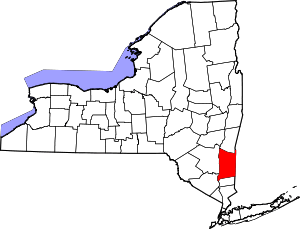 | |
| Towns | ||
| Villages | ||
| CDPs | ||
| Other hamlets | ||
| Footnotes | ‡This populated place also has portions in an adjacent county or counties | |