Finisterre Range
| Finisterre Range | |
|---|---|
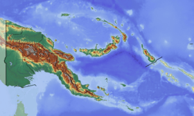 Finisterre Range Location in Papua New Guinea | |
| Highest point | |
| Elevation | 4,150 m (13,620 ft) [1] |
| Prominence |
3,709 m (12,169 ft) [2] Ranked 41st |
| Isolation | 150 kilometres (93 mi) |
| Listing | Ultra |
| Coordinates | 05°57′15″S 146°22′30″E / 5.95417°S 146.37500°ECoordinates: 05°57′15″S 146°22′30″E / 5.95417°S 146.37500°E |
| Geography | |
| Location | Papua New Guinea |
| Climbing | |
| First ascent | 25 June 2014 |
| Easiest route | YDS class 3 |
Finisterre Range is a mountain range in north-eastern Papua New Guinea, at 5°48′S 146°06′E / 5.8°S 146.1°E. The highest point 5°57′15″S 146°22′30″E / 5.95417°S 146.37500°E, which is ranked 41st in the world by prominence, has an elevation of 4,150 m.[1] Although the range's highpoint is not named on official maps, the name "Mount Boising" is used locally.[1] This peak was possibly the most prominent unclimbed peak in the world until the first known ascent on 25 June 2014.[3][4]
The range runs into the Saruwaged Range to the east and together they form a natural barrier between the Ramu and Markham valleys to the south and Vitiaz Strait to the north. Many rivers originate in this range, including some tributaries of the Ramu.
The Finisterre Range campaign (1943–1944) of World War II, including a series of actions known as Battle of Shaggy Ridge, saw fierce fighting between Australian and Japanese forces.
See also
References
- 1 2 3 Bjørstad, Petter. "Mount Boising". Retrieved 2014-08-03.
- ↑ "Papua New Guinea Ultra-Prominence PAge". peaklist.org.
- ↑ Bjørstad, Petter. "Mount Boising". Retrieved 14 July 2014.
The summit area consists of a pretty sharp (short) ridge with considerable drops. We built cairns at each end. [...] The first ascent was made on June 25th at 1410 (local time) by a party of 5
- ↑ Kvamme, Lars. "Først på toppen". Bergens Tidende (in Norwegian). Bergens Tidende. Retrieved 16 July 2014.