Fimbul Ice Shelf
Coordinates: 70°30′S 0°10′W / 70.500°S 0.167°W
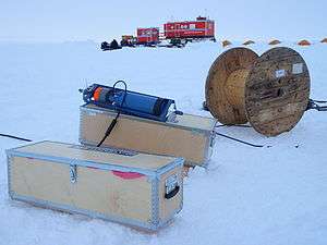
In December 2009 new oceanographic moorings
were deployed below the Fimbul ice shelf in the project Fimbul Ice Shelf - Top to Bottom.
The Fimbul Ice Shelf is an ice shelf about 200 km (120 mi) long and 100 km (62 mi) wide, nourished by Jutulstraumen Glacier, bordering the coast of Queen Maud Land from 3°W to 3°E. It was photographed from the air by the Third German Antarctic Expedition (1938–39), mapped by Norwegian cartographers from surveys and air photos by the Norwegian–British–Swedish Antarctic Expedition (1949–1952) and from air photos by the Norwegian expedition (1958–59) and named Fimbulisen (the giant ice).[1]
References
- ↑ "Fimbul Ice Shelf". Geographic Names Information System. United States Geological Survey. Retrieved 2012-03-22.
External links
![]() This article incorporates public domain material from the United States Geological Survey document "Fimbul Ice Shelf" (content from the Geographic Names Information System).
This article incorporates public domain material from the United States Geological Survey document "Fimbul Ice Shelf" (content from the Geographic Names Information System).
This article is issued from Wikipedia - version of the 7/29/2016. The text is available under the Creative Commons Attribution/Share Alike but additional terms may apply for the media files.