Fillmore, California
| City of Fillmore | |
|---|---|
| City | |
|
Central Avenue in downtown Fillmore | |
| Motto: The Last, Best Small Town. | |
 Location in Ventura County and the state of California | |
 City of Fillmore Location in the United States | |
| Coordinates: 34°24′5″N 118°55′4″W / 34.40139°N 118.91778°WCoordinates: 34°24′5″N 118°55′4″W / 34.40139°N 118.91778°W | |
| Country |
|
| State |
|
| County | Ventura |
| Incorporated | July 10, 1914[1] |
| Government | |
| • Type | Council-Manager |
| • City council[2] |
Mayor Diane McCall Doug Tucker Manuel Minjares Rick Neal Carrie Broggie |
| • City manager | David W. Rowlands |
| • State senator | Hannah-Beth Jackson (D)[3] |
| • Assemblymember | Monique Limón (D)[3] |
| • U. S. rep. | Julia Brownley (D)[4] |
| Area[5] | |
| • Total | 3.365 sq mi (8.715 km2) |
| • Land | 3.364 sq mi (8.712 km2) |
| • Water | 0.001 sq mi (0.003 km2) 0.03% |
| Elevation[6] | 456 ft (139 m) |
| Population (April 1, 2010)[7] | |
| • Total | 15,002 |
| • Estimate (2013)[7] | 15,255 |
| • Density | 4,500/sq mi (1,700/km2) |
| Time zone | Pacific (UTC-8) |
| • Summer (DST) | PDT (UTC-7) |
| ZIP codes | 93015-93016 |
| Area code | 805 |
| FIPS code | 06-24092 |
| GNIS feature IDs | 1652710, 2410504 |
| Website |
www |
.JPG)
Fillmore is a city in Ventura County, California, United States in the Santa Clara River Valley. In an agricultural area with rich, fertile soil, Fillmore has a historic downtown that was established when Southern Pacific built the railroad through the valley in 1887. They also provided a name for the town; J. A. Fillmore was a general superintendent for the company's Pacific system. The population was 15,002 at the 2010 census, up from 13,643 at the 2000 census.
History
In 1769, the Spanish Portola expedition, first Europeans to see inland areas of California, came down the valley from the previous night's encampment near today's Rancho Camulos and camped in the vicinity of Fillmore on August 11. Fray Juan Crespi, a Franciscan missionary travelling with the expedition, had previously named the valley Cañada de Santa Clara. He noted that the party travelled about 9–10 miles and camped near a large native village.[8]
Founded in 1887 upon the arrival of the Southern Pacific Rail line, the city voted to incorporate in 1914.[9]
Geography
Fillmore is a small town in the Santa Clara River Valley below the San Cayetano Mountain peak in the Los Padres National Forest. Fillmore is within a historic Ventura County agricultural and tree-farming belt. It is home to the Fillmore Unified School District. Educational facilities for this district include two high schools, one middle school, and four elementary schools. A fifth elementary school is located in the city of Piru, which is also a part of the school district. Another K-8 private school, the Fillmore Christian Academy, is also located in the city. Sespe Condor Sanctuary, where the critically endangered California condor is recovering, lies to the north. The nearby Sespe Creek is a tributary of the Santa Clara River. According to the United States Census Bureau, the city has a total area of 3.4 square miles (8.8 km2), 99.97% of it land and 0.03% of it water.
Climate
This region experiences hot and dry summers. Temperatures can easily reach above 100 degrees . According to the Köppen Climate Classification system, Fillmore has a warm-summer Mediterranean climate, abbreviated "Csb" on climate maps.[10]
| Climate data for Fillmore, California | |||||||||||||
|---|---|---|---|---|---|---|---|---|---|---|---|---|---|
| Month | Jan | Feb | Mar | Apr | May | Jun | Jul | Aug | Sep | Oct | Nov | Dec | Year |
| Record high °F (°C) | 92 (33) |
92 (33) |
96 (36) |
105 (41) |
102 (39) |
106 (41) |
105 (41) |
105 (41) |
109 (43) |
108 (42) |
99 (37) |
99 (37) |
109 (43) |
| Average high °F (°C) | 69 (21) |
69 (21) |
71 (22) |
74 (23) |
75 (24) |
77 (25) |
81 (27) |
83 (28) |
82 (28) |
79 (26) |
74 (23) |
69 (21) |
75.3 (24.1) |
| Average low °F (°C) | 41 (5) |
43 (6) |
44 (7) |
46 (8) |
50 (10) |
53 (12) |
57 (14) |
56 (13) |
55 (13) |
50 (10) |
44 (7) |
41 (5) |
48.3 (9.2) |
| Record low °F (°C) | 25 (−4) |
26 (−3) |
25 (−4) |
30 (−1) |
35 (2) |
37 (3) |
38 (3) |
40 (4) |
40 (4) |
32 (0) |
28 (−2) |
25 (−4) |
25 (−4) |
| Average precipitation inches (mm) | 3.7 (94) |
5.0 (127) |
2.7 (69) |
0.8 (20) |
0.3 (8) |
0.1 (3) |
0.0 (0) |
0.0 (0) |
0.2 (5) |
0.7 (18) |
1.4 (36) |
2.5 (64) |
17.4 (444) |
| Source: The Weather Channel.[11] | |||||||||||||
Demographics
| Historical population | |||
|---|---|---|---|
| Census | Pop. | %± | |
| 1920 | 1,597 | — | |
| 1930 | 2,893 | 81.2% | |
| 1940 | 3,252 | 12.4% | |
| 1950 | 3,884 | 19.4% | |
| 1960 | 4,808 | 23.8% | |
| 1970 | 6,285 | 30.7% | |
| 1980 | 9,602 | 52.8% | |
| 1990 | 11,992 | 24.9% | |
| 2000 | 13,643 | 13.8% | |
| 2010 | 15,002 | 10.0% | |
| Est. 2015 | 15,548 | [12] | 3.6% |
2010
The 2010 United States Census[14] reported that Fillmore had a population of 15,002. The population density was 4,458.5 people per square mile (1,721.4/km2). The racial makeup of Fillmore was 8,581 (57.2%) White, 75 (0.5%) African American, 180 (1.2%) Native American, 155 (1.0%) Asian, 12 (0.1%) Pacific Islander, 5,204 (34.7%) from other races, and 795 (5.3%) from two or more races. Hispanic or Latino of any race were 11,212 persons (74.7%).
The Census reported that 14,836 people (98.9% of the population) lived in households, 83 (0.6%) lived in non-institutionalized group quarters, and 83 (0.6%) were institutionalized.
There were 4,156 households, out of which 2,053 (49.4%) had children under the age of 18 living in them, 2,483 (59.7%) were opposite-sex married couples living together, 569 (13.7%) had a female householder with no husband present. 312 (7.5%) had a male householder with no wife present. There were 259 (6.2%) unmarried opposite-sex partnerships, and 34 (0.8%) same-sex married couples or partnerships. 642 households (15.4%) were made up of individuals and 299 (7.2%) had someone living alone who was 65 years of age or older. The average household size was 3.57. There were 3,364 families (80.9% of all households); the average family size was 3.92.
The population was spread out with 4,534 people (30.2%) under the age of 18, 1,555 people (10.4%) aged 18 to 24, 4,141 people (27.6%) aged 25 to 44, 3,221 people (21.5%) aged 45 to 64, and 1,551 people (10.3%) who were 65 years of age or older. The median age was 31.9 years. For every 100 females there were 99.8 males. For every 100 females age 18 and over, there were 98.9 males.
There were 4,408 housing units at an average density of 1,310.0 per square mile (505.8/km2), of which 2,674 (64.3%) were owner-occupied, and 1,482 (35.7%) were occupied by renters. The homeowner vacancy rate was 3.0%; the rental vacancy rate was 4.5%. 9,324 people (62.2% of the population) lived in owner-occupied housing units and 5,512 people (36.7%) lived in rental housing units.
2000
As of the census[15] of 2000, there were 13,643 people, 3,762 households, and 3,032 families residing in the city. The population density was 4,910.8 inhabitants per square mile (1,894.8/km2). There were 3,852 housing units at an average density of 1,386.5 per square mile (535.0/km2). The racial makeup of the city was 53.5% White, 0.3% African American, 1.4% Native American, 1% Asian, 0.1% Pacific Islander, and 39.5% from other races. Hispanic or Latino of any race were 66.6% of the population.
There were 3,762 households out of which 45.8% had children under the age of 18 living with them, 62.3% were married couples living together, 12.8% had a female householder with no husband present, and 19.4% were non-families. 16.1% of all households were made up of individuals and 9.1% had someone living alone who was 65 years of age or older. The average household size was 3.56 and the average family size was 3.94.
In the city the population was spread out with 32.3% under the age of 18, 10.7% from 18 to 24, 29.0% from 25 to 44, 17.5% from 45 to 64, and 10.4% who were 65 years of age or older. The median age was 30 years. For every 100 females there were 101.7 males. For every 100 females age 18 and over, there were 102.4 males.
The median income for a household in the city was $45,510, and the median income for a family was $47,449. Males had a median income of $34,441 versus $24,660 for females. The per capita income for the city was $15,010. About 11.4% of families and 13.2% of the population were below the poverty line, including 17.3% of those under age 18 and 7.4% of those age 65 or over.
Economy
Fillmore's economy is still largely driven by agriculture. Most agricultural industry in the Fillmore area is related to orange, lemon, avocado orchard farming and packing and, more recently, specimen tree farming. To a lesser extent, row crop farming and small industry and assembly are also present in and near Fillmore and in other parts of the Santa Clara Valley. The single largest employer is the Fillmore Unified School District.
In 2014, a plan was presented for a business park on the old Chevron refinery property east of Fillmore.[16]

Tourism
Fillmore has a classic "turn of the 20th century" downtown architecture, the one-screen Fillmore Towne Theatre, and many unique shops and businesses, including a local winery. Adjacent to the railroad tracks and a much-photographed city hall is the Railroad Visitor Center operated by the Santa Clara River Valley Railroad Historical Society,[17] which has many displays as well as a fully operational 90-foot (27 m) train turntable and several restored railroad cars.
A short walk down Main Street from the Railroad Visitor Center is the Fillmore Historical Museum,[18] which includes the restored Southern Pacific Railroad Fillmore 1887 standard-design One Story Combination Depot No. 11 built in 1887,[19] a 1956 Southern Pacific railroad caboose, and railroad-related displays. The small post office from the community of Bardsdale and a 1919 farm worker bunkhouse from Rancho Sespe were moved to the site along with the 1906 Craftsman-style Hinckley House, the home of the community's first dentist and druggist.[20] The bunkhouse contains many displays illustrating the history of Fillmore and the nearby communities of Bardsdale and Piru.
The Fillmore and Western Railway trains take tourists through the orchards. The Elkins Ranch Golf Course is nearby. Also located nearby are a fish hatchery and the Sespe Creek and Sespe Wilderness, home to the California condor Sespe sanctuary.
Fillmore has provided a commercial and business center for the small community of Bardsdale, which is located about three-mile south of Fillmore (5 km), directly across the Santa Clara River.
Well-preserved downtown Fillmore is a popular filming location for television and movies. The January 4, 2007, episode of CSI entitled Leaving Las Vegas prominently featured old-town Fillmore as the fictional town of "Larkston, Nevada". Scenes in the television series Jericho and Big Love are also filmed there.
Government
The City of Fillmore is an established municipality within Ventura County, founded in 1888 and incorporated on July 10, 1914. The city is governed by a five-person council with the position of mayor and mayor pro-tem elected by the council every two years. Council members serve four-year terms.
Public safety
Law enforcement
In 1987, the City of Fillmore contracted with the Ventura County Sheriff's Department to provide protection for Fillmore, Bardsdale and Piru, an area with over 450 square miles (1,200 km2). Fillmore's Police Department is headed by Sheriff's Capt. Dave Wareham, 5 Patrol Sergeants, 2 Detectives, 35 regular deputies, 1 cadet and 1 dispatcher. Fillmore is also served by three Sheriff's Store Front Locations, a Juvenile Liaison Program with the School District, Citizens Patrol Disaster Response Team, Fillmore Mountain Search and Rescue Team and Citizens Patrol.
The Fillmore Police Department has a Bike Patrol Unit, which consists of eight specially trained deputies. The Bike Patrol is utilized for proactive patrols, civic events, enforcement of public nuisance crimes, and other team operations. Each year the Santa Clara Valley Station offers a Bike Rodeo for the youth in the community.
Also, the Fillmore Station is home to a Special Enforcement Detail that provides a variety of specialized duties including gang enforcement, tagging/graffiti investigations, and alcohol beverage control. This unit is utilized for any specific crime concerns that are beyond the scope of normal patrol resources.
In August 2001, the City of Fillmore introduced its first traffic enforcement motorcycle, a BMW bike, which was purchased with technology grant funds from the State. The motor officer's primary duty is to enforce traffic laws within the city and to investigate traffic accidents that occur within the city limits. The officer is trained in accident reconstruction, skid marks analysis, and accident investigation.*
Furthermore, during certain events, such as the Fillmore 4th of July Festival or the Fillmore May Festival, extra law enforcement is required to patrol in order to maintain safety regulations.
Fire department
The Fillmore Fire Department provides fire protection and emergency medical services at the advanced life support (ALS) level. The Department is staffed with a combination of career and volunteer staff. American Medical Response (AMR) is the primary paramedic ambulance provider for the City while the Ventura County Fire Department provides 9-1-1 dispatching and telecommunication service.
Education
High school
Sierra High School
Junior high
- Fillmore Middle School
Fillmore Middle School is the first school in California to offer skateboarding in its Physical Education Program.
Elementary school
- San Cayetano Elementary School
- Sespe Elementary School
- Fillmore Christian Academy
- Mountain Vista Elementary School
- Rio Vista Elementary School
Transportation
Major highways
It is primarily served by State Highway 126 and State Highway 23.
Transit
VISTA
Fillmore is at the east end of the Ventura Intercity Service Transit Authority Highway 126 route that originates at the Pacific View Mall in Ventura, and operates along SR 126 to Saticoy, Santa Paula and Fillmore.
Valley Express
Fillmore will have its first regularly scheduled bus service. Fillmore will have a single bus on a 30-minute loop throughout the city, and one route running between Fillmore and Piru. Both city bus systems will connect to the regional Highway 126 bus to Ventura, with free, timed transfers.
Scheduled service began in 2015 for the Heritage Valley communities with two routes in Santa Paula, one route in Fillmore and one in Piru that runs to Fillmore. They are designed to mesh with the schedule of the VISTA Highway 126 route.[21][22] 16-seat buses are used on the Valley Express. The dial-a-ride services in both cities, which for now are the only public transit option, will remain in operation after the bus routes start.
Notable residents
- Nati Cano (1933-2014), mariachi musician, former leader of Mariachi los Camperos[23]
Cultural references
Movies & television (TV) shows filmed in Fillmore
References
- ↑ "California Cities by Incorporation Date" (Word). California Association of Local Agency Formation Commissions. Retrieved August 25, 2014.
- ↑ "City Council". City of Fillmore. Retrieved January 12, 2015.
- 1 2 "Statewide Database". UC Regents. Retrieved November 23, 2014.
- ↑ "California's 26th Congressional District - Representatives & District Map". Civic Impulse, LLC. Retrieved October 5, 2014.
- ↑ "2010 Census U.S. Gazetteer Files – Places – California". United States Census Bureau.
- ↑ "Fillmore". Geographic Names Information System. United States Geological Survey. Retrieved November 4, 2014.
- 1 2 "Fillmore (city) QuickFacts". United States Census Bureau. Retrieved March 15, 2015.
- ↑ Bolton, Herbert E. (1927). Fray Juan Crespi: Missionary Explorer on the Pacific Coast, 1769-1774. HathiTrust Digital Library. p. 155. Retrieved April 2014. Check date values in:
|access-date=(help) - ↑ Biasotti, Tony (July 2, 2014) "Fillmore is celebrating its 100th birthday July 10" Ventura County Star
- ↑ Climate Summary for Fillmore, California
- ↑ "MONTHLY AVERAGES for Fillmore, CA". The Weather Channel. July 2016. Retrieved July 20, 2016.
- ↑ "Annual Estimates of the Resident Population for Incorporated Places: April 1, 2010 to July 1, 2015". Retrieved July 2, 2016.
- ↑ "Census of Population and Housing". Census.gov. Archived from the original on May 11, 2015. Retrieved June 4, 2015.
- ↑ "2010 Census Interactive Population Search: CA - Fillmore city". U.S. Census Bureau. Retrieved July 12, 2014.
- ↑ "American FactFinder". United States Census Bureau. Archived from the original on September 11, 2013. Retrieved 2008-01-31.
- ↑ Biasotti, Tony (November 19, 2014) "Fillmore residents still skeptical about development plans for former oil refinery site" Ventura County Star (subscription may be required or content may be available in libraries)
- ↑ http://scrvrhs.com/
- ↑ http://fillmorehistoricalmuseum.com/fillmorehistoricalmuseum.com/Home.html
- ↑ Bender, Henry E., Jr. (2013). Southern Pacific Lines Standard-Design Depots. Berkeley and Wilton, California: Signature Press. p. 97. ISBN 9781930013339.
- ↑ Green, Nick (February 13, 1997) "Depot Running Late on Trip to New Home" Los Angeles Times
- ↑ Biasotti, Tony (February 11, 2015). "Fillmore prepares for bus service". Ventura County Star.
- ↑ Martinez, Arlene (March 3, 2015). "Valley Express offering free bus rides today in Santa Paula, Fillmore, Piru". Ventura County Star.
- ↑ Colker, David (2014-10-04). "Musician Nati Cano dies at 81; leader of Mariachi los Camperos". Los Angeles Times. Retrieved 2014-10-25.
External links
- Official website
- The Fillmore Gazette - Print and Online Newspaper of Record for the City of Fillmore
- Fillmore Chamber of Commerce
- Fillmore @ The Official Conejo Valley Website, a Web site with local history, events, and community information.
- Fillmore High School Website
- Heritage Valley Website
- The Sespe Sun - Online Newspaper of Record for the Santa Clara Valley
| Wikimedia Commons has media related to Fillmore, California. |
 |
Topatopa Mountains Los Padres National Forest |
| ||
| |
Piru Santa Clarita SR 126; Los Angeles via I-5 | |||
| ||||
| | ||||
| Santa Paula Ventura SR 126 |
Moorpark SR 23 |
Simi Valley SR 23, SR 118 |
Municipalities and communities of Ventura County, California, United States | ||
|---|---|---|
| Cities | 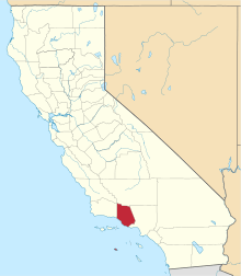 | |
| CDPs | ||
| Unincorporated communities | ||
| Footnotes | ‡This populated place also has portions in an adjacent county or counties | |