Figuig
| Figuig فكيك ⵉⴼⵢⵢⴻⵢ | ||
|---|---|---|
 | ||
| ||
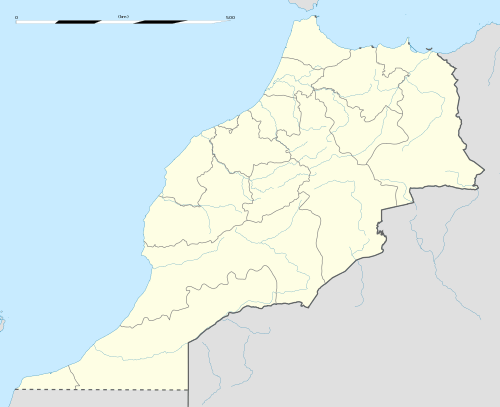 Figuig Location in Morocco | ||
| Coordinates: 32°7′0″N 1°13′37″W / 32.11667°N 1.22694°WCoordinates: 32°7′0″N 1°13′37″W / 32.11667°N 1.22694°W | ||
| Country |
| |
| Region | Oriental | |
| Province | Figuig | |
| Area | ||
| • Total | 200 km2 (80 sq mi) | |
| Elevation | 900 m (3,000 ft) | |
| Population (2014) | ||
| • Total | 10,872 | |
| • Density | 54/km2 (140/sq mi) | |
| Time zone | WET (UTC+0) | |
| • Summer (DST) | WEST (UTC+1) | |
Figuig (Arabic: فكيك; Berber: ⵉⴼⵢⵢⴻⵢ) is a town in eastern Morocco near the Atlas Mountains, on the border with Algeria.
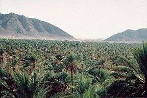
The town is built around an oasis of date palms, called Tazdayt, meaning "palm tree" in the Berber language, surrounded by rugged, mountainous wilderness. Modernization has somewhat raised the standard of living, and drawn much of the town's population away, so that it is now struggling to reach stability. Its population in 2014 was 10,872, down from a peak of 14,571 in 1982.[1]
The Ksour Range is a mountainous area extending between Figuig and El Bayadh.[2]
Aghrem
Figuig consists of seven different communities (Ighermawen in South Oran Berber dialect) which are: At-Wadday, At-Amar, At-Lamiz, At-Sliman, At-Annaj, At-Addi, Iznayen. A community territory is called an Agram, which is the word some local Berbers use to describe themselves in their tongue; plural Igramawan. The communities are usually made up of a fortified group of houses. Many Agrams are designed with defensive measures like watch-towers and heavy doors on the main entrances, which are closed at night, as well as a mazelike layout, called an Abrid (meaning "pathway" in Berber), which makes navigation for unwanted intruders extremely difficult.
Homes, or Tidriwin, are extended by building rooms over the alleyways; these extensions are referred to as Askif. Houses are built mainly with soil, though palm trunks (tizidin) and leaf-heads (tikachba, taratta) are used in roof construction. The arrival of electricity, plumbing, and concrete construction has not essentially altered the nature of Aghram building. However, modern age buildings are being built more and more in the newly appointed area's at the edge of each "Agram".
Culture
Aghrams are often centered on a plaza once used for communal gatherings and shopping. Arab nomads would exhibit merchandise like cooked butter (Udi), dried milk (Ibrassa), and sheep wool (Douft). However, due to lack of demand and western-influenced tastes, the plaza-markets have waned in both their variety and importance.
The akharbish education, often held near a mosque, had already been replaced by modern French schools since the establishment of the French colonisation. This trend has only been strengthened by the advantages a Western French education is perceived to confer, and as a result, knowledge of the Berber language has suffered.
The original mainly spoken language is Amazigh (a Berber language). Figuig's population are referred to as At-Ufyyey in that language. Amazigh is spoken but not written in Figuig.
Agriculture
The town was established next to an oasis of date palms, and dates, or tiyni, are by far its most important resource. Some hundreds of thousands of date palms are cultivated in the area, and their fruit has become Figuig's primary crop. In the 1960s and 1970s however, Figuig had lost countless date palms because of the Bayud disease.
Wheat, or tasharza, is also an important product of the town. Its cultivation near the town assured a steady supply of the crucial grain which allowed for a higher quality of life. In order to increase arable land, many private farmers have constructed soil-filled stone terraces along the Jorf, a salt mountain nearby.
The Jorf is a sort of salt mountain about 1 kilometre long and 50 metres high. It is a nesting site of wild pigeons and bees, as well as scorpions and snakes, and is divided between several private landowners . The Jorf also serves to divide between the upper and lower portions of the town, and several thoroughfares connecting them run across it. The town's water-supply (aman) is drawn from its northern end, near the pass which serves as the main entrance to Figuig, and water can generally be found there at the shallow depth of 10 metres.
The water is conducted from its source via underground channels (lakbawat) to lime and stone or cement cisterns (sharij), from which farmers can utilise it at their convenience. The cisterns sometimes double as swimming holes to provide recreation for the local children.
Modernisation
New technologies such as cement and steel construction, as well as electricity, gas, telegraphs, cellular networks, digital satellite programming, and even Broadband Internet access, have made their way to Figuig. These developments have begun to bring the residents remaining in the town into close-contact with local culture, and the town has even seen the opening of several cafes.
Figuig is however lacking medical facilities equipped to serve a town of this size. Many patients are therefore forced to seek medical aid elsewhere.
A central bureaucracy, held-over from the French control, has supplanted the tribal structure as a center of Figuigs' administration.
Most people who are originally from Figuig and who live abroad visit Figuig every summer. The city becomes very crowded and teenagers enjoy meeting there. They go to swimming pools and biking as well as sightseeing.
See also
References
- ↑ "Démographie". Site officiel de la ville de Figuig (in French and Arabic). 2016. Retrieved 23 May 2016.
- ↑ Montagnes des Ksour - Géographie militaire
External links
Capital: Oujda | ||
| Provinces | 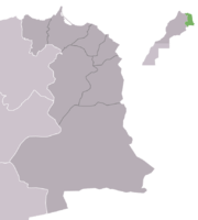 | |
| Cities |
| |