Field-Map
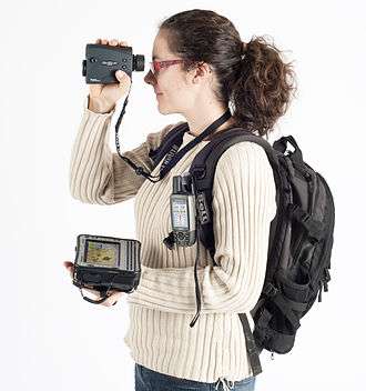
Example of instruments used for conducting forest inventories (rugged laptop, GPS and laser rangefinder).
Field-Map is an integrated tool designed for programmatic field data collection. It is mainly used for the allocation of forest ecosystems and data collection during field analysis. This application is able to work with relational databases, and provides seamless communication with external devices such as GPS, laser rangefinders and inclinometers. The Field-Map technology is currently used for national forest inventories in Ireland, Cape Verde, Czech Republic, Belgium, Slovakia, Hungary and Russia.
References
- In Transcarpathia, Ukraine, GIS Aids Statistical Forest Inventory. Retrieved on 2009-13-3.
This article is issued from Wikipedia - version of the 11/3/2016. The text is available under the Creative Commons Attribution/Share Alike but additional terms may apply for the media files.